
Lunar Corona above Town Hall in Grand Place

This cityscape shows a colourful lunar corona at the left side of the Town Hall in the city of Brussels, capital of European Union (EU). The lunar corona is formed while bright moonlight is diffracted by water droplets in thin clouds, drifting in front of the lunar disk. The beautiful building in the foreground is the Town Hall of the City of Brussels, a Gothic building from the Middle Ages – between 1401 and 1455 – and made the Grand Place the seat of municipal power. The major tower have 96 metres (315 ft) high, and is capped by a 4-metre (12 ft) statue of Saint Michael slaying a demon. It is located on the famous Grand Place in Brussels, Belgium, and is the only remaining medieval building of the Grand Place and is considered a masterpiece of civil Gothic architecture and more particularly of Brabantine Gothic. As a UNESCO World Heritage Site, Grand-Place testifies in particular to the success of Brussels, mercantile city of northern Europe that, at the height of its prosperity, rose from the terrible bombardment inflicted by the troops of Louis XIV in 1695. Destroyed in three days, this gothic building has survived.
PT: Esta paisagem urbana mostra uma colorida coroa lunar à esquerda da Câmara Municipal da cidade de Bruxelas, capital da União Europeia (UE). A coroa lunar é formada devido à difração da luz brilhante do luar nas gotas de água presentes em nuvens finas, que transitam na frente do disco lunar. O magnífico edifício em primeiro plano, é a Câmara Municipal da Cidade de Bruxelas, um edifício gótico da Idade Média – entre 1401 e 1455 – que fez da Grand Place o lugar do poder municipal. A torre principal tem 96 metros (315 pés) de altura e está coberta por uma estátua de 4 metros (12 pés) de Saint Michael, matando um demónio. Localizado na famosa Grand Place, em Bruxelas, na Bélgica, é o único edifício medieval que permanece da Grand Place original e é considerado uma obra-prima da arquitetura gótica civil e mais particularmente do Brabantine Gothic. Incluído na lista do Património Mundial da UNESCO, a Grand-Place atesta, em particular, o sucesso de Bruxelas, cidade mercantil do norte da Europa, que, no auge de sua prosperidade, surgiu do terrível bombardeamento infligido pelas tropas de Louis XIV em 1695. Totalmente destruída em três dias, este edifício gótico foi dos únicos que sobreviveu ao bombardeamento
Lunar Christmas Earthshine above Mértola Castle

Captured one day after the new moon during the Christmas week, the moon was only 2% illuminated by the sunlight. Though, we can clearly distinguish the entire disk due to a phenomenon called Lunar Earthshine. In the foreground, located in a top hill, is a beautiful well-preserved medieval castle from Mértola village, in Dark Sky® Alqueva Reserve, decorated with Christmas lights around the walls and by coincidence very well aligned with the crescent moon, forming the perfect frame for a Christmas Card.
PT: Captada no dia após a lua nova e durante a semana que antecede o Natal, a lua encontrava-se 2% iluminada pela luz solar directa. No entanto, é possível distinguir claramente todo o disco devido a um fenómeno chamado Lunar Earthshine. Em primeiro plano, localizado numa colina superior, encontra-se o bem preservado e belo castelo da vila de Mértola, na Reserva Dark Sky® Alqueva, decorado com luzes de Natal ao redor das paredes e por coincidência muito bem alinhado com a lua crescente, forma o par perfeito para um Postal de Natal.
Slightly Crescent Moon above Mértola Village

Captured one day after the new moon during the Christmas week, the moon was only 2% illuminated by the sunlight. Though, we can clearly distinguish the entire disk due to a phenomenon called Lunar Earthshine. In the foreground, located in a top hill, is a beautiful well-preserved medieval castle from Mértola village, in Dark Sky® Alqueva Reserve, decorated with Christmas lights around the walls and by coincidence very well aligned with the crescent moon, forming the perfect frame for a Christmas Card.
PT: Captada no dia após a lua nova e durante a semana que antecede o Natal, a lua encontrava-se 2% iluminada pela luz solar directa. No entanto, é possível distinguir claramente todo o disco devido a um fenómeno chamado Lunar Earthshine. Em primeiro plano, localizado numa colina superior, encontra-se o bem preservado e belo castelo da vila de Mértola, na Reserva Dark Sky® Alqueva, decorado com luzes de Natal ao redor das paredes e por coincidência muito bem alinhado com a lua crescente, forma o par perfeito para um Postal de Natal.
Bright Milky Way Mixed with Airglow and Clouds above Mina de São Domingos

A wide view of the Milky Way with planet Saturn shinning against the galaxy core above Scorpius constellation, while in the opposite direction, bright star Arcturus is setting behind a layer of orange clouds. In the background horizon, a smooth presence of green airglow is also mixed with a starry sky. In the top right corner of the image, a pink/red emission from North America Nebula (NGC7000) is well visible near Deneb star, forming a perfect triangle with the blue star Vega (top center) and Altair star (left center). This mosaic of the Milky Way was captured above a puddle of acid water from Achada do Gamo, that was – since the beginning of modern mining activities in the São Domingos Mine – the center of metallurgical activities on extracted minerals. Already during the 20th century, between the 30s and 40s, a new direction of industrial exploration took place: the sulfur, however much valued, began to be extracted from the copper pyrites through furnaces (Orkla process) in two plants installed in the Achada do Gamo during the years of 1934 and 1943.
São Domingos Mine is located in Baixo Alentejo, about 240 km from Lisbon, in the municipality of Mértola, which recently joined the Dark Sky® Alqueva Route for the great quality of the night sky. The São Domingos mining area is part of the Iberian Pyrite Range and is a decisive source of basic metals (S, Zn, Pb, Sn, Ag, Au, Fe, Co, Cd, etc.) and other elements such as sulfur (S). It has been a sought after place for the extraction of ores since antiquity, with evidence of gold, silver and copper mining in the pre-Roman and Roman times. The pyritic deposit of São Domingos (St. Dominic) was explored in various historical periods, namely: for several centuries of the first millennium BC (Eastern period), during the period between 14 BC and 395 AD (Roman period), during the Islamic period and during the modern period that was initiated in 1858 for the extraction of copper, gold and silver and was maintained until 1966, the year in which the reserves were considered exhausted. During this period, the work was done in the open air up to 120 meters deep, with work continued through wells and galleries up to 400 meters. Over 108 years of regular exploration, more than 20 million tons of materials were removed from the site, producing about 14.7 million tons of waste accumulated in heaps up to 14 meters high with a dozen different materials such as pyrite , gossan, slag, ash, iron oxides, barren rock, sludge, debris, etc. The areas of heaps, slag and channels of water, give the landscape a “lunar” aspect. The heaps are composed of different materials with high levels of metals, such as slag and ash, whose leaching through the rainwater leads to the production of acid mine drainage, usually with an ocher or reddish color.|
PT: Nesta imagem é possível aceder a uma ampla visão da Via Láctea com o planeta Saturno brilhando contra o núcleo da galáxia acima da constelação do Escorpião, enquanto na direção oposta, a estrela brilhante Arcturus se põe atrás de uma camada de nuvens alaranjada. Logo acima do horizonte e em pano de fundo, uma presença suave de airglow (luminescência foto-química) mistura-se com um céu estrelado. No canto superior direito da imagem, uma emissão rosa/vermelha proveniente da Nebulosa América do Norte (NGC7000) é bem visível perto da estrela Deneb, formando um triângulo perfeito com a estrela azul Vega (centro superior) e a estrela Altair (centro esquerdo). Este mosaico da Via Láctea foi captado acima das águas ácidas da Achada do Gamo, que foi desde o início das atividades modernas de mineração na Mina de São Domingos, o centro das atividades metalúrgicas sobre os minérios extraídos. Já durante o século XX, entre as décadas de 30 e 40, uma nova direção de exploração industrial tomou lugar: o enxofre, entretanto muito valorizado, passou a ser extraído das pirites cupríferas através de fornos (processo Orkla) em duas unidades fabris instaladas na Achada do Gamo durante os anos de 1934 e 1943.
A Mina de São Domingos, situa-se no Baixo Alentejo, a cerca de 240 km de Lisboa, no concelho de Mértola, que passou a integrar recentemente a Rota Dark Sky® Alqueva pela grande qualidade do seu céu escuro. A área mineira de São Domingos, está inserida na Faixa Piritosa Ibérica e constitui uma fonte decisiva de metais básicos (Cu, Zn, Pb, Sn, Ag, Au, Fe, Co, Cd, etc.) e de outros elementos como o enxofre (S). Foi desde a Antiguidade um local procurado para a extracção de minérios, existindo indícios de trabalhos de extracção de ouro, prata e cobre no período pré-romano e romano. O depósito pirítico de São Domingos foi explorado em diversos períodos históricos, nomeadamente: durante vários séculos do primeiro milénio a.C. (período Oriental), durante o período que mediou entre o ano 14 a.C. e o ano de 395 d.C. (período romano), durante o período islâmico e durante o período moderno que se iniciou em 1858 para a extracção de cobre, ouro e prata e manteve-se até 1966, ano em que as reservas foram consideradas esgotadas. Neste período, a lavra foi feita a céu aberto até aos 120 metros de profundidade, tendo os trabalhos continuado por meio de poços e galerias até aos 400 metros. Ao longo de 108 anos de exploração regular, foram retirados do local mais de 20 milhões de toneladas de materiais, tendo produzido cerca 14,7 milhões de toneladas de resíduos acumulados em escombreiras de até 14 metros de altura, com uma dezena de materiais diferentes como pirite, gossan, escórias, cinzas, óxidos de ferro, rocha estéril, lamas, entulhos, etc. As áreas de escombreiras, escórias e canais de água, dão à paisagem um aspecto “lunar”. As escombreiras são constituídas por diferentes materiais com teores elevados em metais, como escórias e cinzas, cuja lixiviação através das águas das chuvas leva à produção de águas ácidas (‘acid mine drainage’), geralmente com uma cor ocre ou avermelhada.
Mina de São Domingos, an Open Hole to a Chemical Universe

The magnificent chemical landscape from Achada do Gamo, seems to show an hole to the Universe where we can immerse through a puddle of acid waters, reflecting the starlight from Scorpius and planet Saturn shinning bright against the galaxy core. Since the beginning of modern mining activities in the São Domingos Mine, Achada do Gamo was the center of metallurgical activities on extracted minerals. Some heavy elements presented in these minerals have been created billions of years ago in those stars and through supernovae explosions. The gold for example was made from neutron stars during collisions. Although, silver production occurs in less massive stars than those that produce gold—and through an entirely different type of nuclear fusion, called the weak r-process. The sites of nuclear creation of some elements, such as copper, are not really well known and are continuing topics of observational and computational research. The areas of heaps, slag and channels of water, give the landscape a “lunar” aspect. The heaps are composed of different materials with high levels of metals, such as slag and ash, whose leaching through the rainwater leads to the production of acid mine drainage, usually with an ocher or reddish color.|
São Domingos Mine is located in Baixo Alentejo, about 240 km from Lisbon, in the municipality of Mértola, which recently joined the Dark Sky® Alqueva Route for the great quality of the night sky. The São Domingos mining area is part of the Iberian Pyrite Range and is a decisive source of basic metals (S, Zn, Pb, Sn, Ag, Au, Fe, Co, Cd, etc.) and other elements such as sulfur (S). It has been a sought after place for the extraction of ores since antiquity, with evidence of gold, silver and copper mining in the pre-Roman and Roman times. The pyritic deposit of São Domingos (St. Dominic) was explored in various historical periods, namely: for several centuries of the first millennium BC (Eastern period), during the period between 14 BC and 395 AD (Roman period), during the Islamic period and during the modern period that was initiated in 1858 for the extraction of copper, gold and silver and was maintained until 1966, the year in which the reserves were considered exhausted. During this period, the work was done in the open air up to 120 meters deep, with work continued through wells and galleries up to 400 meters. Over 108 years of regular exploration, more than 20 million tons of materials were removed from the site, producing about 14.7 million tons of waste accumulated in heaps up to 14 meters high with a dozen different materials such as pyrite , gossan, slag, ash, iron oxides, barren rock, sludge, debris, etc.
PT: A magnífica paisagem química de Achada do Gamo, parece mostrar um buraco para o Universo onde podemos mergulhar através de um charco de águas ácidas, refletindo a luz das estrelas do Escorpião e o planeta Saturno brilhando contra o núcleo da galáxia. Desde o início das modernas atividades de mineração na mina de São Domingos, a Achada do Gamo foi o centro das atividades metalúrgicas nos minerais extraídos. Alguns elementos pesados presentes nestes minerais foram criados há milhares de milhões de anos atrás nessas estrelas e através de explosões de supernovas. O ouro, por exemplo, foi feito a partir de estrelas de neutrões durante colisões. Apesar disso, a produção de prata ocorre em estrelas menos maciças do que aquelas que produzem ouro – e através de um tipo completamente diferente de fusão nuclear, chamado de processo-r fraco. As áreas de montes, escórias e canais de água, dão à paisagem um aspecto “lunar” que lhe confere um cenário ímpar. Os montes são compostos de diferentes materiais com altos níveis de metais, como escórias e cinzas, cuja lixiviação através da água da chuva leva à produção de drenagem de minas ácidas, geralmente com uma cor ocre ou avermelhada.
A Mina de São Domingos, situa-se no Baixo Alentejo, a cerca de 240 km de Lisboa, no concelho de Mértola, que passou a integrar recentemente a Rota Dark Sky® Alqueva pela grande qualidade do seu céu escuro. A área mineira de São Domingos, está inserida na Faixa Piritosa Ibérica e constitui uma fonte decisiva de metais básicos (Cu, Zn, Pb, Sn, Ag, Au, Fe, Co, Cd, etc.) e de outros elementos como o enxofre (S). Foi desde a Antiguidade um local procurado para a extracção de minérios, existindo indícios de trabalhos de extracção de ouro, prata e cobre no período pré-romano e romano. O depósito pirítico de São Domingos foi explorado em diversos períodos históricos, nomeadamente: durante vários séculos do primeiro milénio a.C. (período Oriental), durante o período que mediou entre o ano 14 a.C. e o ano de 395 d.C. (período romano), durante o período islâmico e durante o período moderno que se iniciou em 1858 para a extracção de cobre, ouro e prata e manteve-se até 1966, ano em que as reservas foram consideradas esgotadas. Neste período, a lavra foi feita a céu aberto até aos 120 metros de profundidade, tendo os trabalhos continuado por meio de poços e galerias até aos 400 metros. Ao longo de 108 anos de exploração regular, foram retirados do local mais de 20 milhões de toneladas de materiais, tendo produzido cerca 14,7 milhões de toneladas de resíduos acumulados em escombreiras de até 14 metros de altura, com uma dezena de materiais diferentes como pirite, gossan, escórias, cinzas, óxidos de ferro, rocha estéril, lamas, entulhos, etc.
The Arch of Milky Way Shinning Against the Acid Landscape of Achada do Gamo

The arch of Milky Way galaxy behind a tiny layer of clouds mixed with a smooth presence of green airglow, is shinning above a puddle of acid water from Achada do Gamo, that was – since the beginning of modern mining activities in the São Domingos Mine – the center of metallurgical activities on extracted minerals. Already during the 20th century, between the 30s and 40s, a new direction of industrial exploration took place: the sulfur, however much valued, began to be extracted from the copper pyrites through furnaces (Orkla process) in two plants installed in the Achada do Gamo during the years of 1934 and 1943. Near the left chimney is visible the Andromeda galaxy, seen from here as an elongated diffuse dot.
São Domingos Mine is located in Baixo Alentejo, about 240 km from Lisbon, in the municipality of Mértola, which recently joined the Dark Sky® Alqueva Route for the great quality of the night sky. The São Domingos mining area is part of the Iberian Pyrite Range and is a decisive source of basic metals (S, Zn, Pb, Sn, Ag, Au, Fe, Co, Cd, etc.) and other elements such as sulfur (S). It has been a sought after place for the extraction of ores since antiquity, with evidence of gold, silver and copper mining in the pre-Roman and Roman times. The pyritic deposit of São Domingos (St. Dominic) was explored in various historical periods, namely: for several centuries of the first millennium BC (Eastern period), during the period between 14 BC and 395 AD (Roman period), during the Islamic period and during the modern period that was initiated in 1858 for the extraction of copper, gold and silver and was maintained until 1966, the year in which the reserves were considered exhausted. During this period, the work was done in the open air up to 120 meters deep, with work continued through wells and galleries up to 400 meters. Over 108 years of regular exploration, more than 20 million tons of materials were removed from the site, producing about 14.7 million tons of waste accumulated in heaps up to 14 meters high with a dozen different materials such as pyrite , gossan, slag, ash, iron oxides, barren rock, sludge, debris, etc. The areas of heaps, slag and channels of water, give the landscape a “lunar” aspect. The heaps are composed of different materials with high levels of metals, such as slag and ash, whose leaching through the rainwater leads to the production of acid mine drainage, usually with an ocher or reddish color.|
PT: O arco da Via Láctea ergue-se por detrás de uma fina camada de nuvens que se mistura em pano de fundo com a presença suave de airglow, tornando-se visível acima das águas ácidas da Achada do Gamo, que foi desde o início das atividades modernas de mineração na Mina de São Domingos, o centro das atividades metalúrgicas sobre os minérios extraídos. Já durante o século XX, entre as décadas de 30 e 40, uma nova direção de exploração industrial tomou lugar: o enxofre, entretanto muito valorizado, passou a ser extraído das pirites cupríferas através de fornos (processo Orkla) em duas unidades fabris instaladas na Achada do Gamo durante os anos de 1934 e 1943. Logo acima do horizonte esquerdo, e perto da primeira chaminé, é visível a galáxia de Andrómeda, vista a partir daqui como um ponto difuso alongado.
A Mina de São Domingos, situa-se no Baixo Alentejo, a cerca de 240 km de Lisboa, no concelho de Mértola, que passou a integrar recentemente a Rota Dark Sky® Alqueva pela grande qualidade do seu céu escuro. A área mineira de São Domingos, está inserida na Faixa Piritosa Ibérica e constitui uma fonte decisiva de metais básicos (Cu, Zn, Pb, Sn, Ag, Au, Fe, Co, Cd, etc.) e de outros elementos como o enxofre (S). Foi desde a Antiguidade um local procurado para a extracção de minérios, existindo indícios de trabalhos de extracção de ouro, prata e cobre no período pré-romano e romano. O depósito pirítico de São Domingos foi explorado em diversos períodos históricos, nomeadamente: durante vários séculos do primeiro milénio a.C. (período Oriental), durante o período que mediou entre o ano 14 a.C. e o ano de 395 d.C. (período romano), durante o período islâmico e durante o período moderno que se iniciou em 1858 para a extracção de cobre, ouro e prata e manteve-se até 1966, ano em que as reservas foram consideradas esgotadas. Neste período, a lavra foi feita a céu aberto até aos 120 metros de profundidade, tendo os trabalhos continuado por meio de poços e galerias até aos 400 metros. Ao longo de 108 anos de exploração regular, foram retirados do local mais de 20 milhões de toneladas de materiais, tendo produzido cerca 14,7 milhões de toneladas de resíduos acumulados em escombreiras de até 14 metros de altura, com uma dezena de materiais diferentes como pirite, gossan, escórias, cinzas, óxidos de ferro, rocha estéril, lamas, entulhos, etc. As áreas de escombreiras, escórias e canais de água, dão à paisagem um aspecto “lunar”. As escombreiras são constituídas por diferentes materiais com teores elevados em metais, como escórias e cinzas, cuja lixiviação através das águas das chuvas leva à produção de águas ácidas (‘acid mine drainage’), geralmente com uma cor ocre ou avermelhada.
Star Spica and Planet Jupiter above the Acid Water of Mina de São Domingos

A moonlight scene with blue star Spica and planet Jupiter setting and shinning behind a layer of clouds, while their lights are reflecting in a puddle of acid water from Achada do Gamo, that was – since the beginning of modern mining activities in the São Domingos Mine – the center of metallurgical activities on extracted minerals. The areas of heaps, slag and channels of water, give the landscape a “lunar” aspect. The heaps are composed of different materials with high levels of metals, such as slag and ash, whose leaching through the rainwater leads to the production of acid mine drainage, usually with an ocher or reddish color.
São Domingos Mine is located in Baixo Alentejo, about 240 km from Lisbon, in the municipality of Mértola, which recently joined the Dark Sky® Alqueva Route for the great quality of the night sky. The São Domingos mining area is part of the Iberian Pyrite Range and is a decisive source of basic metals (S, Zn, Pb, Sn, Ag, Au, Fe, Co, Cd, etc.) and other elements such as sulfur (S). It has been a sought after place for the extraction of ores since antiquity, with evidence of gold, silver and copper mining in the pre-Roman and Roman times. The pyritic deposit of São Domingos (St. Dominic) was explored in various historical periods, namely: for several centuries of the first millennium BC (Eastern period), during the period between 14 BC and 395 AD (Roman period), during the Islamic period and during the modern period that was initiated in 1858 for the extraction of copper, gold and silver and was maintained until 1966, the year in which the reserves were considered exhausted. During this period, the work was done in the open air up to 120 meters deep, with work continued through wells and galleries up to 400 meters. Over 108 years of regular exploration, more than 20 million tons of materials were removed from the site, producing about 14.7 million tons of waste accumulated in heaps up to 14 meters high with a dozen different materials such as pyrite , gossan, slag, ash, iron oxides, barren rock, sludge, debris, etc.|
PT: Uma cena de luar com a estrela azul Spica e o planeta Jupiter se pondo e brilhando atrás de uma fina camada de nuvens, enquanto o seu brilho se reflecte nas águas ácidas da Achada do Gamo, que foi desde o início das atividades modernas de mineração na Mina de São Domingos, o centro das atividades metalúrgicas sobre os minérios extraídos. As áreas de escombreiras, escórias e canais de água, dão à paisagem um aspecto “lunar”. As escombreiras são constituídas por diferentes materiais com teores elevados em metais, como escórias e cinzas, cuja lixiviação através das águas das chuvas leva à produção de águas ácidas (‘acid mine drainage’), geralmente com uma cor ocre ou avermelhada.
A Mina de São Domingos, situa-se no Baixo Alentejo, a cerca de 240 km de Lisboa, no concelho de Mértola, que passou a integrar recentemente a Rota Dark Sky® Alqueva pela grande qualidade do seu céu escuro. A área mineira de São Domingos, está inserida na Faixa Piritosa Ibérica e constitui uma fonte decisiva de metais básicos (Cu, Zn, Pb, Sn, Ag, Au, Fe, Co, Cd, etc.) e de outros elementos como o enxofre (S). Foi desde a Antiguidade um local procurado para a extracção de minérios, existindo indícios de trabalhos de extracção de ouro, prata e cobre no período pré-romano e romano. O depósito pirítico de São Domingos foi explorado em diversos períodos históricos, nomeadamente: durante vários séculos do primeiro milénio a.C. (período Oriental), durante o período que mediou entre o ano 14 a.C. e o ano de 395 d.C. (período romano), durante o período islâmico e durante o período moderno que se iniciou em 1858 para a extracção de cobre, ouro e prata e manteve-se até 1966, ano em que as reservas foram consideradas esgotadas. Neste período, a lavra foi feita a céu aberto até aos 120 metros de profundidade, tendo os trabalhos continuado por meio de poços e galerias até aos 400 metros. Ao longo de 108 anos de exploração regular, foram retirados do local mais de 20 milhões de toneladas de materiais, tendo produzido cerca 14,7 milhões de toneladas de resíduos acumulados em escombreiras de até 14 metros de altura, com uma dezena de materiais diferentes como pirite, gossan, escórias, cinzas, óxidos de ferro, rocha estéril, lamas, entulhos, etc.
Milky Way Arm above an Acid Water

A view of the Milky Way arm mixed with some clouds with planet Saturn shinning against the galaxy core, near Scorpius constellation. In the top right corner of the image, a pink/red emission from North America Nebula (NGC7000) is well visible near Deneb star, forming a triangle with the blue star Vega (top center) and Altair star (left center). This mosaic of the Milky Way was captured above a puddle of acid water reflecting the starlight from Scorpius and Saturn, located in Achada do Gamo, that was – since the beginning of modern mining activities in the São Domingos Mine – the center of metallurgical activities on extracted minerals. Already during the 20th century, between the 30s and 40s, a new direction of industrial exploration took place: the sulfur, however much valued, began to be extracted from the copper pyrites through furnaces (Orkla process) in two plants installed in the Achada do Gamo during the years of 1934 and 1943.
São Domingos Mine is located in Baixo Alentejo, about 240 km from Lisbon, in the municipality of Mértola, which recently joined the Dark Sky® Alqueva Route for the great quality of the night sky. The São Domingos mining area is part of the Iberian Pyrite Range and is a decisive source of basic metals (S, Zn, Pb, Sn, Ag, Au, Fe, Co, Cd, etc.) and other elements such as sulfur (S). It has been a sought after place for the extraction of ores since antiquity, with evidence of gold, silver and copper mining in the pre-Roman and Roman times. The pyritic deposit of São Domingos (St. Dominic) was explored in various historical periods, namely: for several centuries of the first millennium BC (Eastern period), during the period between 14 BC and 395 AD (Roman period), during the Islamic period and during the modern period that was initiated in 1858 for the extraction of copper, gold and silver and was maintained until 1966, the year in which the reserves were considered exhausted. During this period, the work was done in the open air up to 120 meters deep, with work continued through wells and galleries up to 400 meters. Over 108 years of regular exploration, more than 20 million tons of materials were removed from the site, producing about 14.7 million tons of waste accumulated in heaps up to 14 meters high with a dozen different materials such as pyrite , gossan, slag, ash, iron oxides, barren rock, sludge, debris, etc. The areas of heaps, slag and channels of water, give the landscape a “lunar” aspect. The heaps are composed of different materials with high levels of metals, such as slag and ash, whose leaching through the rainwater leads to the production of acid mine drainage, usually with an ocher or reddish color.|
PT: Uma visão do braço da Via Láctea misturado com algumas nuvens com o planeta Saturno brilhando contra o centro da galáxia, perto da constelação do Escorpião. No canto superior direito da imagem, uma emissão rosa/vermelha proveniente da Nebulosa América do Norte (NGC7000) é bem visível perto da estrela Deneb, formando um triângulo com a estrela azul Vega (centro superior) e a estrela Altair (centro esquerdo). Este mosaico da Via Láctea foi captado acima das águas ácidas de um charco, reflectindo a luz estelar de Escorpião e Saturno, a partir da região da Achada do Gamo, que foi desde o início das atividades modernas de mineração na Mina de São Domingos, o centro das atividades metalúrgicas sobre os minérios extraídos. Já durante o século XX, entre as décadas de 30 e 40, uma nova direção de exploração industrial tomou lugar: o enxofre, entretanto muito valorizado, passou a ser extraído das pirites cupríferas através de fornos (processo Orkla) em duas unidades fabris instaladas na Achada do Gamo durante os anos de 1934 e 1943.
A Mina de São Domingos, situa-se no Baixo Alentejo, a cerca de 240 km de Lisboa, no concelho de Mértola, que passou a integrar recentemente a Rota Dark Sky® Alqueva pela grande qualidade do seu céu escuro. A área mineira de São Domingos, está inserida na Faixa Piritosa Ibérica e constitui uma fonte decisiva de metais básicos (Cu, Zn, Pb, Sn, Ag, Au, Fe, Co, Cd, etc.) e de outros elementos como o enxofre (S). Foi desde a Antiguidade um local procurado para a extracção de minérios, existindo indícios de trabalhos de extracção de ouro, prata e cobre no período pré-romano e romano. O depósito pirítico de São Domingos foi explorado em diversos períodos históricos, nomeadamente: durante vários séculos do primeiro milénio a.C. (período Oriental), durante o período que mediou entre o ano 14 a.C. e o ano de 395 d.C. (período romano), durante o período islâmico e durante o período moderno que se iniciou em 1858 para a extracção de cobre, ouro e prata e manteve-se até 1966, ano em que as reservas foram consideradas esgotadas. Neste período, a lavra foi feita a céu aberto até aos 120 metros de profundidade, tendo os trabalhos continuado por meio de poços e galerias até aos 400 metros. Ao longo de 108 anos de exploração regular, foram retirados do local mais de 20 milhões de toneladas de materiais, tendo produzido cerca 14,7 milhões de toneladas de resíduos acumulados em escombreiras de até 14 metros de altura, com uma dezena de materiais diferentes como pirite, gossan, escórias, cinzas, óxidos de ferro, rocha estéril, lamas, entulhos, etc. As áreas de escombreiras, escórias e canais de água, dão à paisagem um aspecto “lunar”. As escombreiras são constituídas por diferentes materiais com teores elevados em metais, como escórias e cinzas, cuja lixiviação através das águas das chuvas leva à produção de águas ácidas (‘acid mine drainage’), geralmente com uma cor ocre ou avermelhada.
Shadows from a Fragmented Chair by the Moonlight
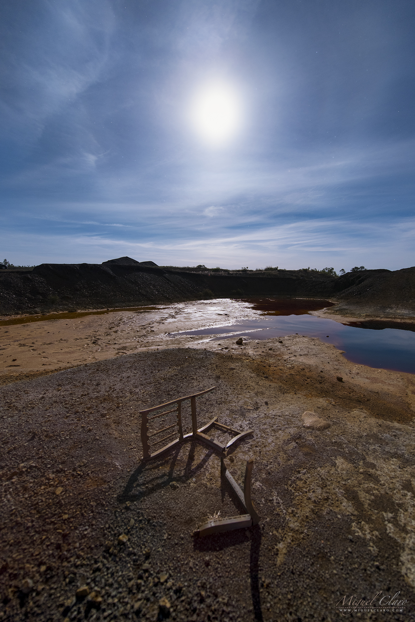
Shadows from a fragmented chair illuminated by the light of a smooth Lunar Halo above a puddle of acid water from Achada do Gamo, that was – since the beginning of modern mining activities in the São Domingos Mine – the center of metallurgical activities on extracted minerals. The areas of heaps, slag and channels of water, give the landscape a “lunar” aspect. The heaps are composed of different materials with high levels of metals, such as slag and ash, whose leaching through the rainwater leads to the production of acid mine drainage, usually with an ocher or reddish color.
São Domingos Mine is located in Baixo Alentejo, about 240 km from Lisbon, in the municipality of Mértola, which recently joined the Dark Sky® Alqueva Route for the great quality of the night sky. The São Domingos mining area is part of the Iberian Pyrite Range and is a decisive source of basic metals (S, Zn, Pb, Sn, Ag, Au, Fe, Co, Cd, etc.) and other elements such as sulfur (S). It has been a sought after place for the extraction of ores since antiquity, with evidence of gold, silver and copper mining in the pre-Roman and Roman times. The pyritic deposit of São Domingos (St. Dominic) was explored in various historical periods, namely: for several centuries of the first millennium BC (Eastern period), during the period between 14 BC and 395 AD (Roman period), during the Islamic period and during the modern period that was initiated in 1858 for the extraction of copper, gold and silver and was maintained until 1966, the year in which the reserves were considered exhausted. During this period, the work was done in the open air up to 120 meters deep, with work continued through wells and galleries up to 400 meters. Over 108 years of regular exploration, more than 20 million tons of materials were removed from the site, producing about 14.7 million tons of waste accumulated in heaps up to 14 meters high with a dozen different materials such as pyrite , gossan, slag, ash, iron oxides, barren rock, sludge, debris, etc.|
PT: Sombras de uma cadeira fragmentada iluminada pela luz de um quase imperceptível Halo lunar, que se formava acima da paisagem ácida de Achada do Gamo, que foi desde o início das atividades modernas de mineração na Mina de São Domingos, o centro das atividades metalúrgicas sobre os minérios extraídos. As áreas de escombreiras, escórias e canais de água, dão à paisagem um aspecto “lunar”. As escombreiras são constituídas por diferentes materiais com teores elevados em metais, como escórias e cinzas, cuja lixiviação através das águas das chuvas leva à produção de águas ácidas (‘acid mine drainage’), geralmente com uma cor ocre ou avermelhada.
A Mina de São Domingos, situa-se no Baixo Alentejo, a cerca de 240 km de Lisboa, no concelho de Mértola, que passou a integrar recentemente a Rota Dark Sky® Alqueva pela grande qualidade do seu céu escuro. A área mineira de São Domingos, está inserida na Faixa Piritosa Ibérica e constitui uma fonte decisiva de metais básicos (Cu, Zn, Pb, Sn, Ag, Au, Fe, Co, Cd, etc.) e de outros elementos como o enxofre (S). Foi desde a Antiguidade um local procurado para a extracção de minérios, existindo indícios de trabalhos de extracção de ouro, prata e cobre no período pré-romano e romano. O depósito pirítico de São Domingos foi explorado em diversos períodos históricos, nomeadamente: durante vários séculos do primeiro milénio a.C. (período Oriental), durante o período que mediou entre o ano 14 a.C. e o ano de 395 d.C. (período romano), durante o período islâmico e durante o período moderno que se iniciou em 1858 para a extracção de cobre, ouro e prata e manteve-se até 1966, ano em que as reservas foram consideradas esgotadas. Neste período, a lavra foi feita a céu aberto até aos 120 metros de profundidade, tendo os trabalhos continuado por meio de poços e galerias até aos 400 metros. Ao longo de 108 anos de exploração regular, foram retirados do local mais de 20 milhões de toneladas de materiais, tendo produzido cerca 14,7 milhões de toneladas de resíduos acumulados em escombreiras de até 14 metros de altura, com uma dezena de materiais diferentes como pirite, gossan, escórias, cinzas, óxidos de ferro, rocha estéril, lamas, entulhos, etc.
Summer Triangle and Planet Saturn Shinning above Achada do Gamo

A view of the Milky Way arm with planet Saturn shinning against the galaxy core, near Scorpius constellation. In the top right corner of the image, a pink/red emission from North America Nebula (NGC7000) is well visible near Deneb star, forming a perfect triangle with the blue star Vega (top center) and Altair star (left center). This mosaic of the Milky Way was captured above a puddle of acid water from Achada do Gamo, that was – since the beginning of modern mining activities in the São Domingos Mine – the center of metallurgical activities on extracted minerals. Already during the 20th century, between the 30s and 40s, a new direction of industrial exploration took place: the sulfur, however much valued, began to be extracted from the copper pyrites through furnaces (Orkla process) in two plants installed in the Achada do Gamo during the years of 1934 and 1943.
São Domingos Mine is located in Baixo Alentejo, about 240 km from Lisbon, in the municipality of Mértola, which recently joined the Dark Sky® Alqueva Route for the great quality of the night sky. The São Domingos mining area is part of the Iberian Pyrite Range and is a decisive source of basic metals (S, Zn, Pb, Sn, Ag, Au, Fe, Co, Cd, etc.) and other elements such as sulfur (S). It has been a sought after place for the extraction of ores since antiquity, with evidence of gold, silver and copper mining in the pre-Roman and Roman times. The pyritic deposit of São Domingos (St. Dominic) was explored in various historical periods, namely: for several centuries of the first millennium BC (Eastern period), during the period between 14 BC and 395 AD (Roman period), during the Islamic period and during the modern period that was initiated in 1858 for the extraction of copper, gold and silver and was maintained until 1966, the year in which the reserves were considered exhausted. During this period, the work was done in the open air up to 120 meters deep, with work continued through wells and galleries up to 400 meters. Over 108 years of regular exploration, more than 20 million tons of materials were removed from the site, producing about 14.7 million tons of waste accumulated in heaps up to 14 meters high with a dozen different materials such as pyrite , gossan, slag, ash, iron oxides, barren rock, sludge, debris, etc. The areas of heaps, slag and channels of water, give the landscape a “lunar” aspect. The heaps are composed of different materials with high levels of metals, such as slag and ash, whose leaching through the rainwater leads to the production of acid mine drainage, usually with an ocher or reddish color.|
PT: Uma visão do braço da Via Láctea com o planeta Saturno brilhando contra o centro da galáxia, perto da constelação do Escorpião. No canto superior direito da imagem, uma emissão rosa/vermelha proveniente da Nebulosa América do Norte (NGC7000) é bem visível perto da estrela Deneb, formando um triângulo perfeito com a estrela azul Vega (centro superior) e a estrela Altair (centro esquerdo). Este mosaico da Via Láctea foi captado acima das águas ácidas da Achada do Gamo, que foi desde o início das atividades modernas de mineração na Mina de São Domingos, o centro das atividades metalúrgicas sobre os minérios extraídos. Já durante o século XX, entre as décadas de 30 e 40, uma nova direção de exploração industrial tomou lugar: o enxofre, entretanto muito valorizado, passou a ser extraído das pirites cupríferas através de fornos (processo Orkla) em duas unidades fabris instaladas na Achada do Gamo durante os anos de 1934 e 1943.
A Mina de São Domingos, situa-se no Baixo Alentejo, a cerca de 240 km de Lisboa, no concelho de Mértola, que passou a integrar recentemente a Rota Dark Sky® Alqueva pela grande qualidade do seu céu escuro. A área mineira de São Domingos, está inserida na Faixa Piritosa Ibérica e constitui uma fonte decisiva de metais básicos (Cu, Zn, Pb, Sn, Ag, Au, Fe, Co, Cd, etc.) e de outros elementos como o enxofre (S). Foi desde a Antiguidade um local procurado para a extracção de minérios, existindo indícios de trabalhos de extracção de ouro, prata e cobre no período pré-romano e romano. O depósito pirítico de São Domingos foi explorado em diversos períodos históricos, nomeadamente: durante vários séculos do primeiro milénio a.C. (período Oriental), durante o período que mediou entre o ano 14 a.C. e o ano de 395 d.C. (período romano), durante o período islâmico e durante o período moderno que se iniciou em 1858 para a extracção de cobre, ouro e prata e manteve-se até 1966, ano em que as reservas foram consideradas esgotadas. Neste período, a lavra foi feita a céu aberto até aos 120 metros de profundidade, tendo os trabalhos continuado por meio de poços e galerias até aos 400 metros. Ao longo de 108 anos de exploração regular, foram retirados do local mais de 20 milhões de toneladas de materiais, tendo produzido cerca 14,7 milhões de toneladas de resíduos acumulados em escombreiras de até 14 metros de altura, com uma dezena de materiais diferentes como pirite, gossan, escórias, cinzas, óxidos de ferro, rocha estéril, lamas, entulhos, etc. As áreas de escombreiras, escórias e canais de água, dão à paisagem um aspecto “lunar”. As escombreiras são constituídas por diferentes materiais com teores elevados em metais, como escórias e cinzas, cuja lixiviação através das águas das chuvas leva à produção de águas ácidas (‘acid mine drainage’), geralmente com uma cor ocre ou avermelhada.
Moonlight and Jupiter Shinning above Corta da Mina Landscape

A Moonlight scene in a cloudy sky with bright planet Jupiter shinning above Corta da Mina landscape, that is the result of the open-pit mining operation begun in 1867 in São Domingos Mine. It has a geometrical shape of an ellipse and a depth of 120 m and a perimeter of approximately 2 km. It was the place from which the ores were extracted: the pyrites, sulfur, copper, iron, zinc, gold and silver. Around the cavity it is possible to observe several types of heaps constituted by diverse materials such as modern slag of black color, brownish Roman slag, gossan fragments of reddish color and encasing mineralization rocks like vulcanites and schists. Some of these commons have significant gold contents assuming the presence of iMt from heaps with 1g / t gold. ” After the end of the work, in 1966, the abandonment of the extraction of water from the bottom of the mine allowed the rise groundwater level within the cut to the current, apparently stationary point. The water currently contained in the cut is extremely acidic (Ph = 2) giving the water an incredible color variation with colours ranging from reddish tones to oranges and yellows, it contains a large amount of dissolved sulfates, mainly iron and arsenic sulfates, but also copper and zinc.
São Domingos Mine is located in Baixo Alentejo, about 240 km from Lisbon, in the municipality of Mértola, which recently joined the Dark Sky® Alqueva Route for the great quality of the night sky. The São Domingos mining area is part of the Iberian Pyrite Range and is a decisive source of basic metals (S, Zn, Pb, Sn, Ag, Au, Fe, Co, Cd, etc.) and other elements such as sulfur (S). It has been a sought after place for the extraction of ores since antiquity, with evidence of gold, silver and copper mining in the pre-Roman and Roman times. The pyritic deposit of São Domingos (St. Dominic) was explored in various historical periods, namely: for several centuries of the first millennium BC (Eastern period), during the period between 14 BC and 395 AD (Roman period), during the Islamic period and during the modern period that was initiated in 1858 for the extraction of copper, gold and silver and was maintained until 1966, the year in which the reserves were considered exhausted. During this period, the work was done in the open air up to 120 meters deep, with work continued through wells and galleries up to 400 meters. Over 108 years of regular exploration, more than 20 million tons of materials were removed from the site, producing about 14.7 million tons of waste accumulated in heaps up to 14 meters high with a dozen different materials such as pyrite , gossan, slag, ash, iron oxides, barren rock, sludge, debris, etc. The areas of heaps, slag and channels of water, give the landscape a “lunar” aspect. The heaps are composed of different materials with high levels of metals, such as slag and ash, whose leaching through the rainwater leads to the production of acid mine drainage, usually with an ocher or reddish color. |
PT: Um cenário ao Luar com a presença do planeta Jupiter a brilhar por detrás de um céu nublado que se precipita acima da paisagem acida da Corta da Mina, o resultado da exploração mineira a céu aberto encetada em 1867 na Mina de São Domingos, em Mértola. Possui uma forma geométrica de uma elipse e uma profundidade de 120 m e um perímetro de aproximadamente 2 km. Era o local de onde se extraíam os minérios: as pirites, enxofre, cobre, ferro, zinco, ouro e prata. Em torno da cavidade é possível observar vários tipos de escombreiras constituídas por materiais diversos como escórias modernas de cor negra, escórias romanas acastanhadas, fragmentos de gossan de cor avermelhada e rochas encaixantes da mineralização como vulcanitos e xistos. Alguns destes corpos de encombros apresentam teores significativos de ouro admitindo-se a presença de iMt de escombreiras com 1g/t de ouro.” Após o fim da laboração, em 1966, o abandono da extração de água do fundo da mina permitiu a subida do nível freático dentro da corta até ao ponto atual, aparentemente estacionário.
A água hoje contida na corta é extremamente ácida (Ph=2) conferindo à água uma variação cromática incrível com cores que vão desde tons avermelhados, a laranjas e amarelos, contém uma grande quantidade de sulfatos dissolvidos, principalmente sulfatos de ferro e arsénico mas também de cobre e zinco
A Mina de São Domingos, situa-se no Baixo Alentejo, a cerca de 240 km de Lisboa, no concelho de Mértola, que passou a integrar recentemente a Rota Dark Sky® Alqueva pela grande qualidade do seu céu escuro. A área mineira de São Domingos, está inserida na Faixa Piritosa Ibérica e constitui uma fonte decisiva de metais básicos (Cu, Zn, Pb, Sn, Ag, Au, Fe, Co, Cd, etc.) e de outros elementos como o enxofre (S). Foi desde a Antiguidade um local procurado para a extracção de minérios, existindo indícios de trabalhos de extracção de ouro, prata e cobre no período pré-romano e romano. O depósito pirítico de São Domingos foi explorado em diversos períodos históricos, nomeadamente: durante vários séculos do primeiro milénio a.C. (período Oriental), durante o período que mediou entre o ano 14 a.C. e o ano de 395 d.C. (período romano), durante o período islâmico e durante o período moderno que se iniciou em 1858 para a extracção de cobre, ouro e prata e manteve-se até 1966, ano em que as reservas foram consideradas esgotadas. Neste período, a lavra foi feita a céu aberto até aos 120 metros de profundidade, tendo os trabalhos continuado por meio de poços e galerias até aos 400 metros. Ao longo de 108 anos de exploração regular, foram retirados do local mais de 20 milhões de toneladas de materiais, tendo produzido cerca 14,7 milhões de toneladas de resíduos acumulados em escombreiras de até 14 metros de altura, com uma dezena de materiais diferentes como pirite, gossan, escórias, cinzas, óxidos de ferro, rocha estéril, lamas, entulhos, etc. As áreas de escombreiras, escórias e canais de água, dão à paisagem um aspecto “lunar”. As escombreiras são constituídas por diferentes materiais com teores elevados em metais, como escórias e cinzas, cuja lixiviação através das águas das chuvas leva à produção de águas ácidas (‘acid mine drainage’), geralmente com uma cor ocre ou avermelhada.
Full Moon Emerging from an Acid Landscape

A Full Moon is reflected in a puddle of acid water from Achada do Gamo, that was – since the beginning of modern mining activities in the São Domingos Mine – the center of metallurgical activities on extracted minerals. The areas of heaps, slag and channels of water, give the landscape a “lunar” aspect, revealed in this image naturally illuminated by the Moonlight. The heaps are composed of different materials with high levels of metals, such as slag and ash, whose leaching through the rainwater leads to the production of acid mine drainage, usually with an ocher or reddish color.
São Domingos Mine is located in Baixo Alentejo, about 240 km from Lisbon, in the municipality of Mértola, which recently joined the Dark Sky® Alqueva Route for the great quality of the night sky. The São Domingos mining area is part of the Iberian Pyrite Range and is a decisive source of basic metals (S, Zn, Pb, Sn, Ag, Au, Fe, Co, Cd, etc.) and other elements such as sulfur (S). It has been a sought after place for the extraction of ores since antiquity, with evidence of gold, silver and copper mining in the pre-Roman and Roman times. The pyritic deposit of São Domingos (St. Dominic) was explored in various historical periods, namely: for several centuries of the first millennium BC (Eastern period), during the period between 14 BC and 395 AD (Roman period), during the Islamic period and during the modern period that was initiated in 1858 for the extraction of copper, gold and silver and was maintained until 1966, the year in which the reserves were considered exhausted. During this period, the work was done in the open air up to 120 meters deep, with work continued through wells and galleries up to 400 meters. Over 108 years of regular exploration, more than 20 million tons of materials were removed from the site, producing about 14.7 million tons of waste accumulated in heaps up to 14 meters high with a dozen different materials such as pyrite , gossan, slag, ash, iron oxides, barren rock, sludge, debris, etc.|
PT: A Lua Cheia reflectida nas águas ácidas da Achada do Gamo, que foi desde o início das atividades modernas de mineração na Mina de São Domingos, o centro das atividades metalúrgicas sobre os minérios extraídos. As áreas de escombreiras, escórias e canais de água, dão à paisagem um aspecto “lunar”, revelado nesta imagem nocturna pela luz natural do luar. As escombreiras são constituídas por diferentes materiais com teores elevados em metais, como escórias e cinzas, cuja lixiviação através das águas das chuvas leva à produção de águas ácidas (‘acid mine drainage’), geralmente com uma cor ocre ou avermelhada.
A Mina de São Domingos, situa-se no Baixo Alentejo, a cerca de 240 km de Lisboa, no concelho de Mértola, que passou a integrar recentemente a Rota Dark Sky® Alqueva pela grande qualidade do seu céu escuro. A área mineira de São Domingos, está inserida na Faixa Piritosa Ibérica e constitui uma fonte decisiva de metais básicos (Cu, Zn, Pb, Sn, Ag, Au, Fe, Co, Cd, etc.) e de outros elementos como o enxofre (S). Foi desde a Antiguidade um local procurado para a extracção de minérios, existindo indícios de trabalhos de extracção de ouro, prata e cobre no período pré-romano e romano. O depósito pirítico de São Domingos foi explorado em diversos períodos históricos, nomeadamente: durante vários séculos do primeiro milénio a.C. (período Oriental), durante o período que mediou entre o ano 14 a.C. e o ano de 395 d.C. (período romano), durante o período islâmico e durante o período moderno que se iniciou em 1858 para a extracção de cobre, ouro e prata e manteve-se até 1966, ano em que as reservas foram consideradas esgotadas. Neste período, a lavra foi feita a céu aberto até aos 120 metros de profundidade, tendo os trabalhos continuado por meio de poços e galerias até aos 400 metros. Ao longo de 108 anos de exploração regular, foram retirados do local mais de 20 milhões de toneladas de materiais, tendo produzido cerca 14,7 milhões de toneladas de resíduos acumulados em escombreiras de até 14 metros de altura, com uma dezena de materiais diferentes como pirite, gossan, escórias, cinzas, óxidos de ferro, rocha estéril, lamas, entulhos, etc.
A Lunar Landscape shows a Full Moon Reflected in the Acid Water of Mina de São Domingos

A Full Moon is reflected in a puddle of acid water from Achada do Gamo, that was – since the beginning of modern mining activities in the São Domingos Mine – the center of metallurgical activities on extracted minerals. The areas of heaps, slag and channels of water, give the landscape a “lunar” aspect. The heaps are composed of different materials with high levels of metals, such as slag and ash, whose leaching through the rainwater leads to the production of acid mine drainage, usually with an ocher or reddish color.
São Domingos Mine is located in Baixo Alentejo, about 240 km from Lisbon, in the municipality of Mértola, which recently joined the Dark Sky® Alqueva Route for the great quality of the night sky. The São Domingos mining area is part of the Iberian Pyrite Range and is a decisive source of basic metals (S, Zn, Pb, Sn, Ag, Au, Fe, Co, Cd, etc.) and other elements such as sulfur (S). It has been a sought after place for the extraction of ores since antiquity, with evidence of gold, silver and copper mining in the pre-Roman and Roman times. The pyritic deposit of São Domingos (St. Dominic) was explored in various historical periods, namely: for several centuries of the first millennium BC (Eastern period), during the period between 14 BC and 395 AD (Roman period), during the Islamic period and during the modern period that was initiated in 1858 for the extraction of copper, gold and silver and was maintained until 1966, the year in which the reserves were considered exhausted. During this period, the work was done in the open air up to 120 meters deep, with work continued through wells and galleries up to 400 meters. Over 108 years of regular exploration, more than 20 million tons of materials were removed from the site, producing about 14.7 million tons of waste accumulated in heaps up to 14 meters high with a dozen different materials such as pyrite , gossan, slag, ash, iron oxides, barren rock, sludge, debris, etc.|
PT: A Lua Cheia reflectida nas águas ácidas da Achada do Gamo, que foi desde o início das atividades modernas de mineração na Mina de São Domingos, o centro das atividades metalúrgicas sobre os minérios extraídos. As áreas de escombreiras, escórias e canais de água, dão à paisagem um aspecto “lunar”. As escombreiras são constituídas por diferentes materiais com teores elevados em metais, como escórias e cinzas, cuja lixiviação através das águas das chuvas leva à produção de águas ácidas (‘acid mine drainage’), geralmente com uma cor ocre ou avermelhada.
A Mina de São Domingos, situa-se no Baixo Alentejo, a cerca de 240 km de Lisboa, no concelho de Mértola, que passou a integrar recentemente a Rota Dark Sky® Alqueva pela grande qualidade do seu céu escuro. A área mineira de São Domingos, está inserida na Faixa Piritosa Ibérica e constitui uma fonte decisiva de metais básicos (Cu, Zn, Pb, Sn, Ag, Au, Fe, Co, Cd, etc.) e de outros elementos como o enxofre (S). Foi desde a Antiguidade um local procurado para a extracção de minérios, existindo indícios de trabalhos de extracção de ouro, prata e cobre no período pré-romano e romano. O depósito pirítico de São Domingos foi explorado em diversos períodos históricos, nomeadamente: durante vários séculos do primeiro milénio a.C. (período Oriental), durante o período que mediou entre o ano 14 a.C. e o ano de 395 d.C. (período romano), durante o período islâmico e durante o período moderno que se iniciou em 1858 para a extracção de cobre, ouro e prata e manteve-se até 1966, ano em que as reservas foram consideradas esgotadas. Neste período, a lavra foi feita a céu aberto até aos 120 metros de profundidade, tendo os trabalhos continuado por meio de poços e galerias até aos 400 metros. Ao longo de 108 anos de exploração regular, foram retirados do local mais de 20 milhões de toneladas de materiais, tendo produzido cerca 14,7 milhões de toneladas de resíduos acumulados em escombreiras de até 14 metros de altura, com uma dezena de materiais diferentes como pirite, gossan, escórias, cinzas, óxidos de ferro, rocha estéril, lamas, entulhos, etc.
Moonrise Behind a Metallurgic Structure from Achada do Gamo

The Full Moon is rising against the silhouette structure from Achada do Gamo, that was – since the beginning of modern mining activities in the São Domingos Mine – the center of metallurgical activities on extracted minerals. Already during the 20th century, between the 30s and 40s, a new direction of industrial exploration took place: the sulfur, however much valued, began to be extracted from the copper pyrites through furnaces (Orkla process) in two plants installed in the Achada do Gamo during the years of 1934 and 1943.
São Domingos Mine is located in Baixo Alentejo, about 240 km from Lisbon, in the municipality of Mértola, which recently joined the Dark Sky® Alqueva Route for the great quality of the night sky. The São Domingos mining area is part of the Iberian Pyrite Range and is a decisive source of basic metals (S, Zn, Pb, Sn, Ag, Au, Fe, Co, Cd, etc.) and other elements such as sulfur (S). It has been a sought after place for the extraction of ores since antiquity, with evidence of gold, silver and copper mining in the pre-Roman and Roman times. The pyritic deposit of São Domingos (St. Dominic) was explored in various historical periods, namely: for several centuries of the first millennium BC (Eastern period), during the period between 14 BC and 395 AD (Roman period), during the Islamic period and during the modern period that was initiated in 1858 for the extraction of copper, gold and silver and was maintained until 1966, the year in which the reserves were considered exhausted. During this period, the work was done in the open air up to 120 meters deep, with work continued through wells and galleries up to 400 meters. Over 108 years of regular exploration, more than 20 million tons of materials were removed from the site, producing about 14.7 million tons of waste accumulated in heaps up to 14 meters high with a dozen different materials such as pyrite , gossan, slag, ash, iron oxides, barren rock, sludge, debris, etc. The areas of heaps, slag and channels of water, give the landscape a “lunar” aspect. The heaps are composed of different materials with high levels of metals, such as slag and ash, whose leaching through the rainwater leads to the production of acid mine drainage, usually with an ocher or reddish color. |
PT: A Lua Cheia nasce por detrás da silhueta da estrutura metalúrgica da Achada do Gamo, que foi desde o início das atividades modernas de mineração na Mina de São Domingos, o centro das atividades metalúrgicas sobre os minérios extraídos. Já durante o século XX, entre as décadas de 30 e 40, uma nova direção de exploração industrial tomou lugar: o enxofre, entretanto muito valorizado, passou a ser extraído das pirites cupríferas através de fornos (processo Orkla) em duas unidades fabris instaladas na Achada do Gamo durante os anos de 1934 e 1943.
A Mina de São Domingos, situa-se no Baixo Alentejo, a cerca de 240 km de Lisboa, no concelho de Mértola, que passou a integrar recentemente a Rota Dark Sky® Alqueva pela grande qualidade do seu céu escuro. A área mineira de São Domingos, está inserida na Faixa Piritosa Ibérica e constitui uma fonte decisiva de metais básicos (Cu, Zn, Pb, Sn, Ag, Au, Fe, Co, Cd, etc.) e de outros elementos como o enxofre (S). Foi desde a Antiguidade um local procurado para a extracção de minérios, existindo indícios de trabalhos de extracção de ouro, prata e cobre no período pré-romano e romano. O depósito pirítico de São Domingos foi explorado em diversos períodos históricos, nomeadamente: durante vários séculos do primeiro milénio a.C. (período Oriental), durante o período que mediou entre o ano 14 a.C. e o ano de 395 d.C. (período romano), durante o período islâmico e durante o período moderno que se iniciou em 1858 para a extracção de cobre, ouro e prata e manteve-se até 1966, ano em que as reservas foram consideradas esgotadas. Neste período, a lavra foi feita a céu aberto até aos 120 metros de profundidade, tendo os trabalhos continuado por meio de poços e galerias até aos 400 metros. Ao longo de 108 anos de exploração regular, foram retirados do local mais de 20 milhões de toneladas de materiais, tendo produzido cerca 14,7 milhões de toneladas de resíduos acumulados em escombreiras de até 14 metros de altura, com uma dezena de materiais diferentes como pirite, gossan, escórias, cinzas, óxidos de ferro, rocha estéril, lamas, entulhos, etc. As áreas de escombreiras, escórias e canais de água, dão à paisagem um aspecto “lunar”. As escombreiras são constituídas por diferentes materiais com teores elevados em metais, como escórias e cinzas, cuja lixiviação através das águas das chuvas leva à produção de águas ácidas (‘acid mine drainage’), geralmente com uma cor ocre ou avermelhada.
Full Moon Behind a Metallurgic Silhouette from Achada do Gamo

The Full Moon is rising against the silhouette structure from Achada do Gamo, that was – since the beginning of modern mining activities in the São Domingos Mine – the center of metallurgical activities on extracted minerals. Already during the 20th century, between the 30s and 40s, a new direction of industrial exploration took place: the sulfur, however much valued, began to be extracted from the copper pyrites through furnaces (Orkla process) in two plants installed in the Achada do Gamo during the years of 1934 and 1943.
São Domingos Mine is located in Baixo Alentejo, about 240 km from Lisbon, in the municipality of Mértola, which recently joined the Dark Sky® Alqueva Route for the great quality of the night sky. The São Domingos mining area is part of the Iberian Pyrite Range and is a decisive source of basic metals (S, Zn, Pb, Sn, Ag, Au, Fe, Co, Cd, etc.) and other elements such as sulfur (S). It has been a sought after place for the extraction of ores since antiquity, with evidence of gold, silver and copper mining in the pre-Roman and Roman times. The pyritic deposit of São Domingos (St. Dominic) was explored in various historical periods, namely: for several centuries of the first millennium BC (Eastern period), during the period between 14 BC and 395 AD (Roman period), during the Islamic period and during the modern period that was initiated in 1858 for the extraction of copper, gold and silver and was maintained until 1966, the year in which the reserves were considered exhausted. During this period, the work was done in the open air up to 120 meters deep, with work continued through wells and galleries up to 400 meters. Over 108 years of regular exploration, more than 20 million tons of materials were removed from the site, producing about 14.7 million tons of waste accumulated in heaps up to 14 meters high with a dozen different materials such as pyrite , gossan, slag, ash, iron oxides, barren rock, sludge, debris, etc. The areas of heaps, slag and channels of water, give the landscape a “lunar” aspect. The heaps are composed of different materials with high levels of metals, such as slag and ash, whose leaching through the rainwater leads to the production of acid mine drainage, usually with an ocher or reddish color. |
PT: A Lua Cheia nasce por detrás da silhueta da estrutura metalúrgica da Achada do Gamo, que foi desde o início das atividades modernas de mineração na Mina de São Domingos, o centro das atividades metalúrgicas sobre os minérios extraídos. Já durante o século XX, entre as décadas de 30 e 40, uma nova direção de exploração industrial tomou lugar: o enxofre, entretanto muito valorizado, passou a ser extraído das pirites cupríferas através de fornos (processo Orkla) em duas unidades fabris instaladas na Achada do Gamo durante os anos de 1934 e 1943.
A Mina de São Domingos, situa-se no Baixo Alentejo, a cerca de 240 km de Lisboa, no concelho de Mértola, que passou a integrar recentemente a Rota Dark Sky® Alqueva pela grande qualidade do seu céu escuro. A área mineira de São Domingos, está inserida na Faixa Piritosa Ibérica e constitui uma fonte decisiva de metais básicos (Cu, Zn, Pb, Sn, Ag, Au, Fe, Co, Cd, etc.) e de outros elementos como o enxofre (S). Foi desde a Antiguidade um local procurado para a extracção de minérios, existindo indícios de trabalhos de extracção de ouro, prata e cobre no período pré-romano e romano. O depósito pirítico de São Domingos foi explorado em diversos períodos históricos, nomeadamente: durante vários séculos do primeiro milénio a.C. (período Oriental), durante o período que mediou entre o ano 14 a.C. e o ano de 395 d.C. (período romano), durante o período islâmico e durante o período moderno que se iniciou em 1858 para a extracção de cobre, ouro e prata e manteve-se até 1966, ano em que as reservas foram consideradas esgotadas. Neste período, a lavra foi feita a céu aberto até aos 120 metros de profundidade, tendo os trabalhos continuado por meio de poços e galerias até aos 400 metros. Ao longo de 108 anos de exploração regular, foram retirados do local mais de 20 milhões de toneladas de materiais, tendo produzido cerca 14,7 milhões de toneladas de resíduos acumulados em escombreiras de até 14 metros de altura, com uma dezena de materiais diferentes como pirite, gossan, escórias, cinzas, óxidos de ferro, rocha estéril, lamas, entulhos, etc. As áreas de escombreiras, escórias e canais de água, dão à paisagem um aspecto “lunar”. As escombreiras são constituídas por diferentes materiais com teores elevados em metais, como escórias e cinzas, cuja lixiviação através das águas das chuvas leva à produção de águas ácidas (‘acid mine drainage’), geralmente com uma cor ocre ou avermelhada.
A Twilight of a Double Moonrise above Mina de São Domingos

A twilight of a “double” moonrise reflected in a puddle of acid water from Achada do Gamo, that was – since the beginning of modern mining activities in the São Domingos Mine – the center of metallurgical activities on extracted minerals. Already during the 20th century, between the 30s and 40s, a new direction of industrial exploration took place: the sulfur, however much valued, began to be extracted from the copper pyrites through furnaces (Orkla process) in two plants installed in the Achada do Gamo during the years of 1934 and 1943.
São Domingos Mine is located in Baixo Alentejo, about 240 km from Lisbon, in the municipality of Mértola, which recently joined the Dark Sky® Alqueva Route for the great quality of the night sky. The São Domingos mining area is part of the Iberian Pyrite Range and is a decisive source of basic metals (S, Zn, Pb, Sn, Ag, Au, Fe, Co, Cd, etc.) and other elements such as sulfur (S). It has been a sought after place for the extraction of ores since antiquity, with evidence of gold, silver and copper mining in the pre-Roman and Roman times. The pyritic deposit of São Domingos (St. Dominic) was explored in various historical periods, namely: for several centuries of the first millennium BC (Eastern period), during the period between 14 BC and 395 AD (Roman period), during the Islamic period and during the modern period that was initiated in 1858 for the extraction of copper, gold and silver and was maintained until 1966, the year in which the reserves were considered exhausted. During this period, the work was done in the open air up to 120 meters deep, with work continued through wells and galleries up to 400 meters. Over 108 years of regular exploration, more than 20 million tons of materials were removed from the site, producing about 14.7 million tons of waste accumulated in heaps up to 14 meters high with a dozen different materials such as pyrite , gossan, slag, ash, iron oxides, barren rock, sludge, debris, etc. The areas of heaps, slag and channels of water, give the landscape a “lunar” aspect. The heaps are composed of different materials with high levels of metals, such as slag and ash, whose leaching through the rainwater leads to the production of acid mine drainage, usually with an ocher or reddish color.|
PT: Durante o crepúsculo uma “lua dupla” nasce reflectida nas águas ácidas da Achada do Gamo, que foi desde o início das atividades modernas de mineração na Mina de São Domingos, o centro das atividades metalúrgicas sobre os minérios extraídos. Já durante o século XX, entre as décadas de 30 e 40, uma nova direção de exploração industrial tomou lugar: o enxofre, entretanto muito valorizado, passou a ser extraído das pirites cupríferas através de fornos (processo Orkla) em duas unidades fabris instaladas na Achada do Gamo durante os anos de 1934 e 1943.
A Mina de São Domingos, situa-se no Baixo Alentejo, a cerca de 240 km de Lisboa, no concelho de Mértola, que passou a integrar recentemente a Rota Dark Sky® Alqueva pela grande qualidade do seu céu escuro. A área mineira de São Domingos, está inserida na Faixa Piritosa Ibérica e constitui uma fonte decisiva de metais básicos (Cu, Zn, Pb, Sn, Ag, Au, Fe, Co, Cd, etc.) e de outros elementos como o enxofre (S). Foi desde a Antiguidade um local procurado para a extracção de minérios, existindo indícios de trabalhos de extracção de ouro, prata e cobre no período pré-romano e romano. O depósito pirítico de São Domingos foi explorado em diversos períodos históricos, nomeadamente: durante vários séculos do primeiro milénio a.C. (período Oriental), durante o período que mediou entre o ano 14 a.C. e o ano de 395 d.C. (período romano), durante o período islâmico e durante o período moderno que se iniciou em 1858 para a extracção de cobre, ouro e prata e manteve-se até 1966, ano em que as reservas foram consideradas esgotadas. Neste período, a lavra foi feita a céu aberto até aos 120 metros de profundidade, tendo os trabalhos continuado por meio de poços e galerias até aos 400 metros. Ao longo de 108 anos de exploração regular, foram retirados do local mais de 20 milhões de toneladas de materiais, tendo produzido cerca 14,7 milhões de toneladas de resíduos acumulados em escombreiras de até 14 metros de altura, com uma dezena de materiais diferentes como pirite, gossan, escórias, cinzas, óxidos de ferro, rocha estéril, lamas, entulhos, etc. As áreas de escombreiras, escórias e canais de água, dão à paisagem um aspecto “lunar”. As escombreiras são constituídas por diferentes materiais com teores elevados em metais, como escórias e cinzas, cuja lixiviação através das águas das chuvas leva à produção de águas ácidas (‘acid mine drainage’), geralmente com uma cor ocre ou avermelhada.
A Bright Meteor from Geminid above Monsaraz

As the Earth was passing through a stream of gravelly debris from “rock comet” 3200 Phaethon, I´ve captured a bright meteor above Monsaraz, Dark Sky® Alqueva reserve, in the night before the expected peak of annual Geminid meteor shower.
PT: À medida que a Terra passava pela rota de detritos deixados para trás pelo “cometa rochoso” 3200 Phaethon, foi possível captar um meteoro brilhante acima de Monsaraz, Reserva Dark Sky® Alqueva, na noite anterior ao pico esperado da chuva anual de meteoros Gemínidas.
A Colourful Startrail above São Domingos Mine

In the image above we can see a startrail sequence captured in the region of the sky where appears in the background, the diffuse path of Milky Way, rising above Achada do Gamo, that was – since the beginning of modern mining activities in the São Domingos Mine – the center of metallurgical activities on extracted minerals. Already during the 20th century, between the 30s and 40s, a new direction of industrial exploration took place: the sulfur, however much valued, began to be extracted from the copper pyrites through furnaces (Orkla process) in two plants installed in the Achada do Gamo during the years of 1934 and 1943.
São Domingos Mine is located in Baixo Alentejo, about 240 km from Lisbon, in the municipality of Mértola, which recently joined the Dark Sky® Alqueva Route for the great quality of the night sky. The São Domingos mining area is part of the Iberian Pyrite Range and is a decisive source of basic metals (S, Zn, Pb, Sn, Ag, Au, Fe, Co, Cd, etc.) and other elements such as sulfur (S). It has been a sought after place for the extraction of ores since antiquity, with evidence of gold, silver and copper mining in the pre-Roman and Roman times. The pyritic deposit of São Domingos (St. Dominic) was explored in various historical periods, namely: for several centuries of the first millennium BC (Eastern period), during the period between 14 BC and 395 AD (Roman period), during the Islamic period and during the modern period that was initiated in 1858 for the extraction of copper, gold and silver and was maintained until 1966, the year in which the reserves were considered exhausted. During this period, the work was done in the open air up to 120 meters deep, with work continued through wells and galleries up to 400 meters. Over 108 years of regular exploration, more than 20 million tons of materials were removed from the site, producing about 14.7 million tons of waste accumulated in heaps up to 14 meters high with a dozen different materials such as pyrite , gossan, slag, ash, iron oxides, barren rock, sludge, debris, etc. The areas of heaps, slag and channels of water, give the landscape a “lunar” aspect. The heaps are composed of different materials with high levels of metals, such as slag and ash, whose leaching through the rainwater leads to the production of acid mine drainage, usually with an ocher or reddish color.
PT: Na imagem acima é possível ver um rasto de estrelas na região do céu onde se encontra em pano de fundo a Via Láctea, captada acima da Achada do Gamo, que foi desde o início das atividades modernas de mineração na Mina de São Domingos, o centro das atividades metalúrgicas sobre os minérios extraídos. Já durante o século XX, entre as décadas de 30 e 40, uma nova direção de exploração industrial tomou lugar: o enxofre, entretanto muito valorizado, passou a ser extraído das pirites cupríferas através de fornos (processo Orkla) em duas unidades fabris instaladas na Achada do Gamo durante os anos de 1934 e 1943.
A Mina de São Domingos, situa-se no Baixo Alentejo, a cerca de 240 km de Lisboa, no concelho de Mértola, que passou a integrar recentemente a Rota Dark Sky® Alqueva pela grande qualidade do seu céu escuro. A área mineira de São Domingos, está inserida na Faixa Piritosa Ibérica e constitui uma fonte decisiva de metais básicos (Cu, Zn, Pb, Sn, Ag, Au, Fe, Co, Cd, etc.) e de outros elementos como o enxofre (S). Foi desde a Antiguidade um local procurado para a extracção de minérios, existindo indícios de trabalhos de extracção de ouro, prata e cobre no período pré-romano e romano. O depósito pirítico de São Domingos foi explorado em diversos períodos históricos, nomeadamente: durante vários séculos do primeiro milénio a.C. (período Oriental), durante o período que mediou entre o ano 14 a.C. e o ano de 395 d.C. (período romano), durante o período islâmico e durante o período moderno que se iniciou em 1858 para a extracção de cobre, ouro e prata e manteve-se até 1966, ano em que as reservas foram consideradas esgotadas. Neste período, a lavra foi feita a céu aberto até aos 120 metros de profundidade, tendo os trabalhos continuado por meio de poços e galerias até aos 400 metros. Ao longo de 108 anos de exploração regular, foram retirados do local mais de 20 milhões de toneladas de materiais, tendo produzido cerca 14,7 milhões de toneladas de resíduos acumulados em escombreiras de até 14 metros de altura, com uma dezena de materiais diferentes como pirite, gossan, escórias, cinzas, óxidos de ferro, rocha estéril, lamas, entulhos, etc. As áreas de escombreiras, escórias e canais de água, dão à paisagem um aspecto “lunar”. As escombreiras são constituídas por diferentes materiais com teores elevados em metais, como escórias e cinzas, cuja lixiviação através das águas das chuvas leva à produção de águas ácidas (‘acid mine drainage’), geralmente com uma cor ocre ou avermelhada.
Super Full Cold Moon Rising above Lake Alqueva in Monsaraz

With the disk illuminated 98%, the photo shows the moon rising against the pink background from “Belt of Venus”, anti-twilight arch phenomenon, above Monsaraz and lake Alqueva, in Dark Sky® Alqueva reserve, one day before the “Full Cold Moon” of December – as it is known – reaches a 100% of light. It will also be the first (and last) “supermoon” of 2017. Supermoons happen when a full moon approximately coincides with the moon’s perigee, or a point in its orbit at which it is closest to Earth. This makes the moon appear up to 8 percent larger and 16 percent brighter than usual.
Super Full Cold Moon Rising Against “Belt of Venus” above Monsaraz

With the disk illuminated 98%, the photo shows the moon rising against the pink background from “Belt of Venus”, anti-twilight arch phenomenon, above Monsaraz and lake Alqueva, in Dark Sky® Alqueva reserve, one day before the “Full Cold Moon” of December – as it is known – reaches a 100% of light. It will also be the first (and last) “supermoon” of 2017. Supermoons happen when a full moon approximately coincides with the moon’s perigee, or a point in its orbit at which it is closest to Earth. This makes the moon appear up to 8 percent larger and 16 percent brighter than usual.
Colourful Yosemite During the Night
First protected in 1864, Yosemite National Park is best known for its waterfalls, but within its nearly 1,200 square miles, it´s full of beauty with deep valleys, grand meadows, ancient giant sequoias, and a vast wilderness area where the animals are living in harmony with the strength of granite, the power of glaciers, and the tranquility of the High Sierra, that shows the persistence of life even with the large and strong fires that seems to threaten all this area each summer.
A blaze near Yosemite National Park have created smoky skies for days. From the center up to the top of the image, a Milky Way is trying to shine above the band of smoke and dust from the fire. Works on the exit road of the park have helped to light up the scene for several hours, making the Tunnel View of Yosemite so colourful and beautiful, even during the night.
Milky Way from the Tunnel View of Yosemite National Park

First protected in 1864, Yosemite National Park is best known for its waterfalls, but within its nearly 1,200 square miles, it´s full of beauty with deep valleys, grand meadows, ancient giant sequoias, and a vast wilderness area where the animals are living in harmony with the strength of granite, the power of glaciers, and the tranquility of the High Sierra, that shows the persistence of life even with the large and strong fires that seems to threaten all this area each summer.
A blaze near Yosemite National Park have created smoky skies for days. On the top of the image, a Milky Way is trying to shine above the band of smoke and dust in this framing from the beautiful Tunnel View of Yosemite. Works on the exit road of the park have helped to light up the scene for several hours.
Lonely Shadow in a Desert of Stars

In a remote place like a desert, faraway from light polluted cities, the Milky Way can reach a level of brightness enough to project a smooth shadow of a body on the ground, like the one of this stargazer that is contemplating the majestic sky from Zabriskie Point, part of Amargosa Range located east of Death Valley in Death Valley National Park in California, United States, noted for its erosional landscape. It is composed of sediments from Furnace Creek Lake, which dried up 5 million years ago—long before Death Valley came into existence. The hottest air temperature ever recorded in Death Valley was 134 °F (56.7 °C) on July 10, 1913, at Furnace Creek, which is the hottest atmospheric temperature ever recorded on earth.
Big Dipper shinning above Zabriskie, in Death Valley

Ursa Major (Big Dipper) shinning above Zabriskie Point, that is part of Amargosa Range located east of Death Valley in Death Valley National Park, in California, United States. Noted for its erosional landscape, it is composed of sediments from Furnace Creek Lake, which dried up 5 million years ago—long before Death Valley came into existence. The hottest air temperature ever recorded in Death Valley was 134 °F (56.7 °C) on July 10, 1913, at Furnace Creek, which is the hottest atmospheric temperature ever recorded on earth.
Milky Way – A lost Candle in the Desert of Death Valley

Zabriskie Point is a part of Amargosa Range located east of Death Valley in Death Valley National Park, in California, United States, noted for its erosional landscape. It is composed of sediments from Furnace Creek Lake, which dried up 5 million years ago—long before Death Valley came into existence. The hottest air temperature ever recorded in Death Valley was 134 °F (56.7 °C) on July 10, 1913, at Furnace Creek, which is the hottest atmospheric temperature ever recorded on earth.During the heat wave that peaked with that record, five consecutive days reached 129 °F (54 °C) or above. In the center of the image, the core of Milky Way is shinning so bright, that creates the illusion like if it was enough to illuminate the right top of the mountain range from Zabriskie point. Although, the mountain was actually and momently illuminated by a car light that was passing by.
Milky Way from Zabriskie Point in Death Valley

Zabriskie Point is a part of Amargosa Range located east of Death Valley in Death Valley National Park in California, United States, noted for its erosional landscape. It is composed of sediments from Furnace Creek Lake, which dried up 5 million years ago—long before Death Valley came into existence. The hottest air temperature ever recorded in Death Valley was 134 °F (56.7 °C) on July 10, 1913, at Furnace Creek, which is the hottest atmospheric temperature ever recorded on earth.During the heat wave that peaked with that record, five consecutive days reached 129 °F (54 °C) or above. In the night that this panoramic scene was captured above Badlands from Zabriskie point, the air temperature near midnight was 41ºc.
The Arch of Milky Way was high in the Sky in that time of the year, making very difficult to capture this perfect “half of circle” touching the Zenith, where we can see in the top center, a blue bright star with an apparent magnitude of 0,0 called Vega, serving as a middle reference in the magnitude system chart created for the first time in 150 B.C.E, by the greek astronomer Hipparchus. Vega, from Lyra constellation, is forming an asterism well know as the “Summer Triangle” with stars Deneb (from Cygnus) and Altair (from Aquila). At the left side – in the beginning of the Milky Way – a bright elliptic and diffuse dot is the light coming from Andromeda Galaxy while in the opposite direction of the sky – right edge of the picture – the orange supergiant star of Antares, from Scorpius constellations, is setting below the hot horizon of Death Valley´s landscape. In the center right, and below the arch, is also visible a faint white light known as Gegenschein. It´s a faint brightening of the night sky in the region of the antisolar point. like the zodiacal light, the gegenschein is sunlight scattered by interplanetary dust.
A Baby Moon is Shinning and Heating

A baby moon is growing and heating while is reflecting more and more sunlight over the days. The shinning side of the moon can reach temperatures of 253 degrees F (123º C) contrasting with the “shadow side” that can have temperatures dipping to minus 243 F (minus 153º C). Less then half of the hottest temperature on the Moon would be enough to start a series of fires in our forests around the Planet. While this “baby” Moon is growing and showing a beautiful Earthshine, here on Earth, Firefighters are fighting like heroes each year, showing the strength and courage to facing the real power of heating, trying to save more human and animal lives as well as avoiding the devastation provoked by fires that leading to an end of the nature in his wild state.
The sculpture in the foreground visible in the image were made by Charneca Brothers, and was erected in Reguengos de Monsaraz, Dark Sky® Alqueva Reserve to honor the Firefighters on their 75th anniversary.
PT: Uma lua “ainda jovem” cresce e aquece enquanto reflete mais e mais luz solar ao longo dos dias. O lado brilhante da lua pode atingir temperaturas de 123ºC (253º F) contrastando com o “lado à sombra” que pode mergulhar em temperaturas de 153ºC negativos (-243º F). Menos de metade da temperatura mais quente da Lua seria suficiente para iniciar uma série de incêndios nas nossas florestas ao redor do Planeta. Enquanto esta lua “bebé” cresce e nos revela um lindo Earthshine lunar, aqui na Terra, bombeiros lutam como heróis a cada ano, mostrando uma força e coragem incansável para enfrentar o poder real do calor proveniente dos fogos florestais, tentando assim salvar mais vidas humanas e animais, evitando a devastação provocada por incêndios, que levam à extinção da natureza no seu estado mais puro e selvagem.
A escultura em primeiro plano visível na imagem, é da autoria dos Irmãos Charneca e foi erguida em Reguengos de Monsaraz, Reserva Dark Sky® Alqueva, para homenagear os Bombeiros, no seu 75º aniversário.
Skywatcher Observing the Largest and Strongest Sunspot in a Decade

On this carefully planned single shot taken on September 7 with a telephoto lens at 600mm, 2,1km away from the Castle of Noudar Park, in Portugal, a skywatcher can be seen observing with its filtered binoculars the majestic group of sunspots (AR 2679; AR2674 and AR2673) well visible in the Sun´s disk just a few minutes before the sun going down behind the castle. On Sept. 6th at 1202 UT, the sunspot AR2673 – so large and wide as our entire planet Earth – (seen at the right side of the man´s silhouette) unleashed a major X9.3-class solar flare, the strongest solar flare in more than a decade. X-rays and UV radiation from the blast ionized the top of Earth’s atmosphere, causing a strong shortwave radio blackout over Europe, Africa and the Atlantic Ocean. The debris from Wednesday’s monster X9-class solar flare reached Earth last night, and its impact produced a severe G4-class geomagnetic storm.
Included in the great Alqueva Dark Sky Reserve – first site in the world to receive the “Starlight Tourism Destination” certification – Noudar Natural Park is located in a farm estate called Herdade da Coitadinha spreads across 1000 hectare, near the village of Barrancos (Alentejo, Portugal) and in the border with Spain. The road from the Park’s entrance to the Noudar Castle goes through an extensive holm oak grove (‘montado’) area, ending with a majestic view over the water lines. In Noudar, life presents itself in a state of wilderness and absolute purity.
The Castle of Noudar and the church of Nossa Senhora do Desterro is located between the Múrtega and the Ardila rivers which flow towards the West. Its construction was finished in 1307, during the reign of Don Dinis. The place was chosen because of its natural defenses, easy access and the closeness of a water spring of excellent quality. This medieval fortress was very important for border defense against the kingdom of Castile during the early 14th Century.
PT: Este disparo único cuidadosamente planeado, captado no Parque de Natureza de Noudar a 2,1 km de distância do Castelo e onde podemos ver a silhueta humano de um amigo (Fernando Formiga), enquanto observava com seus binóculos filtrados o majestoso grupo de manchas solares (AR 2679; AR2674 e AR2673) bem visíveis no disco do Sol enquanto este se punha atrás do castelo. No passado dia 6 de setembro, a mancha solar AR2673 – tão grande e ampla quanto o planeta Terra – (vista à direita da silhueta) desencadeou um grande Flare Solar de classe X9.3, a explosão solar mais forte em mais de uma década. Os raios-X e a radiação UV da explosão ionizaram o topo da atmosfera terrestre, causando um forte apagão de rádio de ondas curtas sobre a Europa, África e o Oceano Atlântico. As partículas carregadas decorrentes da explosão solar da passada quarta-feira chegaram à Terra na noite passada, e seu impacto produziu uma tempestade geo magnética de classe G4, classificada como grave. Isto é, auroraras boreais muito intensas que poderão ser visíveis até de Nova Iorque.
Um pequeno “behind the scenes” feito com o iphone foi partilhado na minha página pública e pode ser visto aqui.
Poster and Sequence of Total Solar Eclipse

On August 21, 2017, millions of people across the United States had the opportunity to witness the unique and unforgettable moment when the Moon itself completely blocks the sun´s disc. The poster above is a composite result of a series of shots taken in sequence from Stanley Lake, Idaho, from the beginning of partial phase (right opaque listed disc) up to the totality (in the center) and the final stage of partiality (opaque listed disc at left). During totality, the moon´s dark disc completely covers the entire disc of the sun, what give us the unique opportunity to watch the Solar Corona (the most outer atmosphere of the sun), visible in the image above as the background faint white light, although, due to the tremendous variance of brightness in the dynamic range between the surface of the sun and Corona, is not possible to see both of them at the same time. In this this final composite poster of the entire sequence, we are able to safely appreciate the sun´s surface with two group of Sunspots – known as Active Regions (AR) AR2672 and AR2671 mixed with the inner and most outer Solar Corona only visible during totality event.
Milky Way and a Reddish Moon Behind the Smoke of Fire in Yosemite

First protected in 1864, Yosemite National Park is best known for its waterfalls, but within its nearly 1,200 square miles, it´s full of beauty with deep valleys, grand meadows, ancient giant sequoias, and a vast wilderness area where the animals are living in harmony with the strength of granite, the power of glaciers, and the tranquility of the High Sierra, that shows the persistence of life even with the large and strong fires that seems to threaten all this area each summer.
A blaze in Yosemite National Park have create smoky skies. The South Fork Fire, started about a mile east of Wawona grew to more than 5,100 acres, while to the north, near Glacier Point Road, the Empire Fire, started by a lightning, and grew to more than 2,300 acres. In the park, areas like Yosemite Valley, Half Dome, and El Capitan have remained smoky for days. Due to this effect, we can see on the image taken in the Yosemite Valley, a reddish moon behind the smoke while at left side, the Milky Way is trying to shine. There are hints of red and brown but also blues in the clouds. Smoke particles are much smaller than the wavelengths of sunlight and scatter blue light much more strongly than red (Rayleigh scattering). The blues of the rays are strengthened whereas the clouds seen by transmission through shadowed smoky air have their light reddened because the blues are more strongly scattered from the direct beam.
Partial Phase of the Eclipse – Moon´s Disc near Sunspots AR2671

On August 21, 2017, I and millions of people across the United States had the opportunity to witness the unique and unforgettable moment when the Moon itself completely blocks the sun´s disc. The image above was captured in Stanley Lake, Idaho, during the partial phase after totality, where we could see the shadow of the Moon´s disc near the group of Sunspots – known as Active Regions (AR) – AR2671.
Shadow of Moon Projected in the horizon during Total Solar Eclipse

One of the most beautiful and deeply things that we can experience in nature, is viewing a total solar eclipse. When the diamond ring appears for the first time and the Baily’s beads phenomenon turns on, we start to listen people screaming and crying…immediately after that, the beautiful light from solar corona becomes visible, and the daytime becomes twilight, it´s really impressive! On August 21, 2017, I and millions of people across the United States had the opportunity to witness the unique and unforgettable moment when the Moon itself completely blocks the sun´s disc.
The image above, was captured in the beautiful Stanley Lake, Idaho, few seconds in the end of Totality, and when it seems to me that I have catch the similar phenomenon of Earth Shadow, but this time produced not by the shadow of Earth itself, but by the shadow of moon to be in front of the sun, and maybe intensified by the fact that the sun was starting to appear a little bit which means that could have projected well the shadow of the moon disc and due also the fact that in the ground the light was yet faint like twilight, allowing to be more well seen with naked eye. I also would like to add, that I only noticed this because I took another shot with the same setup and position, just few seconds later and the pink shadow near the horizon have vanished.
Baily’s beads shinning during America´s Solar Eclipse

One of the most beautiful things about viewing the solar corona during a total solar eclipse is the light from the corona itself with the fine structures and lines coming from magnetic fields. On August 21, 2017, I and millions of people across the United States had the opportunity to witness the unique and unforgettable moment when the Moon itself completely blocks the sun´s disc. The image above was captured in Stanley Lake, Idaho, a beautiful scenario with an amazing atmosphere of happiness vs stress, for being controlling all the equipment.
The Baily’s beads effect, or Diamond ring effect, is a feature of total and annular solar eclipses. As the moon “grazes” by the Sun during a solar eclipse, the rugged lunar limb topography allows beads of sunlight to shine through in some places, and not in others. The name is in honor of Francis Baily who provided an exact explanation of the phenomenon in 1836. The diamond ring effect is seen when only one bead is left; a shining diamond set in a bright ring around the lunar silhouette.
Diamond Ring shinning during America´s Solar Eclipse

One of the most beautiful things about viewing the solar corona during a total solar eclipse is the light from the corona itself with the fine structures and lines coming from magnetic fields. On August 21, 2017, I and millions of people across the United States had the opportunity to witness the unique and unforgettable moment when the Moon itself completely blocks the sun´s disc. The image above was captured in Stanley Lake, Idaho, a beautiful scenario with an amazing atmosphere of happiness vs stress, for being controlling all the equipment.
The Baily’s beads effect, or Diamond ring effect, is a feature of total and annular solar eclipses. As the moon “grazes” by the Sun during a solar eclipse, the rugged lunar limb topography allows beads of sunlight to shine through in some places, and not in others. The name is in honor of Francis Baily who provided an exact explanation of the phenomenon in 1836. The diamond ring effect is seen when only one bead is left; a shining diamond set in a bright ring around the lunar silhouette.
Solar Radiography – Sun´s Corona Shinning bright during a Total Solar Eclipse

One of the most beautiful things about viewing the solar corona during a total solar eclipse is the light from the corona itself with the fine structures and lines coming from magnetic fields. On August 21, 2017, I and millions of people across the United States had the opportunity to witness the unique and unforgettable moment when the Moon itself completely blocks the sun´s disc. The image above was captured in Stanley Lake, Idaho, a beautiful scenario with an amazing atmosphere of happiness vs stress, for being controlling all the equipment.
A corona (Latin, ‘crown’) is an aura of plasma that surrounds the sun and other stars. The Sun’s corona extends millions of kilometres into space and is most easily seen during a total solar eclipse, but it is also observable with a coronagraph. The word “corona” is a Latin word meaning “crown”, from the Ancient Greek κορώνη (korōnè, “garland, wreath”).
The maximum temperature inside of our star is about 16 million degrees (Celsius). The photosphere – the visible surface of the Sun – has a temperature of about 6000 degrees C. However, the temperature increases very steeply from 6000 degrees to a few million degrees in the corona, in the region 500 kilometers above the photosphere.
Crepuscular Rays and Shadows in the Sky of Las Vegas

As seen above the city that never sleeps, Las Vegas, this cityscape shows the twilight sky with the dramatic effect of the phenomenon known as “Crepuscular rays”. In atmospheric optics, are rays of sunlight that appear to radiate from the point in the sky where the sun is located. These rays, which stream through gaps in clouds (particularly stratocumulus) or between other objects like mountains, are columns of sunlit air separated by darker cloud-shadowed regions. Despite seeming to converge at a point, the rays are in fact near-parallel shafts of sunlight, and their apparent convergence is a perspective effect (similar, for example, to the way that parallel railway lines seem to converge at a point in the distance).”
“The name comes from their frequent occurrences during crepuscular hours (those around dawn and dusk), when the contrasts between light and dark are the most obvious. Crepuscular comes from the Latin word “crepusculum”, meaning twilight.”
PT: Visto acima da cidade que nunca dorme, Las Vegas, nesta cityscape captada ao crepúsculo é possível ver o forte fenómeno dos “Raios Crepusculares e Sombras” projectadas no céu. Estes raios de luz solar irradiam do ponto do céu onde o sol se encontra, fluindo através de lacunas nas nuvens (particularmente estratocumulos) ou entre outros objetos como montanhas. São basicamente colunas de ar iluminadas pelo sol, separadas por regiões mais sombrias e sombreadas. Apesar de parecerem convergir de um único ponto, os raios são, de facto, os eixos paralelos da luz solar e a sua convergência aparente é um efeito de perspectiva (semelhante, por exemplo, ao modo como as linhas ferroviárias paralelas parecem convergir em um ponto distante).
International Space Station Crossing a Solar Prominence
Our Sun is now entering in a relatively quiet cycle of 11 years, featuring only a small sunspot, but an interesting group of prominences in the upper limb of suns disk, this image shows some extra activity, with the dark silhouette of ISS crossing the sun´s disc at a distance of 426km from us and a speed of about 28,000km/h, the International Space Station (ISS) completes an entire orbit around Earth each 90 minutes. This large artificial satellite with a width of 108.5 meters seems although very small when compared with the Solar disc with an angular size of 31.5′ is actually 29.2 times larger than the ISS in the moment of the passage. Hard to see it even with a special telescope equipped with Ha filters, only the camera shutter of a fast sequence of shots could capture this rare moment that happens in a blink of an eye, as it was seen from Mourão, Dark Sky® Alqueva Reserve, Portugal, on June 14, 2017, at 13h53m10s with a total duration of only 0,54 seconds. Its very interesting to recognise on the picture the ISS structure with the solar panels and main body well distinct, remembering that this celestial object have astronauts on board permanently, with a privileged view from our beautiful “Pale Blue Dot”.
PT: O nosso Sol encontra-se agora mum ciclo relativamente calmo de 11 anos, com apenas uma pequena mancha solar visível mas um interessante grupo de protuberâncias no limbo superior do disco, esta fotografia revela-nos alguma atividade incomum, com a silhueta escura da ISS atravessando o sol a uma distância de 426km de nós e uma velocidade média de cerca de 28,000 km/h, a Estação Espacial Internacional (ISS) completa uma órbita em torno da Terra a cada 90 minutos. Este grande satélite artificial com uma envergadura de 108,5 metros parece muito pequeno quando comparado com o disco solar com um tamanho angular de 31,5 ‘ é na verdade 29,2 vezes maior do que a ISS no momento da passagem. Difícil de observá-la mesmo com um telescópio especial equipado com filtros de protecção Ha, só o obturador da câmara fotográfica numa sequência de disparos rápidos tem a capacidade de captar e eternizar este momento raro que acontece num um piscar de olhos, com a curta duração de apenas 0.54 segundos, como foi visto a partir de Mourão, Reserva Dark Sky® Alqueva, Portugal, em 14 de junho de 2017, às 13h53m10s. Na fotografia é possível reconhecer a estrutura da ISS com os seus painéis solares e o corpo principal bem distinto, lembrando que este objeto celestial tem astronautas a bordo em permanência com acesso a uma visão privilegiada do nosso “Pequeno Ponto Azul”.
Technical details | Detalhes Técnicos
LUNT LS100T Ha | AZ-HEQ5GT | Nikon D810a (DX) | F/7 | ISO1600 – Exp. 1/6400 | Median Sum of 80 images Disk + 80 images Solar Flares. Mourão, Dark Sky® Alqueva, Portugal. 14/06/2017 13h53m10s.
ISS Details | Detalhes da ISS:
ISS angular size: 64.80″; distance: 426 km
Angular separation: 1° 09′; azimuth: 196.2°; altitude: 73.5°
Center line distance: In the center; visibility path width: 3.93 km
R.A.: 05h 35m; Dec: +22° 25′; parallactic angle: -16.5°
ISS velocity: 58.1 ′/s (angular); 7.20 km/s (transverse)
ISS velocity: -1.63 km/s (radial); 7.39 km/s (total);
Direction of motion relative to zenith: -31.6°
Sun angular size: 31.5′; 29.2 times larger than the ISS
International Space Station ISS Transiting the Sun´s Disc Over Portugal
Our Sun is now entering in a relatively quiet cycle of 11 years, featuring only a shy group of sunspots AR2661, and a little solar flare in the lower right limb, this image shows some extra activity, with the dark silhouette of ISS crossing the sun´s disc at a distance of 770km from us and a speed of about 28,000km/h, the International Space Station (ISS) completes an entire orbit around Earth each 90 minutes. This large artificial satellite with a width of 108.5 meters seems although very small when compared with the Solar disc with an angular size of 31.5′ is actually 52.8 times larger than the ISS. Hard to see it even with a special telescope equipped with Ha filters, only the camera shutter of a fast sequence of shots could capture this rare moment that happens in a blink of an eye, as it was seen from Corroios, Portugal, on June 6, 2017, at 17h36m11s with a total duration of only 1,05 seconds. Its very interesting to recognise on the picture the ISS structure with the solar panels and main body well distinct, remembering that this celestial object have astronauts on board permanently, with a privileged view from our beautiful “Pale Blue Dot”.
PT: O nosso Sol encontra-se agora mum ciclo relativamente calmo de 11 anos, com apenas um grupo tímido de manchas solares visível no centro da imagem AR2661 e um pequeno flare solar no limbo inferior direito, esta fotografia revela-nos alguma atividade incomum, com a silhueta escura da ISS atravessando o sol a uma distância de 770 km de nós e uma velocidade média de cerca de 28,000 km/h, a Estação Espacial Internacional (ISS) completa uma órbita em torno da Terra a cada 90 minutos. Este grande satélite artificial com uma envergadura de 108,5 metros parece muito pequeno quando comparado com o disco solar com um tamanho angular de 31,5 ‘ é na verdade 52,8 vezes maior do que a ISS. Difícil de observá-la mesmo com um telescópio especial equipado com filtros de protecção Ha, só o obturador da câmara fotográfica numa sequência de disparos rápidos tem a capacidade de captar e eternizar este momento raro que acontece num um piscar de olhos, com a curta duração de apenas 1.05 segundos, como foi visto a partir de Corroios, Portugal, em 6 de junho de 2017, às 17h36m11s. Na fotografia é possível reconhecer a estrutura da ISS com os seus painéis solares e o corpo principal bem distinto, lembrando que este objeto celestial tem astronautas a bordo em permanência com acesso a uma visão privilegiada do nosso “Pequeno Ponto Azul”.
Technical details | Detalhes Técnicos
LUNT LS100T Ha | AZ-HEQ5GT | Canon 6D | F/7 + Barlow2x | ISO1250 – Exp. 1/500 | Median Sum of 27 images. Corroios, Almada, Portugal. 06/06/2017 17h36m11s.
ISS Details | Detalhes da ISS:
ISS angular size: 42.32″; distance: 771 km
Angular separation: 7° 12′; azimuth: 277.3°; altitude: 29.3°
Center line distance: Close to; visibility path width: 7.67 km
R.A.: 04h 28m; Dec: +23° 00′; parallactic angle: -48.7°
ISS velocity: 26.1 ′/s (angular); 5.85 km/s (transverse)
ISS velocity: -4.47 km/s (radial); 7.36 km/s (total);
Direction of motion relative to zenith: -47.9°
Sun angular size: 31.5′; 52.8 times larger than the ISS
Rho Ophiuchi – A Colourful Cloud in Space

Featuring the bright orange star Antares from Scorpius constellation, Rho Ophiuchi Cloud Complex is one of the most colourful nebulas in space and the closest star-forming regions to the Solar System, at an estimated distance of 460 light years.These interstellar clouds of gas and dust contain both red emission nebulas and blue reflection nebulas. The dark brown regions are caused by dust grains, born in young stellar atmospheres, which effectively block light emitted behind them. From the lower left corner, many dark absorption nebulas extends from the central band of our Milky Way Galaxy. Connecting the Pipe Nebula to the colourful region near bright star Antares, is a dark cloud known as “Dark River”, it can be identified as the brown dust lane connected to Antares, and spans about 100 light years. Since the Dark River dust lane lies only about 500 light years away, it only appears as a bridge to the much more distant Galactic Center, that actually lies about 25,000 light years farther away. The distant globular cluster M4 is just seen at the right of the red supergiant star Antares, one of the brighter stars in the night sky, though it lies far behind the colourful cloud complex, at a distance of some 7,000 light-years.
PT: Nesta imagem é possível ver a brilhante estrela alaranjada Antares da constelação do Escorpião, no meio do complexo de Rho Ophiuchi, um dos complexos nebulosos mais coloridos do espaço e uma das regiões de formações de estrelas mais próximas ao sistema solar, localizado a uma distância estimada de 460 anos-luz, estas nuvens inter-estelares de gás e poeiras contêm nebulosas de emissão (vermelhas) e nebulosas de reflexão (azul). As regiões a castanho escuro são causadas por grãos de poeira, nascidos em atmosferas estelares jovens, que efetivamente bloqueiam a luz emitida por trás delas. No canto inferior esquerdo, muitas nebulosas de absorção escura se estendem da banda central de nossa Galáxia, a Via Láctea, conectando a “Pipe Nebula” à região colorida perto da estrela brilhante Antares. Esta nebulosa escura é conhecida como “Dark River”, pode ser identificada como a banda de poeira castanha escura que está conectada à região de Antares e que se estende por 100 anos-luz de distância. O aglomerado globular M4 pode ser visto à direita da estrela super gigante vermelha Antares, uma das estrelas mais brilhantes do céu noturno, este aglomerado está no entanto bem atrás do complexo colorido, a uma distância de cerca de 7.000 anos-luz.
Technical details | Detalhes Técnicos
Nikon D810a | 105mm f/3.5| ISO800 – Exp. 105 seconds x 42 lights | Montagem HEQ5 Pro |Total integration of 42 Lights: 73,5 minutes. Processing on PixInsight 1.8 and Photoshop CC. Cumeada Observatory from Dark Sky® Alqueva Reserve, Reguengos de Monsaraz.
Half of the Moon and Lunar X in a Craters Show

When the Moon in it´s orbital movement around Earth is 50% illuminated the by sunlight, can show us a beautiful game of light and shadows providing a remarkable view from its large and small craters, in a one night show for an observer equipped with a telescope. In this high resolution sharp mosaic of two panels, composed by an average stack of 16 pictures each one, the crescent moon lies at a distance of more than 373,000km from Earth, showing besides the grey landscape spread by lunar impacts of ancient times, an interesting shape known as the Lunar X (try to find it for yourself). This strange effect in which light and shadow creates the appearance of a letter ‘X’ on the rim of the Blanchinus, La Caille and Purbach craters, is only visible for a few hours before the first quarter, slightly below the lunar terminator. But this fine sharp picture, can also provide a detailed view from craters like, Aristoteles with a diameter of 87km and a depth of 3.3 km, lies near the southern edge of the Mare Frigoris and to the east of the Montes Alpes mountain range. Posidonius (with a diameter of 95 km and a 2.3 km of depth) is a lunar impact crater that is located on the north-eastern edge of Mare Serenitatis, to the south of Lacus Somniorum. The floor is also slightly bulged due to the past lava uplift, which also likely produced the complex of rilles. The crater Chacornac is attached to the southeast rim, and to the north is Daniell. Not far away, in the northeast part of the Moon we find a similar but smaller shape of Hercules (with diameter of 69 km and a 3.2 km of depth).The crater floor has been flooded by lava in the past, and contains several areas of low albedo. Captured on April 4 of 2017 in Cumeada Observatory from Dark Sky® Alqueva Reserve, Reguengos de Monsaraz.
PT: Quando a Lua no seu movimento orbital ao redor da Terra se encontra 50% iluminada pela luz do Sol, revela-se um fantástico jogo entre luz e sombra, proporcionando uma visão notável desde as crateras mais pequenas às mais profundas, incluíndo vales, montes e mares. Uma visão ímpar ao alcance de um observador equipado com telescópio ou binóculos. Neste mosaico de alta resolução de dois painéis, composto cada um por 16 imagens empilhadas, a lua crescente encontra-se a uma distância de mais de 373.000 quilómetros da terra, mostrando além da paisagem cinzenta salpicada pelos impactos lunares ocorridos em tempos ancestrais, uma “intrigante e interessante” forma conhecida como o Lunar X. Este estranho efeito em que luz e sombra criam a aparência de uma letra “X” na borda das crateras de Blanchinus, La Caille e Purbach, só pode ser visível por algumas horas antes da Lua atingir o Primeiro Quarto (Crescente), Ligeiramente abaixo do terminador lunar. Esta imagem, permite ainda aceder a uma visão detalhada de algumas crateras como, Aristoteles com um diâmetro de 87 km e uma profundidade de 3,3 km, que fica perto da borda sul da Mare Frigoris e ao leste da cordilheira Montes Alpes. Posidonius (com um diâmetro de 95 km e 2.3 km de profundidade) é uma cratera de impacto lunar que está localizada na borda nordeste de Mare Serenitatis, ao sul de Lacus Somniorum. O “chão” desta cratera também é ligeiramente abaulado devido ao seu passado associada à passagem de lava, que também produziu provavelmente o complexo de fissuras. A cratera Chacornac é anexada ao bordo sudeste, e ao norte encontra-se Daniell. Não muito longe, na parte nordeste da Lua, encontramos ainda uma forma similar mas de menor dimensão, a cratera Hércules (com diâmetro de 69 km e uma profundidade de 3,2 km). O chão desta cratera foi inundado por lava no passado e contém várias áreas de baixo albedo.
Technical details | Detalhes Técnicos
Celestron C14 EDGE HD (XLT) | Canon 6D | ISO1250 – Exp. 1/250 | Mosaic of two panels with 16 images each. Cumeada Observatory from Dark Sky® Alqueva Reserve, Reguengos de Monsaraz.
Respecting the Night Sky – Milky Way above Cumeada Observatory, Dark Sky Alqueva

Cumeada, in Reguengos de Monsaraz, Portugal, is a small village where is located the headquarter of Dark Sky® Alqueva Reserve, the First Starlight Tourism Destination in the World. The recovered building is an old primary school rehabilitated by the Municipality of Reguengos to receive the official Observatory of Dark Sky® Alqueva. All the public lights from the entire village were changed to LED and the position of incident light, directed to the ground, as we can see in the image. An effort between the main power supplier company operating in Portugal (EDP), the Municipality and the Dark Sky® Alqueva, to respect the night sky and all the surrounding needs. Whenever the Observatory is operating, the light flux from the entire village can be reduced from 100% to 10% only, using a smartphone app, so even with the street lights On and set to 10%, we can clearly distinguish the Milky Way arch, the street itself, the roads and surrounding area, so people can feel secure at the same time. This procedure had a huge impact in the night sky quality that is constantly monitored with a Sky Quality Meter registering an average measurement of SQM: 21.45 mag/arcsec^2.
PT: A Cumeada, em Reguengos de Monsaraz, Portugal, é uma pequena vila onde está localizada a sede da Dark Sky® Alqueva, o Primeiro Destino Turístico do Mundo certificado pela Fundação Starlight. O edifício recuperado é uma antiga escola primária do Estado Novo reabilitada pelo Município de Reguengos para receber o Observatório oficial do Dark Sky® Alqueva. As luzes públicas de toda a vila foram alteradas para LED e a posição da luz incidente, direcionada para o chão, como é possível ver na imagem captada numa noite húmida e fria, permitindo registar esse ângulo de incidência da luz. Um esforço conjunto entre a EDP, o Município e a Reserva Dark Sky® Alqueva, para respeitar o céu noturno e todas as necessidades circundantes. Sempre que o Observatório está operando, o fluxo de luz de toda a vila pode ser reduzido de 100% para 10% apenas, usando um aplicativo para smartphone. Deste modo, mesmo com as luzes da rua acesas e reduzidas para 10%, é possível distinguir claramente o braço arqueado da Via Láctea no céu, assim como a rua, as estradas e área circundante, para que as pessoas também se possam sentir simultaneamente seguras. Este procedimento teve um enorme impacto na qualidade do céu noturno da região da sede, que é constantemente monitorizado com um Medidor da Qualidade do Céu (SQM) registando uma medida média de SQM: 21,45 mag/arcsec^2.
The Shadow of Earth and Belt of Venus above Alqueva

In the background sky of this beautiful spring field scene from Alqueva region, is strongly visible above the horizon of Campinho village, the Earth’s shadow, which is the shadow that the Earth itself casts on its atmosphere. This shadow is visible in the opposite half of the sky to the sunset or sunrise, and is seen right above the horizon as a dark blue band. Immediately above, where the evening air is still lit, glows a pink band called the anti-twilight arch, also known as “Belt of Venus”, and is caused by backscattering of refracted sunlight due to fine dust particles high in the atmosphere. Captured during the twilight in Dark Sky® Alqueva Reserve.
PT: No céu de fundo desta paisagem primaveril alentejana, é possível ver logo acima do horizonte da aldeia do Campinho, um fenómeno conhecido como “Earth Shadow”, que é a sombra da própria Terra projectada na atmosfera. Apesar deste fenómeno atmosférico ser relativamente comum e visível durante o amanhecer e crepúsculo nem sempre é visível com tanta intensidade, passando despercebido a muitas das pessoas. Logo acima do tom azul escuro associada à sombra da Terra, encontramos numa tonalidade rosa o “Cinturão de Vénus” (Belt of Venus). Esta esplendorosa tonalidade rosácea ou arco anti-crepuscular, torna-se visível estendendo-se por cerca de 10°a 20 ° acima do horizonte. A cor rosa do arco deve-se à retro-difusão da luz avermelhada do nascer ou pôr do Sol. Imagem captada durante o crepúsculo no Campinho, Dark Sky® Alqueva.
A Musician Inspired by the Moonlight

The moon has inspired over the centuries not only astronomers and scientists, but also poets, painters, writers and musicians, such as Beethoven who wrote the “Moonlight Sonata” in 1801. The April full moon is the first full moon of spring in the Northern Hemisphere (it’s the first fall season full moon in the Southern Hemisphere). Also known as the Pink Moon does not actually turn pink, not even when it´s rising above the horizon when normally can be seen more yellowish orange than white due to the layers of the atmosphere. In fact, the moon never changes its colour. Similar the other “moon names” it was originated in Native American traditions of keeping time based on lunar phases. The Pink Moon owes its name to pink flowers called wild ground phlox which bloom in springtime and become widespread throughout the U.S. and Canada this time of year.
This single shot shows a beautiful moonlight scene inspired by musicians like Beethoven, and was captured in Borba, Alentejo, where we can see this April Full Moon rising in the background against the silhouette of a young women who is holding with love her violin in a small hill of a marble quarry.
EN: A lua tem inspirado ao longo dos séculos não só astrónomos e cientistas, mas também poetas, pintores, escritores e músicos, como Beethoven, que escreveu a “Sonata Moonlight” em 1801. A lua cheia de abril é a primeira lua cheia de primavera no Hemisfério Norte.
Também conhecida como a “Lua Cor-de-rosa” (Pink Moon), esta lua não se torna cor-de-rosa, nem mesmo quando está a nascer acima do horizonte em que pode ser vista numa tonalidade mais amarelada ou alaranjada devido ao efeito da atmosfera. Na verdade, a lua nunca muda de cor. Similar a outros “nomes de lua”, foi originado em tradições nativas americanas de manter o tempo baseado em fases lunares. A “Lua Cor-de-rosa” deve seu nome às flores cor-de-rosa chamadas Phlox Selvagem que florescem na primavera e tornam-se visíveis ao longo dos EUA e Canadá nesta época do ano.
Esta fotografia, resultado de um disparo único (single frame), mostra-nos uma bela cena de luar inspirada na música de Beethoven e outros músicos, e foi capturada em Borba, no Alentejo, onde podemos no fundo do céu esta Lua Cheia de Abril erguendo-se contra a silhueta de uma mulher que está segurando com amor seu violino, acima de uma pequena colina de uma pedreira de mármore.
Playing in the Moonlight

The moon has inspired over the centuries not only astronomers and scientists, but also poets, painters, writers and musicians, such as Beethoven who wrote the “Moonlight Sonata” in 1801. The April full moon is the first full moon of spring in the Northern Hemisphere (it’s the first fall season full moon in the Southern Hemisphere). Also known as the Pink Moon does not actually turn pink, not even when it´s rising above the horizon when normally can be seen more yellowish orange than white due to the layers of the atmosphere. In fact, the moon never changes its colour. Similar the other “moon names” it was originated in Native American traditions of keeping time based on lunar phases. The Pink Moon owes its name to pink flowers called wild ground phlox which bloom in springtime and become widespread throughout the U.S. and Canada this time of year.
This single shot shows a beautiful moonlight scene inspired by musicians like Beethoven, and was captured in Borba, Alentejo, where we can see this April Full Moon rising in the background against the silhouette of a young women who is holding with love her violin in a small hill of a marble quarry.
EN: A lua tem inspirado ao longo dos séculos não só astrónomos e cientistas, mas também poetas, pintores, escritores e músicos, como Beethoven, que escreveu a “Sonata Moonlight” em 1801. A lua cheia de abril é a primeira lua cheia de primavera no Hemisfério Norte.
Também conhecida como a “Lua Cor-de-rosa” (Pink Moon), esta lua não se torna cor-de-rosa, nem mesmo quando está a nascer acima do horizonte em que pode ser vista numa tonalidade mais amarelada ou alaranjada devido ao efeito da atmosfera. Na verdade, a lua nunca muda de cor. Similar a outros “nomes de lua”, foi originado em tradições nativas americanas de manter o tempo baseado em fases lunares. A “Lua Cor-de-rosa” deve seu nome às flores cor-de-rosa chamadas Phlox Selvagem que florescem na primavera e tornam-se visíveis ao longo dos EUA e Canadá nesta época do ano.
Esta fotografia, resultado de um disparo único (single frame), mostra-nos uma bela cena de luar inspirada na música de Beethoven e outros músicos, e foi capturada em Borba, no Alentejo, onde podemos no fundo do céu esta Lua Cheia de Abril erguendo-se contra a silhueta de uma mulher que está segurando com amor seu violino, acima de uma pequena colina de uma pedreira de mármore.
Beethoven´s Moonlight

The moon has inspired over the centuries not only astronomers and scientists, but also poets, painters, writers and musicians, such as Beethoven who wrote the “Moonlight Sonata” in 1801. The April full moon is the first full moon of spring in the Northern Hemisphere (it’s the first fall season full moon in the Southern Hemisphere). Also known as the Pink Moon does not actually turn pink, not even when it´s rising above the horizon when normally can be seen more yellowish orange than white due to the layers of the atmosphere. In fact, the moon never changes its colour. Similar the other “moon names” it was originated in Native American traditions of keeping time based on lunar phases. The Pink Moon owes its name to pink flowers called wild ground phlox which bloom in springtime and become widespread throughout the U.S. and Canada this time of year.
This single shot shows a beautiful moonlight scene inspired by musicians like Beethoven, and was captured in Borba, Alentejo, where we can see this April Full Moon rising in the background against the silhouette of a young women who is holding with love her violin in a small hill of a marble quarry.
EN: A lua tem inspirado ao longo dos séculos não só astrónomos e cientistas, mas também poetas, pintores, escritores e músicos, como Beethoven, que escreveu a “Sonata Moonlight” em 1801. A lua cheia de abril é a primeira lua cheia de primavera no Hemisfério Norte.
Também conhecida como a “Lua Cor-de-rosa” (Pink Moon), esta lua não se torna cor-de-rosa, nem mesmo quando está a nascer acima do horizonte em que pode ser vista numa tonalidade mais amarelada ou alaranjada devido ao efeito da atmosfera. Na verdade, a lua nunca muda de cor. Similar a outros “nomes de lua”, foi originado em tradições nativas americanas de manter o tempo baseado em fases lunares. A “Lua Cor-de-rosa” deve seu nome às flores cor-de-rosa chamadas Phlox Selvagem que florescem na primavera e tornam-se visíveis ao longo dos EUA e Canadá nesta época do ano.
Esta fotografia, resultado de um disparo único (single frame), mostra-nos uma bela cena de luar inspirada na música de Beethoven e outros músicos, e foi capturada em Borba, no Alentejo, onde podemos no fundo do céu esta Lua Cheia de Abril erguendo-se contra a silhueta de uma mulher que está segurando com amor seu violino, acima de uma pequena colina de uma pedreira de mármore.
Heart Nebula, When the Universe Falls in Love

The beautiful Heart Nebula also known as IC 1805, is an emission nebula that have the shape of a human heart showing glowing ionized hydrogen gas and darker dust lanes. Lying at about 7500 light years away from Earth, is located in the Perseus Arm of the Galaxy in the constellation Cassiopeia. The very brightest part of this nebula (the knot at the right edge) is separately classified as NGC 896, because it was the first part of this nebula to be discovered. The nebula’s intense red output and its configuration are driven by the radiation emanating from a small group of stars near the nebula’s center. This open cluster of stars known as Melotte 15, contains a few bright stars nearly 50 times the mass of our Sun, and many more dim stars that are only a fraction of our Sun’s mass.
PT: A bela Nebulosa do Coração também conhecida como IC 1805, é uma nebulosa de emissão que tem a forma de um coração humano, revelando o brilho do hidrogénio ionizado e faixas de poeira mais escuras. Situada a cerca de 7500 anos-luz da Terra, está localizada no Braço de Perseus da nossa Galáxia, mais precisamente na constelação Cassiopeia. A parte mais brilhante desta nebulosa (o nó na borda direita) é classificado separadamente como NGC 896, porque foi a primeira parte desta nebulosa a ser descoberta. A intensa emissão vermelha da nebulosa e a sua configuração são impulsionadas pela radiação que emana de um pequeno grupo de estrelas perto do centro da nebulosa. Este conjunto aberto de estrelas conhecido como Melotte 15, contém algumas estrelas brilhantes com quase 50 vezes a massa do nosso Sol, e muitas mais estrelas fracas que são apenas uma fração da massa do nosso Sol.
Technical details | Detalhes Técnicos
Taka FSQ-106ED – EM200 auto-guided | Canon 60Da | ISO1600 – Exp. 210 seconds x 12 lights | Total integration of 12 Lights: 42 minutes. Processing on PixInsight 1.8 and CS6. Cumeada Observatory from Dark Sky® Alqueva Reserve, Reguengos de Monsaraz.
Milky Way Crossing the Entire Sky of La Palma

PT: Nesta imagem “full dome” captada com uma lente “olho-peixe de 180º” é possível ver a Via Láctea atravessando o céu de La Palma, enquanto na parte superior se encontra visível o Laser Verde do William Herschel Telescope (WHT) projecto em direcção ao Zénite (centro da imagem). Na direcção oposta do céu, (região inferior) encontra-se o Isaac Newton Telescope (INT). Fotografia captada nas montanhas rochosas de Roque de Los Muchachos, em La Palma, nas Ilhas Canárias.
The Powerful Green Laser of William Herschel Telescope

Development of new instrumentation is crucial for the continued scientific health of any telescope facility. At the WHT a vibrant development programme was in place, focusing on providing the widest possible science use of adaptive optics, a technique that greatly improves image quality by correcting for the degradation due to turbulent motions in the Earth’s atmosphere. Adaptive optics is now well established at several telescopes around the world. The potential of adaptive optics is huge because the improved spatial resolution allows the detection of sources and fine structures in complex systems that would otherwise not be resolved. Examples are the study of dense stellar clusters, cores of relatively nearby galaxies, and complex star-formation regions.
The technique of adaptive optics, although of huge potential, has its limitations. The requirement that a bright point source lies very close to the object of interest implies that less than 1% of the sky is accessible for the technique. There is, however, a solution to this problem, which is to create an artificial “star” by projecting a bright laser beam on the sky. Such a laser beacon assumes the role of the bright star, hence opening virtually all of the sky to observation with adaptive optics. The current developments at the WHT focus on the design and construction of such a laser beacon system, which will result in a dramatic enhancement of the science prospects of the telescope. Interestingly, adaptive optics and laser beacons are crucial for the next generation of extremely large telescopes that are currently being planned. These future telescopes, with unprecedented large primary mirror diameters of 30 or even 100m, require many solutions to be found for a range of technological problems. Thanks to the ongoing developments in this area at the WHT this telescope is well placed to play a key role as a testbed facility where techniques for these future telescopes can be explored under realistic conditions.
Moonlight Iridium Flare above Isaac Newton Telescope

PT: Este curto startrail captado a partir do Roque de Los Muchachos, La Palma, Ilhas Canárias, mostra um Iridium Flare (Reflexo de um Satélite de comunicações da rede Iridium) brilhando acima da cúpula do telescópio de Isaac Newton (INT), visível acima da camada de nuvens que reflecte a luz proveniente do nascer da Lua acima do Oceano Atlântico.
The Transition between Day and Night

This lovely skyscape scene shows the end of nautical twilight above Roque de Los Muchachos observatory, and the transition between the end of the day and the beginning of the night. Each twilight phase is defined by the solar elevation angle, which is the position of the Sun in relation to the horizon. During nautical twilight, the geometric center of the Sun’s disk is between 6 and 12 degrees below the horizon. In clear weather conditions, the horizon is faintly visible during this twilight phase. Many of the brighter stars can also be seen, making it possible to use the position of the stars in relation to the horizon to navigate at sea. This is why it is called nautical twilight. Although, if we had to this ingredients the perfect position and time of the year to watch the central region of the Milky Way as soon as the sky stays dark, we can capture beyond the brightest stars the dusty core of the galaxy with very natural colours mixed yet with the background light coming from the transition of the Nautical Twilight to the Astronomical Twilight, when the Sun is even low then 12º below the horizon. In the foreground are spread different night and solar observatories from Roque de Los Mucahchos, one of them is William Herschel Telescope, that can be seen in the right edge of the image with the dome opened while it´s laser is pointed high up in the sky.
PT: Esta linda cena “skyscape” mostra o final do Crepúsculo Náutico acima do observatório Roque de Los Muchachos, e a transição entre o final do dia e o início da noite. Cada fase crepuscular é definida pelo ângulo de elevação solar, que é a posição do Sol em relação ao horizonte. Durante o Crepúsculo Náutico, o centro geométrico do disco do Sol está entre 6 e 12 graus abaixo do horizonte. Em condições climáticas claras, o horizonte é visível durante esta fase crepuscular. Muitas das estrelas mais brilhantes também podem ser vistas, tornando possível usar a posição das estrelas em relação ao horizonte para navegar no mar. É por isso que é chamado Crepúsculo Náutico. No entanto, se a estes ingredientes juntarmos a posição e época do ano perfeita para observar a região central da Via Láctea logo que o céu escureça, podemos captar além das estrelas mais brilhantes o núcleo empoeirado da galáxia com cores muito naturais, misturadas ainda com a luz de fundo proveniente da transição do Crepúsculo Náutico para o Crepúsculo Astronómico, quando o Sol está mais de 12º abaixo do horizonte. No primeiro plano, estão espalhados diferentes observatórios noturnos e solares do Roque de Los Mucahchos, um deles é o Telescópio William Herschel, que pode ser visto na extremidade direita da imagem com a cúpula aberta enquanto o laser é apontado para o alto do céu.
William Herschel Pointing to the Middle of Summer Triangle
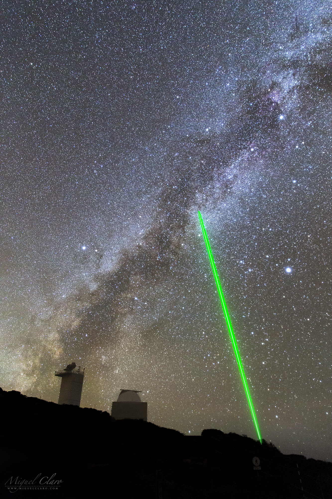
In the foreground we can see from left to right, the tower of Swedish 1-m Solar Telescope (SST), the largest solar telescope in Europe and number one in the world when it comes to high spatial resolution and the Jacobus Kapteyn Telescope (JKT) with a parabolic primary mirror of 1.0 m diameter. At lower right is visible the powerful green laser from William Herschel Telescope (WHT) pointing high in sky and by coincidence, centred exactly in the middle of the well known asterism of “Summer Triangle”, formed by the stars Altair (from Aquila constellation), Vega (Lyra) and Deneb (Cygnus). Roque de Los Muchachos mountain, is located in La Palma, Canary islands. The laser guide star is in use at the WHT during a few nights per semester, so this was a rare opportunity to capture it.
PT: Em primeiro plano podemos ver da esquerda para a direita, a torre do Swedish 1-m Solar Telescope (SST), o maior telescópio solar da Europa e o número um no mundo quando se trata de alta resolução espacial, seguido do telescópio Jacobus Kapteyn (JKT ) com um espelho primário parabólico de 1,0 m de diâmetro. Mais abaixo à direita é visível o poderoso laser verde do telescópio William Herschel (WHT) que apontando alto para o céu, por coincidência, está centrado exatamente no meio do conhecido asterismo “Triângulo de Verão”, formado pelas estrelas Altair (da constelação Aquila), Vega (Lyra) e Deneb (Cygnus). A montanha rochosa de Roque de Los Muchachos está localizado em La Palma, nas ilhas Canárias.
MAGIC – A Pair of Twins in the Moonlight

This moonlight scene shows the large structure of MAGIC (Major Atmospheric Gamma-ray Imaging Cherenkov Telescopes), a system of two Imaging Atmospheric Cherenkov telescopes located at the Roque de los Muchachos Observatory on La Palma, one of the Canary Islands, at about 2200 m above sea level. MAGIC detects particle showers released by gamma rays, using the Cherenkov radiation, i.e., faint light radiated by the charged particles in the showers. With a diameter of 17 meters and 236 m2 reflective surface, it was the largest in the world before the construction of H.E.S.S. II. MAGIC is not only huge, but also pioneers a number of technical developments that had never been applied to Cherenkov telescopes before. The mirror is extremely light and can be moved to any position in the sky in less than thirty seconds. It is made up of 270 individual mirror panels that can be independently focussed using an active mirror control system equipped with lasers.
The cosmos and its evolution are studied using all radiation, in particular electromagnetic waves. The observable spectrum extends from radio waves to infrared, visible, ultraviolet, X-ray, gamma-rays and finally very high energy gamma rays (starting at energies of 10 GeV). Observations at visible wavelengths (.5 to 1 micrometer) have a history of centuries, gamma astronomy by satellites (keV to few GeV) and ground-based telescopes (above 300 GeV) are end-of-20th century newcomers. The MAGIC telescope can detect very high energy gamma rays in a range of energies where no other telescope in the world can operate, so it opens up a brand new window into the universe.
PT: Esta cena ao luar mostra a grande estrutura de MAGIC (Major Atmospheric Gamma-ray Imaging Cherenkov Telescopes), um sistema de dois telescópios gémeos, preparados para detectar explosões de Raios-Gama. Localizado no Observatório Roque de los Muchachos em La Palma, Ilhas Canárias, esta estrutura encontra-se a cerca de 2200m de altitude.
La Palma Twilight and the Dome of WHT

Adaptive Optics in William Herschel Telescope

Development of new instrumentation is crucial for the continued scientific health of any telescope facility. At the WHT a vibrant development programme was in place, focusing on providing the widest possible science use of adaptive optics, a technique that greatly improves image quality by correcting for the degradation due to turbulent motions in the Earth’s atmosphere. Adaptive optics is now well established at several telescopes around the world. The potential of adaptive optics is huge because the improved spatial resolution allows the detection of sources and fine structures in complex systems that would otherwise not be resolved. Examples are the study of dense stellar clusters, cores of relatively nearby galaxies, and complex star-formation regions.
The technique of adaptive optics, although of huge potential, has its limitations. The requirement that a bright point source lies very close to the object of interest implies that less than 1% of the sky is accessible for the technique. There is, however, a solution to this problem, which is to create an artificial “star” by projecting a bright laser beam on the sky. Such a laser beacon assumes the role of the bright star, hence opening virtually all of the sky to observation with adaptive optics. The current developments at the WHT focus on the design and construction of such a laser beacon system, which will result in a dramatic enhancement of the science prospects of the telescope. Interestingly, adaptive optics and laser beacons are crucial for the next generation of extremely large telescopes that are currently being planned. These future telescopes, with unprecedented large primary mirror diameters of 30 or even 100m, require many solutions to be found for a range of technological problems. Thanks to the ongoing developments in this area at the WHT this telescope is well placed to play a key role as a testbed facility where techniques for these future telescopes can be explored under realistic conditions.
A wide view from Roque de Los Muchachos

PT: Vista panorâmica da montanha de Roque de Los Muchachos, em La Palma, nas Ilhas Canárias, onde se encontra um dos maiores observatórios do mundo, um complexo de 15 telescópios de 19 nações que opera perto da costa da África, Oceano Atlântico. Da esquerda para a direita, podemos ver o laser verde do telescópio William Herschel (WHT), o braço da Via Láctea e abaixo dele, uma camada de nuvens iluminada pelo luar. Acima das nuvens, fica a cúpula cinza do Nordic Optical Telescope (NOT) enquanto no primeiro plano (lado direito) encontra-se a cúpula do Telescópio Isaac Newton (INT). No extremo direito, é possível ver a lua a nascer acima do horizonte.
A Green Sword from William Herschel Telescope

A portrait view taken from Roque de Los Muchachos observatory, in La Palma Canary island, where we can see the powerful green laser from William Herschel Telescope (WHT) pointed to the Zenith. The CANARY laser guide star is in use at the WHT during a few nights per semester, so this is a rare opportunity to capture it in one entire year. During these nights, the risk of collisions with the pointing of other telescopes can be queried via a laser traffic control system. In the background of this “green sword”, a beautiful arch of gas and dust from our Galaxy, the Milky Way, is shinning against the sky.
PT: Neste retrato captado a partir do Observatório de Roque de Los Muchachos, em La Palma, nas Ilhas Canárias, é possível ver o poderoso laser verde do telescópio William Herschel (WHT) apontado ao Zénite. O CANARY laser guide, funciona como uma “estrela guia” para optimizar a utilização do sistema de óptica adaptativa do WHT durante algumas noites por semestre, assim, esta é uma rara oportunidade para captá-lo ao longo de um ano inteiro. Durante estas noites, o risco de colisões com o apontador por parte de outros telescópios pode ser evitado através da consulta de um sistema de controle de tráfego do laser. No fundo desta “espada verde”, um belo arco de gás e poeira da nossa Galáxia, a Via Láctea, brilha contra o céu de fundo.
Arched Milky Way above La Palma

A panoramic view with the mountain of Roque de Los Muchachos, in La Palma Canary island, where stands a huge complex with 15 telescopes, some of the largest telescopes in the world from 19 nations working near the coast of Africa, in Atlantic Ocean. At left edge, the Zodiacal Light touch the Milky Way that start its arched shape near the William Herschel Telescope (WHT) with the laser pointed to the Zenith, while in the opposite direction, the faintest part of Milky Way arm sets behind the open dome of Isaac Newton Telescope (INT).
PT: Vista panorâmica da montanha de Roque de Los Muchachos, em La Palma, nas Ilhas Canárias, onde se encontra um dos maiores observatórios do mundo, um complexo de 15 telescópios de 19 nações que opera perto da costa da África, Oceano Atlântico. Na extremidade esquerda, a subtileza da Luz Zodiacal toca a Via Láctea que começa a sua forma arqueada perto do Telescópio William Herschel (WHT) que tem o laser apontado em direcção ao Zénite, enquanto na direção oposta, é possível ver a outra extremidade do arco galáctico, representado pela parte mais ténue da Via Láctea que se vai ocultando atrás da cúpula do Telescópio Isaac Newton (INT), visível à direita.
Bright Meteor and Planet Jupiter above Alqueva

In this winter scene of a cloudy night, a bright and fast meteor have crossed the sky near Arcturus while at the right side planet Jupiter were shinning near the blue star Spica. Below, in the small lagoon from the rural hotel Naveterra, in Alandroal, northern part of Dark Sky® Alqueva Reserve, two horses were spotted near the water that is reflecting the greenish color of the sky.
The Trifid Nebula Between a Colorful Ocean of Stars

The Trifid Nebula (M20 and NGC 6514) lies 5200 light-years away and is an H II region located in the constellation of Sagittarius. It was discovered by Charles Messier on June 5, 1764. Its name means ‘divided into three lobes’. The object is an unusual combination of an open cluster of stars; an emission nebula (the lower, red portion), a reflection nebula (the upper, blue portion) and a dark nebula which forms the three prominent dust lanes, also knwon as Barnard 85. The Trifid is only 300,000 years old and is a star forming region in the Scutum spiral arm of the Milky Way. A hot young star in the center illuminates the nebula. The most massive star that has formed in this region is HD 164492A, an O7.5III star with a mass more than 20 times the mass of the Sun. This star is surrounded by a cluster of approximately 3100 young stars.
PT: A Nebulosa Trífida (M20 e NGC 6514) fica a 5200 anos-luz de distância e é uma região H II, ou seja, composta de gás e poeira estelar onde recentemente se começaram a formar novas estrelas, e está localizada na constelação de Sagitário. Foi descoberta por Charles Messier em 5 de junho de 1764. Seu nome significa “dividido em três lóbulos”. O objeto é uma combinação incomum de um aglomerado aberto de estrelas; Uma nebulosa de emissão (parte inferior vermelha), uma nebulosa de reflexão (parte superior azul) e uma nebulosa escura que forma as três faixas proeminentes de poeiras escuras, catalogada como Barnard 85 (B85) por Edward Barnard. A Trífida tem apenas 300.000 anos de idade e está localizada na região Scutum no braço espiral da Via Láctea. Uma estrela jovem e quente no centro ilumina a nebulosa. A estrela mais maciça que se formou nesta região é HD 164492A, uma estrela O7.5III com uma massa de mais de 20 vezes superior à do sol. Esta estrela está cercada por um conjunto de aproximadamente 3100 jovens estrelas.
Technical details | Detalhes Técnicos
Taka FSQ-106ED + Extender-Q 1.6x – EM200 auto-guided | Nikon D810a at DX format (1,5x)| ISO2500 – Exp. 240 seconds x 13 lights | Total integration: 52 minutes. Processing on PixInsight 1.8 and CS6. Noudar Park, Barrancos, Dark Sky® Alqueva Reserve, Portugal.
Alqueva Paradise and the Winter Sky

This paradise night scene of the winter sky above the lake of Campinho village, Alqueva Dark Sky® Reserve, shows, above, star clusters and diffuse red/violet colors shinning from deep space objects like Orion and other emission nebulae spread in the celestial sphere. In the center left of the image, we can see a rare and faint white light known as Gegenschein, a faint brightening of the night sky in the region of the antisolar point. like the zodiacal light, the gegenschein is sunlight scattered by interplanetary dust. Most of this dust is orbiting the Sun in about the ecliptic plane. It is distinguished from zodiacal light by its high angle of reflection of the incident sunlight on the dust particles.
PT: Esta linda cena noturna do céu de inverno que se ergue acima do lago da vila do Campinho, Reserva Dark Sky® Alqueva, mostra-nos aglomerados de estrelas e cores difusas vermelho/violeta brilhando intensamente espalhadas pelo céu de inverno, provenientes de nebulosas de emissão e objectos de céu profundo como Orion. No centro esquerdo da imagem, podemos ver uma luz branca rara e fraca conhecida como Gegenschein, que é um ligeiro brilho do céu noturno na região do ponto antisolar. Como a luz zodiacal, o gegenschein é a luz solar dispersa pela poeira interplanetária. A maior parte dessa poeira está orbitando o Sol em torno do plano eclíptico. Distingue-se da luz zodiacal pelo seu alto ângulo de reflexão da luz solar incidente sobre as partículas de poeira.
Gegenschein Against the Winter Deep Sky

This lovely night scene of the winter sky above the lake of Campinho village, Alqueva Dark Sky® Reserve, shows high above, star clusters and diffuse red/violet colors shinning from deep sky objects like California, Rosette, Barnard´s Loop, Horse Head, Orion and other emission nebulae spread in the winter sky. At left in center of the image, we can see a rare and faint white light known as Gegenschein, that is a faint brightening of the night sky in the region of the antisolar point. like the zodiacal light, the gegenschein is sunlight scattered by interplanetary dust. Most of this dust is orbiting the Sun in about the ecliptic plane. It is distinguished from zodiacal light by its high angle of reflection of the incident sunlight on the dust particles. Below some bands of red airglow are also visible.
PT: Esta linda cena noturna do céu de inverno que se ergue acima do lago da vila do Campinho, Reserva Dark Sky® Alqueva, mostra-nos aglomerados de estrelas e cores difusas vermelho/violeta brilhando intensamente espalhadas pelo céu de inverno. California, Rosette, Barnard´s Loop, Horse Head e Orion, são algumas das imensas nebulosas de emissão visíveis nesta época do ano. À esquerda no centro da imagem, podemos ver uma luz branca rara e fraca conhecida como Gegenschein, que é um ligeiro brilho do céu noturno na região do ponto antisolar. Como a luz zodiacal, o gegenschein é a luz solar dispersa pela poeira interplanetária. A maior parte dessa poeira está orbitando o Sol em torno do plano eclíptico. Distingue-se da luz zodiacal pelo seu alto ângulo de reflexão da luz solar incidente sobre as partículas de poeira. Abaixo, são ainda visíveis algumas faixas de airglow vermelho.
A Bridge to Andromeda Galaxy

In this lovely night scene of the winter sky we can see a small bridge from Campinho region, Alqueva Dark Sky® Reserve that seems to indicate the path to Andromeda Galaxy which is visible just above the horizon in the center of the picture. High above, star clusters and diffuse red/violet colors are shinning and spread in the winter sky, coming from deep sky objects like Orion, California, Rosette, Barnard´s Loop, Heart & Soul and other emission nebulae. At left in the direction of Pleiades, a faint white light is visible and known as the Zodiacal Light.
PT: Nesta cena de céu noturno do inverno, podemos ver uma pequena ponte da região do Campinho, na Reserva Dark Sky® Alqueva, que parece indicar o caminho para a Galáxia de Andrómeda, que é visível logo acima do horizonte no centro da fotografia. No alto, aglomerados de estrelas e cores difusas vermelho/violeta brilham intensamente espalhadas pelo céu de inverno. Orion, California, Rosette, Barnard´s Loop, Heart & Soul nebula, são algumas das imensas nebulosas de emissão visíveis nesta época do ano. À esquerda, na direção das Pleiades, uma fraca luz branca é visível e conhecida como a Luz Zodiacal.
The Dusty Shiny Heart of Orion

The Orion Nebula (M42) is a diffuse and large nebula complex situated in the Milky Way, being south of Orion’s Belt in the constellation of Orion, is one of the brightest and beautiful nebulae also visible to naked eye in the night sky. M42 is located at a distance of about 1350 light years and is the closest region of massive star formation to Earth. The M42 nebula is estimated to be 24 light years across. It has a mass of about 2000 times the mass of the Sun. This nebula has revealed much about the process of how stars and planetary systems are formed from collapsing clouds of gas and dust. Astronomers have directly observed protoplanetary disks, brown dwarfs, intense and turbulent motions of the gas, and the photo-ionizing effects of massive nearby stars in the nebula.
The brightest central part of the nebula is called Huygenian region, and the Fish’s Mouth is the dark nebulosity that separates M43 from the bright part. Outside the edges of M42 we can find the “Wings” of Orion. The core of the nebula contains a very young open cluster, known as the Trapezium due to the asterism of its primary four stars. Two of these can be resolved into their component binary systems on nights with good seeing, giving a total of six stars. The stars of the Trapezium, along with many other stars, are still in their early years.
Observers have long noted a distinctive greenish tint to the nebula, in addition to regions of red and of blue-violet. The red hue is a result of the Hα recombination line radiation at a wavelength of 656.3 nm. This red emission glows from the light of hydrogen gas excited by energetic newly-formed hot and young stars in the core of the nebula. The blue-violet coloration is the reflected radiation from the massive O-class stars in the heart of the nebula. This complex contains dark nebulae, emission nebulae, reflection nebulae, and H II regions.
NGC 1977 is a reflection nebula 1/2 degree northeast of the Orion Nebula. This NGC nebula also includes NGC1973 and NGC1975, divided as a complex of blue reflection nebulae mixed with dark lanes and a red emission nebulosity. It is also called The Running Man Nebula and Sharpless Catalog 279. More about
PT: A Nebulosa de Orion (M42) é um grande complexo nebuloso difuso situado na Via Láctea, a sul do Cinturão de Orion na constelação de Orion, sendo também uma das mais brilhantes e fascinantes nebulosas visíveis a olho nu no céu noturno. M42 está localizado a uma distância de cerca de 1350 anos-luz e é a região mais próxima da Terra na formação de estrelas maciças. A nebulosa M42 está estimada em 24 anos-luz de diâmetro. Tem uma massa de cerca de 2000 vezes a massa do Sol. O estudo desta nebulosa já permitiu revelar muito sobre o processo de como as estrelas e os sistemas planetários são formados por nuvens de gás e poeira em colapso. Os astrónomos observaram directamente discos protoplanetários, anãs castanhas, movimentos intensos e turbulentos de gás e os efeitos foto-ionizantes de estrelas maciças próximas, na nebulosa.
A parte central mais brilhante da nebulosa é chamada região de Huygenian, e a “Fish’s Mouth” é a nebulosidade escura que separa M43 da parte mais brilhante da M42. Fora dos limites da M42 encontramos as “Asas” de Orion. O núcleo da nebulosa contém um aglomerado aberto muito jovem, conhecido como o Trapézio devido ao asterismo de suas quatro estrelas primárias. Duas destas podem ser resolvidas nos seus sistemas binários, em noites com boa visibilidade e estabilidade atmosférica, totalizando a soma de seis estrelas. As estrelas do Trapézio, conjuntamente com muitas outras estrelas, estão ainda nos seus primeiros anos de vida.
Além de regiões de tonalidade vermelha e azul-violeta, tem-se observado desde há muito tempo um matiz esverdeado distinto nalgumas regiões da nebulosa. A tonalidade vermelha é explicada pela emissão de uma combinação de linhas de radiação do hidrogênio, Hα, com um comprimento de onda de 656,3 nanómetros. A cor azul-violeta é o reflexo da radiação das estrelas de tipo espectral O (muito luminosas e de cores azuladas) sobre o centro da nebulosa. Este complexo contém nebulosas escuras, nebulosas de emissão, nebulosas de reflexão e regiões H II.
NGC 1977 é uma nebulosa de reflexão 1/2 grau a nordeste (à esquerda na imagem) da Nebulosa de Orion. Esta nebulosa NGC inclui também a NGC1973 e NGC1975, dividindo-se assim como um complexo de nebulosas de reflexão azuis, misturadas com nebulosas escuras e uma nebulosidade de emissão vermelha. É também chamado de “The Running Man Nebula”.
Technical details | Detalhes Técnicos
Taka FSQ-106ED + Extender-Q 1.6x – EM200 auto-guided | Nikon D810A | ISO1600 – Exp. 10 seconds x 5 lights + ISO1600 – Exp. 30 seconds x 5 lights + ISO1600 – Exp. 240 seconds x 17 lights | Total integration of 27 Lights: 71 minutes. Processing on PixInsight 1.8 and CS6. Cumeada Observatory from Dark Sky® Alqueva Reserve, Reguengos de Monsaraz.


