
Total Lunar Eclipse Close-up Immersed in a Layer of Clouds

After finishing this image I thought….well many people will probably think that this is AI, because it seems that the moon is in between the clouds which would be odd and impossible of course, but no, this is not AI! It is a true image of the Eclipsed Moon as seen behind an intense layer of passing clouds, creating this crazy optical illusion. Below a short time lapse sequence of this moment shows how real it was. Using an HDR technique I could then recover the details on the bright side of the moon, the region not fully immersed in the Earth Shadow. Captured with a 600mm lens from Costa da Caparica, Portugal.
PT: Depois de terminar esta imagem, pensei… bem, muitas pessoas provavelmente pensarão que isto é IA, porque parece que a lua está entre as nuvens, o que seria estranho e impossível, claro, mas não, isto não é IA! Mas uma imagem verdadeira da Lua eclipsada vista por detrás de uma camada intensa de nuvens passageiras, criando esta louca ilusão de ótica. Abaixo, uma curta sequência de time-lapse deste momento, revela o quão real foi este evento celestial. Utilizando uma técnica HDR, consegui recuperar os detalhes do lado brilhante da Lua, a região não totalmente imersa na sombra da Terra. Captado com uma lente de 600 mm a partir da Costa da Caparica, Portugal.
BUY THIS PRINT| COMPRAR ESTA IMPRESSÃO
Buy a Fine Art Print or Wall Decor of this Image – Make your order Now!
You can choose the best style of print do you preffer to decorate in a fashion way your walls. Metal Prints with durable and vivid colors, Acrylic, Canvas or the highest quality Gallery Print – a 6 colour UV direct printing on acrylic glass (2mm) including light colours and reinforced by an aluminium dibond plate (3mm). Those type of Prints can highlight the final work in an artistic way, showing the photograph as a piece of art. I work with two high quality specialized Labs in US and in Europe, using Kodak Professional Endura Premier Metallic papers and Fujifilm Crystal Archive DP II Professional. You can select the image above or freely navigate to more than 800 photographs available in my gallery – each one with their own story and magic – and choose the photograph you would love to have in your home or office.
How to Order – Simple and easy, just “copy and paste” the link of this page or the image you choosed and fill it in the form below, with the size you want and any detail you wish to include on the message, like your country, name and postal address. Free Shipping included to all prints (except frames). For US and Europe the delivery is 4-8 working days, while to Portugal and Spain is normally 2-6 working days. After submitting the order through the form, I will contact you for the payment method (Paypal available or bank transfer) and with other questions related to your print(s) or requests. Once payment is confirmed, your order is shipped within 24h. In case you wish, I can send you separtely with no additional cost, a postcard autographed and numbered of the same image you have just bought, as a seal and proof of art work authenticity from the author. Let me know what is your wish.
The Moon Rising While Crossing the Clouds above a Peaceful Lagoon in a Time Lapse Video
A short time lapse sequence shows the moon rising above a peaceful lagoon from the rural hotel Naveterra, in Alandroal, located in the northern part of @darkskyalqueva Reserve. An interesting game of light and shadows can be enjoyed while the moon is getting high in the sky and crosses a layer of clouds.
PT: Uma breve sequência de lapso de tempo mostra a lua nascendo sobre uma lagoa tranquila do hotel rural Naveterra, no Alandroal, localizado na parte norte da Reserva Dark Sky® Alqueva. Um interessante jogo de luzes e sombras pode ser apreciado enquanto sobe mais alto no céu e atravessa uma camada de nuvens.
Venus and Jupiter Shinning Together After a Long Night of Photography

After a long cold night of shooting the Total Lunar Eclipse of 2019, a stargazer and photographer stands in front of his equipment in the final stage of the Eclipse, while in the background of a twilight sky, the brightest planets Venus and Jupiter are shinning in a very close alignment, only separated by approximately 2,5 degrees. The image was captured in Mina de São Domingos, Dark Sky® Alqueva Métola, Portugal.
PT: Depois de uma longa noite fria a fotografar o Eclipse Lunar Total de 2019, um observador de estrelas e fotógrafo, pousa ao pé do seu equipamento fotográfico no estágio final do Eclipse, enquanto em pano de fundo de um céu crepuscular, os planetas mais brilhantes da esfera celeste – Venus e Júpiter – brilham alinhados e separados apenas por aproximadamente 2,5 graus. A imagem foi captada na Mina de São Domingos, Dark Sky® Alqueva Mértola, em Portugal.
A Spring Milky Way above Campinho

The image shows the Arch of Milky Way as seen during a Spring night in the Northern Hemisphere, Campinho, in Dark Sky® Alqueva Reserve. High in the sky, we can see a “blue bright” star with an apparent magnitude of 0,0 called Vega, serving as a middle reference in the magnitude system chart created for the first time in 150 B.C.E, by the greek astronomer Hipparchus. Vega, from Lyra constellation, is forming an asterism well know as the “Summer Triangle” with stars Deneb (from Cygnus) and Altair (from Aquila). At the right center of the picture, planet Mars and Saturn are shinning near the core of the Galaxy. Following the same line we can find the red supergiant star Antares, from Scorpius constellations, and the bright planet Jupiter. Above the horizon is visible a mix of yellow/greenish airglow with the lights from Aldeia da Luz, and below, a water mirror from the largest manmade lake in Europa, The Great Lake Alqueva.
PT: A imagem mostra o Arco da Via Láctea como visto durante uma noite de primavera no Hemisfério Norte, na região do Campinho, Reserva Dark Sky® Alqueva. No alto do céu, é possível ver uma estrela azulada e brilhante com uma magnitude aparente de 0.0, de nome Vega. Serve como uma referência intermédia na tabela do sistema de magnitudes criado pela primeira vez no 150 A.C, pelo astrónomo grego Hiparco. Vega, da constelação de Lyra, forma um asterismo conhecido como o “Triângulo de Verão” com as estrelas Deneb (Cisne) e Altair (da Águia). No centro direito da imagem, o planeta Marte e Saturno brilham perto do centro da galáxia. Seguindo a mesma linha, podemos encontrar a estrela supergigante vermelha Antares, da constelações do Escorpião, terminando no extremo direito da imagem com o brilho intenso do planeta Júpiter. Um pouco acima do horizonte é visível uma tonalidade de amarelo/esverdeado proveniente da subtil presença de airglow (Luminescência Foto-química) que se mistura ainda com algumas luzes da Aldeia da Luz, já bem junto ao horizonte deste panorama. Logo abaixo, o enorme espelho de água do maior lago artificial da Europa Ocidental, o Grande Lago Alqueva, reflecte assim algumas das estrelas que salpicam o firmamento do Dark Sky® Alqueva.
Golden Moonrise above the City of Lisbon

A lovely cityscape view captured from a rooftop shows the Full Moon rising above the city of Lisbon. According to modern folklore, the second Full Moon in a calendar month is called “Blue Moon”. Rather than Blue, the rising moon can appear yellow-orange when it is near the horizon due to the way light scatters in the atmosphere. When the moon is low on the horizon, moonlight passes through more of Earth’s atmosphere than when it is overhead. By the time light reaches the observer, the blue and green light has already been scattered, leaving only the red-orange light. We’ve already had one Blue Moon in January 2018, and the last time this rare event of two Blue Moons occurred in such quick succession was January and March of 1999.
PT: Uma vista fantástica em ambiente citadino captada a partir de um telhado, mostra o nascer da Lua Cheia acima da cidade de Lisboa. De acordo com o folclore moderno, a segunda Lua Cheia que ocorre no mesmo mês é chamada de “Lua Azul”. Contudo, ao invés de azul, a lua pode aparecer num tom amarelo alaranjado quando está mais perto do horizonte devido à forma como a luz se espalha na atmosfera. Este ano já tivemos uma Lua Azul em janeiro de 2018, e a última vez que este evento raro aconteceu – de duas luas azuis ocorrerem num tão curto espaço de tempo sequencial – foi em Janeiro e Março de 1999.
The “Blue Moon” rising behind a layer of clouds above the City of Lisbon

A lovely cityscape view captured from a rooftop shows the Full Moon rising above the city of Lisbon. According to modern folklore, the second Full Moon in a calendar month is called “Blue Moon”. Rather than Blue, the rising moon can appear yellow-orange when it is near the horizon due to the way light scatters in the atmosphere. When the moon is low on the horizon, moonlight passes through more of Earth’s atmosphere than when it is overhead. By the time light reaches the observer, the blue and green light has already been scattered, leaving only the red-orange light. We’ve already had one Blue Moon in January 2018, and the last time this rare event of two Blue Moons occurred in such quick succession was January and March of 1999.
PT: Uma vista fantástica em ambiente citadino captada a partir de um telhado, mostra o nascer da Lua Cheia acima da cidade de Lisboa. De acordo com o folclore moderno, a segunda Lua Cheia que ocorre no mesmo mês é chamada de “Lua Azul”. Contudo, ao invés de azul, a lua pode aparecer num tom amarelo alaranjado quando está mais perto do horizonte devido à forma como a luz se espalha na atmosfera. Este ano já tivemos uma Lua Azul em janeiro de 2018, e a última vez que este evento raro aconteceu – de duas luas azuis ocorrerem num tão curto espaço de tempo sequencial – foi em Janeiro e Março de 1999.

Lunar Corona above Town Hall in Grand Place

This cityscape shows a colourful lunar corona at the left side of the Town Hall in the city of Brussels, capital of European Union (EU). The lunar corona is formed while bright moonlight is diffracted by water droplets in thin clouds, drifting in front of the lunar disk. The beautiful building in the foreground is the Town Hall of the City of Brussels, a Gothic building from the Middle Ages – between 1401 and 1455 – and made the Grand Place the seat of municipal power. The major tower have 96 metres (315 ft) high, and is capped by a 4-metre (12 ft) statue of Saint Michael slaying a demon. It is located on the famous Grand Place in Brussels, Belgium, and is the only remaining medieval building of the Grand Place and is considered a masterpiece of civil Gothic architecture and more particularly of Brabantine Gothic. As a UNESCO World Heritage Site, Grand-Place testifies in particular to the success of Brussels, mercantile city of northern Europe that, at the height of its prosperity, rose from the terrible bombardment inflicted by the troops of Louis XIV in 1695. Destroyed in three days, this gothic building has survived.
PT: Esta paisagem urbana mostra uma colorida coroa lunar à esquerda da Câmara Municipal da cidade de Bruxelas, capital da União Europeia (UE). A coroa lunar é formada devido à difração da luz brilhante do luar nas gotas de água presentes em nuvens finas, que transitam na frente do disco lunar. O magnífico edifício em primeiro plano, é a Câmara Municipal da Cidade de Bruxelas, um edifício gótico da Idade Média – entre 1401 e 1455 – que fez da Grand Place o lugar do poder municipal. A torre principal tem 96 metros (315 pés) de altura e está coberta por uma estátua de 4 metros (12 pés) de Saint Michael, matando um demónio. Localizado na famosa Grand Place, em Bruxelas, na Bélgica, é o único edifício medieval que permanece da Grand Place original e é considerado uma obra-prima da arquitetura gótica civil e mais particularmente do Brabantine Gothic. Incluído na lista do Património Mundial da UNESCO, a Grand-Place atesta, em particular, o sucesso de Bruxelas, cidade mercantil do norte da Europa, que, no auge de sua prosperidade, surgiu do terrível bombardeamento infligido pelas tropas de Louis XIV em 1695. Totalmente destruída em três dias, este edifício gótico foi dos únicos que sobreviveu ao bombardeamento
Star Spica and Planet Jupiter above the Acid Water of Mina de São Domingos

A moonlight scene with blue star Spica and planet Jupiter setting and shinning behind a layer of clouds, while their lights are reflecting in a puddle of acid water from Achada do Gamo, that was – since the beginning of modern mining activities in the São Domingos Mine – the center of metallurgical activities on extracted minerals. The areas of heaps, slag and channels of water, give the landscape a “lunar” aspect. The heaps are composed of different materials with high levels of metals, such as slag and ash, whose leaching through the rainwater leads to the production of acid mine drainage, usually with an ocher or reddish color.
São Domingos Mine is located in Baixo Alentejo, about 240 km from Lisbon, in the municipality of Mértola, which recently joined the Dark Sky® Alqueva Route for the great quality of the night sky. The São Domingos mining area is part of the Iberian Pyrite Range and is a decisive source of basic metals (S, Zn, Pb, Sn, Ag, Au, Fe, Co, Cd, etc.) and other elements such as sulfur (S). It has been a sought after place for the extraction of ores since antiquity, with evidence of gold, silver and copper mining in the pre-Roman and Roman times. The pyritic deposit of São Domingos (St. Dominic) was explored in various historical periods, namely: for several centuries of the first millennium BC (Eastern period), during the period between 14 BC and 395 AD (Roman period), during the Islamic period and during the modern period that was initiated in 1858 for the extraction of copper, gold and silver and was maintained until 1966, the year in which the reserves were considered exhausted. During this period, the work was done in the open air up to 120 meters deep, with work continued through wells and galleries up to 400 meters. Over 108 years of regular exploration, more than 20 million tons of materials were removed from the site, producing about 14.7 million tons of waste accumulated in heaps up to 14 meters high with a dozen different materials such as pyrite , gossan, slag, ash, iron oxides, barren rock, sludge, debris, etc.|
PT: Uma cena de luar com a estrela azul Spica e o planeta Jupiter se pondo e brilhando atrás de uma fina camada de nuvens, enquanto o seu brilho se reflecte nas águas ácidas da Achada do Gamo, que foi desde o início das atividades modernas de mineração na Mina de São Domingos, o centro das atividades metalúrgicas sobre os minérios extraídos. As áreas de escombreiras, escórias e canais de água, dão à paisagem um aspecto “lunar”. As escombreiras são constituídas por diferentes materiais com teores elevados em metais, como escórias e cinzas, cuja lixiviação através das águas das chuvas leva à produção de águas ácidas (‘acid mine drainage’), geralmente com uma cor ocre ou avermelhada.
A Mina de São Domingos, situa-se no Baixo Alentejo, a cerca de 240 km de Lisboa, no concelho de Mértola, que passou a integrar recentemente a Rota Dark Sky® Alqueva pela grande qualidade do seu céu escuro. A área mineira de São Domingos, está inserida na Faixa Piritosa Ibérica e constitui uma fonte decisiva de metais básicos (Cu, Zn, Pb, Sn, Ag, Au, Fe, Co, Cd, etc.) e de outros elementos como o enxofre (S). Foi desde a Antiguidade um local procurado para a extracção de minérios, existindo indícios de trabalhos de extracção de ouro, prata e cobre no período pré-romano e romano. O depósito pirítico de São Domingos foi explorado em diversos períodos históricos, nomeadamente: durante vários séculos do primeiro milénio a.C. (período Oriental), durante o período que mediou entre o ano 14 a.C. e o ano de 395 d.C. (período romano), durante o período islâmico e durante o período moderno que se iniciou em 1858 para a extracção de cobre, ouro e prata e manteve-se até 1966, ano em que as reservas foram consideradas esgotadas. Neste período, a lavra foi feita a céu aberto até aos 120 metros de profundidade, tendo os trabalhos continuado por meio de poços e galerias até aos 400 metros. Ao longo de 108 anos de exploração regular, foram retirados do local mais de 20 milhões de toneladas de materiais, tendo produzido cerca 14,7 milhões de toneladas de resíduos acumulados em escombreiras de até 14 metros de altura, com uma dezena de materiais diferentes como pirite, gossan, escórias, cinzas, óxidos de ferro, rocha estéril, lamas, entulhos, etc.
Moonlight and Jupiter Shinning above Corta da Mina Landscape

A Moonlight scene in a cloudy sky with bright planet Jupiter shinning above Corta da Mina landscape, that is the result of the open-pit mining operation begun in 1867 in São Domingos Mine. It has a geometrical shape of an ellipse and a depth of 120 m and a perimeter of approximately 2 km. It was the place from which the ores were extracted: the pyrites, sulfur, copper, iron, zinc, gold and silver. Around the cavity it is possible to observe several types of heaps constituted by diverse materials such as modern slag of black color, brownish Roman slag, gossan fragments of reddish color and encasing mineralization rocks like vulcanites and schists. Some of these commons have significant gold contents assuming the presence of iMt from heaps with 1g / t gold. ” After the end of the work, in 1966, the abandonment of the extraction of water from the bottom of the mine allowed the rise groundwater level within the cut to the current, apparently stationary point. The water currently contained in the cut is extremely acidic (Ph = 2) giving the water an incredible color variation with colours ranging from reddish tones to oranges and yellows, it contains a large amount of dissolved sulfates, mainly iron and arsenic sulfates, but also copper and zinc.
São Domingos Mine is located in Baixo Alentejo, about 240 km from Lisbon, in the municipality of Mértola, which recently joined the Dark Sky® Alqueva Route for the great quality of the night sky. The São Domingos mining area is part of the Iberian Pyrite Range and is a decisive source of basic metals (S, Zn, Pb, Sn, Ag, Au, Fe, Co, Cd, etc.) and other elements such as sulfur (S). It has been a sought after place for the extraction of ores since antiquity, with evidence of gold, silver and copper mining in the pre-Roman and Roman times. The pyritic deposit of São Domingos (St. Dominic) was explored in various historical periods, namely: for several centuries of the first millennium BC (Eastern period), during the period between 14 BC and 395 AD (Roman period), during the Islamic period and during the modern period that was initiated in 1858 for the extraction of copper, gold and silver and was maintained until 1966, the year in which the reserves were considered exhausted. During this period, the work was done in the open air up to 120 meters deep, with work continued through wells and galleries up to 400 meters. Over 108 years of regular exploration, more than 20 million tons of materials were removed from the site, producing about 14.7 million tons of waste accumulated in heaps up to 14 meters high with a dozen different materials such as pyrite , gossan, slag, ash, iron oxides, barren rock, sludge, debris, etc. The areas of heaps, slag and channels of water, give the landscape a “lunar” aspect. The heaps are composed of different materials with high levels of metals, such as slag and ash, whose leaching through the rainwater leads to the production of acid mine drainage, usually with an ocher or reddish color. |
PT: Um cenário ao Luar com a presença do planeta Jupiter a brilhar por detrás de um céu nublado que se precipita acima da paisagem acida da Corta da Mina, o resultado da exploração mineira a céu aberto encetada em 1867 na Mina de São Domingos, em Mértola. Possui uma forma geométrica de uma elipse e uma profundidade de 120 m e um perímetro de aproximadamente 2 km. Era o local de onde se extraíam os minérios: as pirites, enxofre, cobre, ferro, zinco, ouro e prata. Em torno da cavidade é possível observar vários tipos de escombreiras constituídas por materiais diversos como escórias modernas de cor negra, escórias romanas acastanhadas, fragmentos de gossan de cor avermelhada e rochas encaixantes da mineralização como vulcanitos e xistos. Alguns destes corpos de encombros apresentam teores significativos de ouro admitindo-se a presença de iMt de escombreiras com 1g/t de ouro.” Após o fim da laboração, em 1966, o abandono da extração de água do fundo da mina permitiu a subida do nível freático dentro da corta até ao ponto atual, aparentemente estacionário.
A água hoje contida na corta é extremamente ácida (Ph=2) conferindo à água uma variação cromática incrível com cores que vão desde tons avermelhados, a laranjas e amarelos, contém uma grande quantidade de sulfatos dissolvidos, principalmente sulfatos de ferro e arsénico mas também de cobre e zinco
A Mina de São Domingos, situa-se no Baixo Alentejo, a cerca de 240 km de Lisboa, no concelho de Mértola, que passou a integrar recentemente a Rota Dark Sky® Alqueva pela grande qualidade do seu céu escuro. A área mineira de São Domingos, está inserida na Faixa Piritosa Ibérica e constitui uma fonte decisiva de metais básicos (Cu, Zn, Pb, Sn, Ag, Au, Fe, Co, Cd, etc.) e de outros elementos como o enxofre (S). Foi desde a Antiguidade um local procurado para a extracção de minérios, existindo indícios de trabalhos de extracção de ouro, prata e cobre no período pré-romano e romano. O depósito pirítico de São Domingos foi explorado em diversos períodos históricos, nomeadamente: durante vários séculos do primeiro milénio a.C. (período Oriental), durante o período que mediou entre o ano 14 a.C. e o ano de 395 d.C. (período romano), durante o período islâmico e durante o período moderno que se iniciou em 1858 para a extracção de cobre, ouro e prata e manteve-se até 1966, ano em que as reservas foram consideradas esgotadas. Neste período, a lavra foi feita a céu aberto até aos 120 metros de profundidade, tendo os trabalhos continuado por meio de poços e galerias até aos 400 metros. Ao longo de 108 anos de exploração regular, foram retirados do local mais de 20 milhões de toneladas de materiais, tendo produzido cerca 14,7 milhões de toneladas de resíduos acumulados em escombreiras de até 14 metros de altura, com uma dezena de materiais diferentes como pirite, gossan, escórias, cinzas, óxidos de ferro, rocha estéril, lamas, entulhos, etc. As áreas de escombreiras, escórias e canais de água, dão à paisagem um aspecto “lunar”. As escombreiras são constituídas por diferentes materiais com teores elevados em metais, como escórias e cinzas, cuja lixiviação através das águas das chuvas leva à produção de águas ácidas (‘acid mine drainage’), geralmente com uma cor ocre ou avermelhada.
Milky Way from the Tunnel View of Yosemite National Park

First protected in 1864, Yosemite National Park is best known for its waterfalls, but within its nearly 1,200 square miles, it´s full of beauty with deep valleys, grand meadows, ancient giant sequoias, and a vast wilderness area where the animals are living in harmony with the strength of granite, the power of glaciers, and the tranquility of the High Sierra, that shows the persistence of life even with the large and strong fires that seems to threaten all this area each summer.
A blaze near Yosemite National Park have created smoky skies for days. On the top of the image, a Milky Way is trying to shine above the band of smoke and dust in this framing from the beautiful Tunnel View of Yosemite. Works on the exit road of the park have helped to light up the scene for several hours.
Crepuscular Rays and Shadows in the Sky of Las Vegas

As seen above the city that never sleeps, Las Vegas, this cityscape shows the twilight sky with the dramatic effect of the phenomenon known as “Crepuscular rays”. In atmospheric optics, are rays of sunlight that appear to radiate from the point in the sky where the sun is located. These rays, which stream through gaps in clouds (particularly stratocumulus) or between other objects like mountains, are columns of sunlit air separated by darker cloud-shadowed regions. Despite seeming to converge at a point, the rays are in fact near-parallel shafts of sunlight, and their apparent convergence is a perspective effect (similar, for example, to the way that parallel railway lines seem to converge at a point in the distance).”
“The name comes from their frequent occurrences during crepuscular hours (those around dawn and dusk), when the contrasts between light and dark are the most obvious. Crepuscular comes from the Latin word “crepusculum”, meaning twilight.”
PT: Visto acima da cidade que nunca dorme, Las Vegas, nesta cityscape captada ao crepúsculo é possível ver o forte fenómeno dos “Raios Crepusculares e Sombras” projectadas no céu. Estes raios de luz solar irradiam do ponto do céu onde o sol se encontra, fluindo através de lacunas nas nuvens (particularmente estratocumulos) ou entre outros objetos como montanhas. São basicamente colunas de ar iluminadas pelo sol, separadas por regiões mais sombrias e sombreadas. Apesar de parecerem convergir de um único ponto, os raios são, de facto, os eixos paralelos da luz solar e a sua convergência aparente é um efeito de perspectiva (semelhante, por exemplo, ao modo como as linhas ferroviárias paralelas parecem convergir em um ponto distante).
Moonlight Iridium Flare above Isaac Newton Telescope

PT: Este curto startrail captado a partir do Roque de Los Muchachos, La Palma, Ilhas Canárias, mostra um Iridium Flare (Reflexo de um Satélite de comunicações da rede Iridium) brilhando acima da cúpula do telescópio de Isaac Newton (INT), visível acima da camada de nuvens que reflecte a luz proveniente do nascer da Lua acima do Oceano Atlântico.
A wide view from Roque de Los Muchachos

PT: Vista panorâmica da montanha de Roque de Los Muchachos, em La Palma, nas Ilhas Canárias, onde se encontra um dos maiores observatórios do mundo, um complexo de 15 telescópios de 19 nações que opera perto da costa da África, Oceano Atlântico. Da esquerda para a direita, podemos ver o laser verde do telescópio William Herschel (WHT), o braço da Via Láctea e abaixo dele, uma camada de nuvens iluminada pelo luar. Acima das nuvens, fica a cúpula cinza do Nordic Optical Telescope (NOT) enquanto no primeiro plano (lado direito) encontra-se a cúpula do Telescópio Isaac Newton (INT). No extremo direito, é possível ver a lua a nascer acima do horizonte.
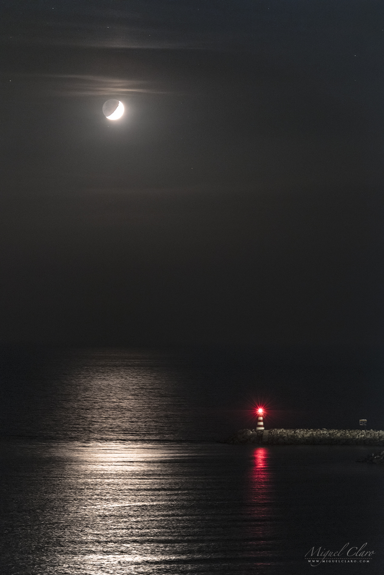
Moon Reflections in the Atlantic Ocean

Moon reflections in the Atlantic Ocean. The air his filled with a thin layer of smoke coming from a fire that broke out in the afternoon on a nearby mountain. At the right side of the bright water, we can see a small lighthouse from Vilamoura marina.
PT: Reflexos do luar nas águas do Oceano Atlântico. Este pôr-da-lua incomum estava rodeado pelas cinzas que pairavam na marina de Vilamoura, no Algarve, provenientes de um incêndio que deflagrou numa serra próxima da região. A ligeira neblina conferiu à imagem uma tonalidade rosada, com uma mística muito particular e a condizer com o pequeno farol vermelho que se pode ver em baixo à direita.
London, a Busy Night City

London is a very busy city since morning until mid night. This time lapse scene shows the Moonpath passing behind “The Shard” tower, where it is also visible beside some bright stars, lots of aerial traffic as well the motion of a busy river while the cranes above the soil are still working all night long. Also referred as the Shard of Glass and formerly London Bridge Tower, is a 95-storey skyscraper in Southwark, London, that forms part of the London Bridge Quarter development. Standing 309.6 metres (1,016 ft) high, the Shard is the tallest building in the United Kingdom, the 105th tallest building in the world, and the fourth tallest building in Europe.
PT: Esta imagem Cityscape da cidade de Londres captada durante uma sequência startrail mostra a agitação que se vive ao longo da noite no centro da cidade. Barcos atravessam o rio, gruas se movimentam freneticamente e a cada minuto aviões cruzam os céus londrinos. Tudo isto acontece a um ritmo alucinante, enquanto que pacificamente a lua se põe por detrás do gigantesco edifício de 300 metros “The Shard”. Também conhecido como “Shard of Glass” e anteriormente London Bridge Tower, o “The Shard” é um arranha-céu de 95 andares em Southwark, Londres, que faz parte do Quarter London Bridge. Atingindo 309,6 metros (1.016 pés) de altura, o Shard é o edifício mais alto do Reino Unido, o edifício 105º entre os mais altos do mundo, e o quarto edifício mais alto da Europa.

Venus Reflecting on Causeway Coast of Northern Ireland

Venus is the second-brightest natural object in the night sky after the Moon, reaching an apparent magnitude of −4.6, bright enough to cast shadows. Is the second planet from the Sun, orbiting it every 224.7 Earth days. It has the longest rotation period (243 days) of any planet in the Solar System and rotates in the opposite direction to most other planets. It has no natural satellite. It is named after the Roman goddess of love and beauty. Normally visible at Dawn or other times at Dusk, Venus has been a major fixture in human culture for as long as records have existed. It has been made sacred to gods of many cultures, and has been a prime inspiration for writers and poets as the “morning star” and “evening star”. In the image above, the brightness of this planet is reflecting in the ocean surface from Causeway Coast in Northern Ireland, due to a presence of tiny water droplets in thin clouds – which diffract the light of bright heavenly bodies working as a natural diffuse filter – we also can see a blueish color from its corona. The Giant’s Causeway is an area of about 40,000 interlocking basalt columns, the result of an ancient volcanic eruption. It is located in County Antrim on the northeast coast of Northern Ireland, about three miles (4.8 km) northeast of the town of Bushmills. It was declared a World Heritage Site by UNESCO in 1986, and a national nature reserve in 1987 by the Department of the Environment for Northern Ireland.
Enjoying the Moon above the City of London

A skygazer is enjoying the busy night of London city, from a lovely balcony view, with the crescent moon visible at the left side of “The Shard” tower. Also referred as the Shard of Glass and formerly London Bridge Tower, is a 95-storey skyscraper in Southwark, London, that forms part of the London Bridge Quarter development. Standing 309.6 metres (1,016 ft) high, the Shard is the tallest building in the United Kingdom, the 105th tallest building in the world, and the fourth tallest building in Europe.
The Moon, The Shard and The Plane

This London twilight view shows de Crescent Moon at the left side of “The Shard” tower. Also referred as the Shard of Glass and formerly London Bridge Tower, is a 95-storey skyscraper in Southwark, London, that forms part of the London Bridge Quarter development. Standing 309.6 metres (1,016 ft) high, the Shard is the tallest building in the United Kingdom, the 105th tallest building in the world, and the fourth tallest building in Europe. At the right side of the tower is also visible a plane flying above the sky of London.
PT: Esta imagem Cityscape da cidade de Londres captada durante o crepúsculo náutico, mostra a Lua Crescente à esquerda da torre londrina “The Shard” e à direita a silhueta de um avião comercial que sobrevoava a cidade. Também conhecido como “Shard of Glass” e anteriormente London Bridge Tower, o “The Shard” é um arranha-céu de 95 andares em Southwark, Londres, que faz parte do Quarter London Bridge. Atingindo 309,6 metros (1.016 pés) de altura, o Shard é o edifício mais alto do Reino Unido, o edifício 105º entre os mais altos do mundo, e o quarto edifício mais alto da Europa.
The Shard Tower and Crescent Moon in London

This London twilight cityscape view, shows de Crescent Moon at the left side of “The Shard” tower. Also referred as the Shard of Glass and formerly London Bridge Tower, is a 95-storey skyscraper in Southwark, London, that forms part of the London Bridge Quarter development. Standing 309.6 metres (1,016 ft) high, the Shard is the tallest building in the United Kingdom, the 105th tallest building in the world, and the fourth tallest building in Europe.
PT: Esta imagem Cityscape da cidade de Londres captada durante o crepúsculo náutico, mostra a Lua Crescente à esquerda da torre londrina “The Shard”. Também conhecido como “Shard of Glass” e anteriormente London Bridge Tower, é um arranha-céu de 95 andares em Southwark, Londres, que faz parte do Quarter London Bridge. Atingindo 309,6 metros (1.016 pés) de altura, o Shard é o edifício mais alto do Reino Unido, o edifício 105º entre os mais altos do mundo, e o quarto edifício mais alto da Europa.
Full Eye over London City

This full dome “eye view” from London city during the twilight, shows de Crescent Moon at the left side of “The Shard” tower. Also referred as the Shard of Glass and formerly London Bridge Tower, is a 95-storey skyscraper in Southwark, London, that forms part of the London Bridge Quarter development. Standing 309.6 metres (1,016 ft) high, the Shard is the tallest building in the United Kingdom, the 105th tallest building in the world, and the fourth tallest building in Europe.
Beyond the Limits of Earth – Astrophotography from an Airplane

When I was back to Lisbon from a large trip between Chile, Argentina and Uruguay with a stopover in São Paulo, Brazil, I had a rare opportunity somewhere in the middle of the Atlantic Ocean and under the moonlight to take some images from the window of an airplane, during the sleeping hours, when the lights of the plane were shut off. I asked my colleague Apolónia Rodrigues to cover my head with a black jacket around the window to avoid any reflections from inside. The shutter speed had to be very fast for a night sky photography because it was very difficult to have a pinpoint stars without shaking with the movements of the plane. After a few attempts and efforts, I could capture some nice views with the stars and the night sky above Earth taken at a high altitude, probably between 10,000 to 12,000 meters at a cruise speed of ~900km/h, some of them with lightning below.

Due to the presence of moonlight we can distinguish very well the limb and transition between the blue color from our atmosphere and the black from outer space. Blue light is scattered more than other wavelengths by the gases in the atmosphere, giving Earth a blue halo. The atmosphere of Earth is the layer of gases, commonly known as air, that surrounds the planet Earth and is retained by Earth’s gravity. The atmosphere protects life on Earth by absorbing ultraviolet solar radiation, warming the surface through heat retention (greenhouse effect), and reducing temperature extremes between day and night (the diurnal temperature variation). The atmosphere has a mass of about 5.15×10¹⁸ kg, three quarters of which is within about 11 km (6.8 mi; 36,000 ft) of the surface. The atmosphere becomes thinner and thinner with increasing altitude, with no definite boundary between the atmosphere and outer space. The Kármán line, at 100 km (62 mi), or 1.57% of Earth’s radius, is often used as the border between the atmosphere and outer space.
PT: De regresso a Lisboa a partir de uma grande viagem entre o Chile, Argentina e Uruguai com escala em São Paulo, Brasil, eu tive uma oportunidade rara enquanto estava algures a sobrevoar o Oceano Atlântico, de captar imagens ao luar a partir da janela de um avião comercial, durante as horas de sono e enquanto as luzes do avião foram desligados. Pedi à minha colega de equipa Apolónia Rodrigues para me cobrir a cabeça e ao redor da janela com um casaco preto, no sentido de evitar quaisquer reflexos a partir do interior do avião. A velocidade do obturador tinha que ser muito rápida para uma fotografia de céu noturna, porque era muito difícil ter estrelas pontuais com a agitação do avião. Depois de algumas tentativas e esforços, tive a felicidade de captar algumas imagens com as estrelas pontuais onde se distinguem as estrelas que compõem o Cão Maior e Orion e onde é possível ver também o contorno da atmosfera acima da Terra. As imagens foram tiradas a uma alta altitude, provavelmente entre 10.000 a 12.000 metros e a uma velocidade de cruzeiro de ~ 900 km/h, alguns deles com relâmpagos abaixo .

The troposphere is the lowest layer of Earth’s atmosphere. It extends from Earth’s surface to an average height of about 12 km, although this altitude actually varies from about 9 km (30,000 ft) at the poles to 17 km (56,000 ft) at the equator, with some variation due to weather. Most conventional aviation activity takes place in the troposphere, and it is the only layer that can be accessed by propeller-driven aircraft.
In one of the pictures I made an annotation with the main constellations visible. Orion and Sirius are very well spotted. Each one is a single shot: Canon 6D, Exp: 1/3s; ISO8000 24mm f/2.8
Lightning Storm during Full Moon in Dominican Republic

While the Full Moon of June was rising above the clouds, a Lightning Storm has spread in the sky of Punta Cana, Dominican Republic. In the foreground, a group of coconut trees is standing up while resists to the wild power of nature, with strong winds, humidity and the danger of a falling thunderbolt.
PT: Enquanto a Lua cheia de junho nasce acima das nuvens, uma tempestade de relâmpagos rapidamente se espalha nos céus de Punta Cana, na República Dominicana. Em primeiro plano, um grupo de coqueiros mantém-se firme de pé, enquanto resiste ao poder selvagem da natureza, com ventos fortes, humidade muito elevada e o perigo iminente de um raio se precipitar sobre eles.
Ursa Major & Ursa Minor above the Ruins of Roman City Ammaia

EN: The northern constellations Ursa Major (Big Dipper) and Ursa Minor – in a diffuse vision by a passing cloud – as seen from inside the remaining ruins of the Southern Gate Tower of the Roman City of Ammaia.
The Gradual consolidation of Roman power led to the establishment of a substantial Roman town in the 1st century. Ammaia occupied up to 25 hectares, and with a population exceeding modern-day Marvão (5000-6000 inhabitants) Ammaia occupied the site of the present-day parish of São Salvador da Aramenha. The town flourished between the 1st century BCE and the collapse of the Roman Empire in the 5th century CE. Roman Ammaia saw the development of improved irrigation and terracing across the Marvão mountain. Chestnut cultivation – Replacing the place dominance of oak is likely to have been introduced at this time. Much of the terracing and ancient watercourses on the mountain Marvão date from this era.
Limited excavations at Ammaia in the past two decades covering a mere 3,000 m2 (32.292 sq ft) of the town’s area – have revealed the success, provincial expanding town that included running water, a forum, baths, the bridge over the river Sever (near today’s ‘Old Bridge’), and monumental gates (one gate was removed to Castelo de Vide in the 18th century, yet sadly dynamited in 1890). The Alentejo region, meanwhile, was criss-crossed with efficient Roman roads, providing links to the wider Empire. Fine wares found at the site Ammaia suggest que Ammaia nobility had access to luxury glassware and jewelery, while archeology has Revealed that marble for the forum was imported from across the Empire. The high quality, for example, of the ‘Mosaic of the Muses’ from a Roman villa in nearby Monforte (4th century BCE) points to the abundant riches to be made to an Alentejo landowner in the Roman era. Sadly, many artifacts from Ammaia in particular the series of marble sculptures were removed during the 19th and 20th centuries, notably by the Anglo-Portuguese Robinson family. These items are now in collections such as those of the British Museum..
Many of the excavations were concentrated over the obvious ruins or where there was evidence of subterranean structures associated with a Roman presence. Discoveries include parts of a Roman city wall with towers and a gate on the south side, with residenctial buildings; a road; a monumental paved square; remains of a house in the location Quinta do Deão; parts of a public bath building; and a centrally-located forum with well-preserved temple podium, walls of a porticus and cryptoporticus. The town plan follows a regular rectangular layout organized along two main perpendicular street axes, linking the central forum to its main gates. A city wall surrounds a roughly rectangular area of some 20 hectares. Several extramural buildings, cemeteries and roads constitute the suburban area.
PT: As constelações do norte, Ursa Maior e Ursa Menor, numa visão difusa através de uma nuvem passageira, vistas a partir das imponentes ruínas da Porta Sul da cidade Romana da Ammaia. A Cidade de Ammaia é indubitavelmente o mais importante vestígio da sua época existente na região do norte alentejano. Localizada em pleno Parque Natural da Serra de São Mamede, em São Salvador de Aramenha, no concelho de Marvão, a sua área central é constituída pela Quinta do Deão e pela Tapada da Aramenha, possuindo uma área de aproximadamente 25 ha.
Embora as suas ruínas tivessem sido classificadas como Monumento Nacional em 1949, estiveram abandonadas até finais de 1994. A partir desta data e com o aparecimento da Fundação Cidade de Ammaia vêm-se desenvolvendo todos os esforços no sentido de estudar e preservar o que resta desta importante cidade. Ammaia foi elevada a Civitas por volta do ano 44/45 d.C. tendo obtido o estatuto de Mvnicipivm ainda durante o séc. I d.C., no entanto apenas temos dados sobre o mesmo no reinado de Lúcio Vero, no ano de 166 d.C.
Moon and Venus above the Ruins of Roman City Ammaia

EN: One of the remaining ruins from the Southern Gate Tower of the Roman City of Ammaia, in a cloudy moonlight scene. At the right side of the moon it is visible the planet Venus.
The Gradual consolidation of Roman power led to the establishment of a substantial Roman town in the 1st century. Ammaia occupied up to 25 hectares, and with a population exceeding modern-day Marvão (5000-6000 inhabitants) Ammaia occupied the site of the present-day parish of São Salvador da Aramenha. The town flourished between the 1st century BCE and the collapse of the Roman Empire in the 5th century CE. Roman Ammaia saw the development of improved irrigation and terracing across the Marvão mountain. Chestnut cultivation – Replacing the place dominance of oak is likely to have been introduced at this time. Much of the terracing and ancient watercourses on the mountain Marvão date from this era.
Limited excavations at Ammaia in the past two decades covering a mere 3,000 m2 (32.292 sq ft) of the town’s area – have revealed the success, provincial expanding town that included running water, a forum, baths, the bridge over the river Sever (near today’s ‘Old Bridge’), and monumental gates (one gate was removed to Castelo de Vide in the 18th century, yet sadly dynamited in 1890). The Alentejo region, meanwhile, was criss-crossed with efficient Roman roads, providing links to the wider Empire. Fine wares found at the site Ammaia suggest que Ammaia nobility had access to luxury glassware and jewelery, while archeology has Revealed that marble for the forum was imported from across the Empire. The high quality, for example, of the ‘Mosaic of the Muses’ from a Roman villa in nearby Monforte (4th century BCE) points to the abundant riches to be made to an Alentejo landowner in the Roman era. Sadly, many artifacts from Ammaia in particular the series of marble sculptures were removed during the 19th and 20th centuries, notably by the Anglo-Portuguese Robinson family. These items are now in collections such as those of the British Museum..
Many of the excavations were concentrated over the obvious ruins or where there was evidence of subterranean structures associated with a Roman presence. Discoveries include parts of a Roman city wall with towers and a gate on the south side, with residenctial buildings; a road; a monumental paved square; remains of a house in the location Quinta do Deão; parts of a public bath building; and a centrally-located forum with well-preserved temple podium, walls of a porticus and cryptoporticus. The town plan follows a regular rectangular layout organized along two main perpendicular street axes, linking the central forum to its main gates. A city wall surrounds a roughly rectangular area of some 20 hectares. Several extramural buildings, cemeteries and roads constitute the suburban area.
PT: Uma noite de luar envolta na neblina que circunda as importantes e imponentes ruínas da Porta Sul da cidade Romana da Ammaia. Logo abaixo da Lua, é ainda possível ver o brilho arrastado do planeta Vénus. A Cidade de Ammaia é indubitavelmente o mais importante vestígio da sua época existente na região do norte alentejano. Localizada em pleno Parque Natural da Serra de São Mamede, em São Salvador de Aramenha, no concelho de Marvão, a sua área central é constituída pela Quinta do Deão e pela Tapada da Aramenha, possuindo uma área de aproximadamente 25 ha.
Embora as suas ruínas tivessem sido classificadas como Monumento Nacional em 1949, estiveram abandonadas até finais de 1994. A partir desta data e com o aparecimento da Fundação Cidade de Ammaia vêm-se desenvolvendo todos os esforços no sentido de estudar e preservar o que resta desta importante cidade. Ammaia foi elevada a Civitas por volta do ano 44/45 d.C. tendo obtido o estatuto de Mvnicipivm ainda durante o séc. I d.C., no entanto apenas temos dados sobre o mesmo no reinado de Lúcio Vero, no ano de 166 d.C.
The Monumental Paved Square from Roman City of Ammaia

EN: One of the remaining ruins from the monumental paved square of the Roman City of Ammaia, in a cloudy moonlight scene. Venus is the bright diffuse light below the right side of the moon.
The Gradual consolidation of Roman power led to the establishment of a substantial Roman town in the 1st century. Ammaia occupied up to 25 hectares, and with a population exceeding modern-day Marvão (5000-6000 inhabitants) Ammaia occupied the site of the present-day parish of São Salvador da Aramenha. The town flourished between the 1st century BCE and the collapse of the Roman Empire in the 5th century CE. Roman Ammaia saw the development of improved irrigation and terracing across the Marvão mountain. Chestnut cultivation – Replacing the place dominance of oak is likely to have been introduced at this time. Much of the terracing and ancient watercourses on the mountain Marvão date from this era.
Limited excavations at Ammaia in the past two decades covering a mere 3,000 m2 (32.292 sq ft) of the town’s area – have revealed the success, provincial expanding town that included running water, a forum, baths, the bridge over the river Sever (near today’s ‘Old Bridge’), and monumental gates (one gate was removed to Castelo de Vide in the 18th century, yet sadly dynamited in 1890). The Alentejo region, meanwhile, was criss-crossed with efficient Roman roads, providing links to the wider Empire. Fine wares found at the site Ammaia suggest que Ammaia nobility had access to luxury glassware and jewelery, while archeology has Revealed that marble for the forum was imported from across the Empire. The high quality, for example, of the ‘Mosaic of the Muses’ from a Roman villa in nearby Monforte (4th century BCE) points to the abundant riches to be made to an Alentejo landowner in the Roman era. Sadly, many artifacts from Ammaia in particular the series of marble sculptures were removed during the 19th and 20th centuries, notably by the Anglo-Portuguese Robinson family. These items are now in collections such as those of the British Museum..
Many of the excavations were concentrated over the obvious ruins or where there was evidence of subterranean structures associated with a Roman presence. Discoveries include parts of a Roman city wall with towers and a gate on the south side, with residenctial buildings; a road; a monumental paved square; remains of a house in the location Quinta do Deão; parts of a public bath building; and a centrally-located forum with well-preserved temple podium, walls of a porticus and cryptoporticus. The town plan follows a regular rectangular layout organized along two main perpendicular street axes, linking the central forum to its main gates. A city wall surrounds a roughly rectangular area of some 20 hectares. Several extramural buildings, cemeteries and roads constitute the suburban area.
PT: Uma noite de luar envolta na neblina que circunda as imponentes ruínas da praça pública pavimentada com blocos de granito, da cidade Romana da Ammaia. À direita da Lua, é possível ver o brilho difuso do planeta Vénus. A Cidade de Ammaia é indubitavelmente o mais importante vestígio da sua época existente na região do norte alentejano. Localizada em pleno Parque Natural da Serra de São Mamede, em São Salvador de Aramenha, no concelho de Marvão, a sua área central é constituída pela Quinta do Deão e pela Tapada da Aramenha, possuindo uma área de aproximadamente 25 ha.
Embora as suas ruínas tivessem sido classificadas como Monumento Nacional em 1949, estiveram abandonadas até finais de 1994. A partir desta data e com o aparecimento da Fundação Cidade de Ammaia vêm-se desenvolvendo todos os esforços no sentido de estudar e preservar o que resta desta importante cidade. Ammaia foi elevada a Civitas por volta do ano 44/45 d.C. tendo obtido o estatuto de Mvnicipivm ainda durante o séc. I d.C., no entanto apenas temos dados sobre o mesmo no reinado de Lúcio Vero, no ano de 166 d.C.
The Starry Sky from Roman City of Ammaia

EN: One of the remaining ruins from the Southern Gate Tower of the Roman City of Ammaia, in a cloudy moonlight scene.
The Gradual consolidation of Roman power led to the establishment of a substantial Roman town in the 1st century. Ammaia occupied up to 25 hectares, and with a population exceeding modern-day Marvão (5000-6000 inhabitants) Ammaia occupied the site of the present-day parish of São Salvador da Aramenha. The town flourished between the 1st century BCE and the collapse of the Roman Empire in the 5th century CE. Roman Ammaia saw the development of improved irrigation and terracing across the Marvão mountain. Chestnut cultivation – Replacing the place dominance of oak is likely to have been introduced at this time. Much of the terracing and ancient watercourses on the mountain Marvão date from this era.
Limited excavations at Ammaia in the past two decades covering a mere 3,000 m2 (32.292 sq ft) of the town’s area – have revealed the success, provincial expanding town that included running water, a forum, baths, the bridge over the river Sever (near today’s ‘Old Bridge’), and monumental gates (one gate was removed to Castelo de Vide in the 18th century, yet sadly dynamited in 1890). The Alentejo region, meanwhile, was criss-crossed with efficient Roman roads, providing links to the wider Empire. Fine wares found at the site Ammaia suggest que Ammaia nobility had access to luxury glassware and jewelery, while archeology has Revealed that marble for the forum was imported from across the Empire. The high quality, for example, of the ‘Mosaic of the Muses’ from a Roman villa in nearby Monforte (4th century BCE) points to the abundant riches to be made to an Alentejo landowner in the Roman era. Sadly, many artifacts from Ammaia in particular the series of marble sculptures were removed during the 19th and 20th centuries, notably by the Anglo-Portuguese Robinson family. These items are now in collections such as those of the British Museum..
Many of the excavations were concentrated over the obvious ruins or where there was evidence of subterranean structures associated with a Roman presence. Discoveries include parts of a Roman city wall with towers and a gate on the south side, with residenctial buildings; a road; a monumental paved square; remains of a house in the location Quinta do Deão; parts of a public bath building; and a centrally-located forum with well-preserved temple podium, walls of a porticus and cryptoporticus. The town plan follows a regular rectangular layout organized along two main perpendicular street axes, linking the central forum to its main gates. A city wall surrounds a roughly rectangular area of some 20 hectares. Several extramural buildings, cemeteries and roads constitute the suburban area.

PT: Uma noite de luar envolta na neblina que circunda as importantes e imponentes ruínas da Porta Sul da cidade Romana da Ammaia. A Cidade de Ammaia é indubitavelmente o mais importante vestígio da sua época existente na região do norte alentejano. Localizada em pleno Parque Natural da Serra de São Mamede, em São Salvador de Aramenha, no concelho de Marvão, a sua área central é constituída pela Quinta do Deão e pela Tapada da Aramenha, possuindo uma área de aproximadamente 25 ha.
Embora as suas ruínas tivessem sido classificadas como Monumento Nacional em 1949, estiveram abandonadas até finais de 1994. A partir desta data e com o aparecimento da Fundação Cidade de Ammaia vêm-se desenvolvendo todos os esforços no sentido de estudar e preservar o que resta desta importante cidade. Ammaia foi elevada a Civitas por volta do ano 44/45 d.C. tendo obtido o estatuto de Mvnicipivm ainda durante o séc. I d.C., no entanto apenas temos dados sobre o mesmo no reinado de Lúcio Vero, no ano de 166 d.C.
ISS Crossing the Skies of the Roman City Ammaia

EN: One of the remaining ruins from the Southern Gate Tower of the Roman City of Ammaia, in a cloudy moonlight scene, during the passage of the International Space Station above the skies. At the right side of the moon it is visible the planet Venus.
The Gradual consolidation of Roman power led to the establishment of a substantial Roman town in the 1st century. Ammaia occupied up to 25 hectares, and with a population exceeding modern-day Marvão (5000-6000 inhabitants) Ammaia occupied the site of the present-day parish of São Salvador da Aramenha. The town flourished between the 1st century BCE and the collapse of the Roman Empire in the 5th century CE. Roman Ammaia saw the development of improved irrigation and terracing across the Marvão mountain. Chestnut cultivation – Replacing the place dominance of oak is likely to have been introduced at this time. Much of the terracing and ancient watercourses on the mountain Marvão date from this era.
Limited excavations at Ammaia in the past two decades covering a mere 3,000 m2 (32.292 sq ft) of the town’s area – have revealed the success, provincial expanding town that included running water, a forum, baths, the bridge over the river Sever (near today’s ‘Old Bridge’), and monumental gates (one gate was removed to Castelo de Vide in the 18th century, yet sadly dynamited in 1890). The Alentejo region, meanwhile, was criss-crossed with efficient Roman roads, providing links to the wider Empire. Fine wares found at the site Ammaia suggest que Ammaia nobility had access to luxury glassware and jewelery, while archeology has Revealed that marble for the forum was imported from across the Empire. The high quality, for example, of the ‘Mosaic of the Muses’ from a Roman villa in nearby Monforte (4th century BCE) points to the abundant riches to be made to an Alentejo landowner in the Roman era. Sadly, many artifacts from Ammaia in particular the series of marble sculptures were removed during the 19th and 20th centuries, notably by the Anglo-Portuguese Robinson family. These items are now in collections such as those of the British Museum..
Many of the excavations were concentrated over the obvious ruins or where there was evidence of subterranean structures associated with a Roman presence. Discoveries include parts of a Roman city wall with towers and a gate on the south side, with residenctial buildings; a road; a monumental paved square; remains of a house in the location Quinta do Deão; parts of a public bath building; and a centrally-located forum with well-preserved temple podium, walls of a porticus and cryptoporticus. The town plan follows a regular rectangular layout organized along two main perpendicular street axes, linking the central forum to its main gates. A city wall surrounds a roughly rectangular area of some 20 hectares. Several extramural buildings, cemeteries and roads constitute the suburban area.
PT: Uma noite de luar envolta na neblina que circunda as importantes e imponentes ruínas da Porta Sul da cidade Romana da Ammaia, enquanto a Estação Espacial Internacional atravessa os céus da região. Logo abaixo da Lua, é ainda possível ver o brilho arrastado do planeta Vénus. A Cidade de Ammaia é indubitavelmente o mais importante vestígio da sua época existente na região do norte alentejano. Localizada em pleno Parque Natural da Serra de São Mamede, em São Salvador de Aramenha, no concelho de Marvão, a sua área central é constituída pela Quinta do Deão e pela Tapada da Aramenha, possuindo uma área de aproximadamente 25 ha.
Embora as suas ruínas tivessem sido classificadas como Monumento Nacional em 1949, estiveram abandonadas até finais de 1994. A partir desta data e com o aparecimento da Fundação Cidade de Ammaia vêm-se desenvolvendo todos os esforços no sentido de estudar e preservar o que resta desta importante cidade. Ammaia foi elevada a Civitas por volta do ano 44/45 d.C. tendo obtido o estatuto de Mvnicipivm ainda durante o séc. I d.C., no entanto apenas temos dados sobre o mesmo no reinado de Lúcio Vero, no ano de 166 d.C.
Ruins from the Roman City of Ammaia

EN: One of the remaining ruins from the Southern Gate Tower of the Roman City of Ammaia, in a cloudy moonlight scene.
The Gradual consolidation of Roman power led to the establishment of a substantial Roman town in the 1st century. Ammaia occupied up to 25 hectares, and with a population exceeding modern-day Marvão (5000-6000 inhabitants) Ammaia occupied the site of the present-day parish of São Salvador da Aramenha. The town flourished between the 1st century BCE and the collapse of the Roman Empire in the 5th century CE. Roman Ammaia saw the development of improved irrigation and terracing across the Marvão mountain. Chestnut cultivation – Replacing the place dominance of oak is likely to have been introduced at this time. Much of the terracing and ancient watercourses on the mountain Marvão date from this era.
Limited excavations at Ammaia in the past two decades covering a mere 3,000 m2 (32.292 sq ft) of the town’s area – have revealed the success, provincial expanding town that included running water, a forum, baths, the bridge over the river Sever (near today’s ‘Old Bridge’), and monumental gates (one gate was removed to Castelo de Vide in the 18th century, yet sadly dynamited in 1890). The Alentejo region, meanwhile, was criss-crossed with efficient Roman roads, providing links to the wider Empire. Fine wares found at the site Ammaia suggest que Ammaia nobility had access to luxury glassware and jewelery, while archeology has Revealed that marble for the forum was imported from across the Empire. The high quality, for example, of the ‘Mosaic of the Muses’ from a Roman villa in nearby Monforte (4th century BCE) points to the abundant riches to be made to an Alentejo landowner in the Roman era. Sadly, many artifacts from Ammaia in particular the series of marble sculptures were removed during the 19th and 20th centuries, notably by the Anglo-Portuguese Robinson family. These items are now in collections such as those of the British Museum..
Many of the excavations were concentrated over the obvious ruins or where there was evidence of subterranean structures associated with a Roman presence. Discoveries include parts of a Roman city wall with towers and a gate on the south side, with residenctial buildings; a road; a monumental paved square; remains of a house in the location Quinta do Deão; parts of a public bath building; and a centrally-located forum with well-preserved temple podium, walls of a porticus and cryptoporticus. The town plan follows a regular rectangular layout organized along two main perpendicular street axes, linking the central forum to its main gates. A city wall surrounds a roughly rectangular area of some 20 hectares. Several extramural buildings, cemeteries and roads constitute the suburban area.
PT: Uma noite de luar envolta na neblina que circunda as importantes e imponentes ruínas da Porta Sul da cidade Romana da Ammaia. A Cidade de Ammaia é indubitavelmente o mais importante vestígio da sua época existente na região do norte alentejano. Localizada em pleno Parque Natural da Serra de São Mamede, em São Salvador de Aramenha, no concelho de Marvão, a sua área central é constituída pela Quinta do Deão e pela Tapada da Aramenha, possuindo uma área de aproximadamente 25 ha.
Embora as suas ruínas tivessem sido classificadas como Monumento Nacional em 1949, estiveram abandonadas até finais de 1994. A partir desta data e com o aparecimento da Fundação Cidade de Ammaia vêm-se desenvolvendo todos os esforços no sentido de estudar e preservar o que resta desta importante cidade. Ammaia foi elevada a Civitas por volta do ano 44/45 d.C. tendo obtido o estatuto de Mvnicipivm ainda durante o séc. I d.C., no entanto apenas temos dados sobre o mesmo no reinado de Lúcio Vero, no ano de 166 d.C.
Orion in the Moonlight above Endovelicus Sanctuary of Rocha da Mina

EN: Endovelicus sanctuary of Rocha da Mina, in a winter sky by the moonlight, which highlights the constellation of Orion and the star Sirius, the brightest of the celestial sphere (left image) and a startrail pointing north (right image). Endovelicus was a solar healing supreme god, thus a god of Medicine.
PT: Santuário Endovélico Rocha da Mina num céu de inverno ao luar, de onde se destaca a constelação de Orion e a estrela Sirius, a mais brilhante da esfera celeste (imagens esquerda) e um rasto de estrelas a norte (imagem direita). Endovélico é uma divindade da Idade do Ferro venerada na Lusitânia pré-romana, deus da medicina, tinha um carácter simultaneamente solar | Céu do Alandroal
Outside of Earth

EN: An “All Sky” view of Moonlit scene forming the appearance of a little planet Earth.
PT: Uma visão “All Sky” de um cenário enluarado formando a aparência de um pequeno planeta Terra.
A moonlit scene where stone, sand, and water merge into a perfect combination

EN: The beauty of inhospitable landscape, a scene in the moonlight where stone, sand, and water merge into a perfect combination to celebrate the union between the starry Sky and the damp Earth of Alqueva Lake | Sky of Mourão
PT: Paisagem inospitamente bela, num cenário à luz do luar onde pedra, ar e água, se fundem numa combinação perfeita para celebrar a união entre o Céu estrelado e a Terra húmida do lago Alqueva | Céu de Mourão
“Boat of Fire” – The Battle Against Light Pollution

EN: The effects of light pollution can be dramatically noticeable, when there are clouds around. Using lighting and proper intensity is one of the most effective ways, to fight it. Before starting the programme of Dark Sky Alqueva reserve, and his fighting against light pollution, the castle of Monsaraz could be seen from far away looking like if it was a boat of fire, suspended in the clouds above
PT: Os efeitos da poluição luminosa podem ser drasticamente perceptíveis quando existem nuvens por perto. Usar iluminação e intensidade apropriada é uma das forma mais eficazes de a combater. Antes de se iniciar o programa da reserva Dark Sky Alqueva, e a sua luta contra a poluição luminosa, o castelo de Monsaraz, podia ser visto a dezenas de quilómetros de distância sendo apelidado de “barco de fogo”, pela sua forma característica e quantidade excessiva de luz projectada para as nuvens | Captado a partir de Mourão
A nostalgic view of the full moon

EN: A nostalgic view of the full moon shrouded in the thick fog that is felt in certain cold mornings of Alentejo winter | Sky of Monsaraz
PT: Uma visão nostálgica da lua cheia envolta no nevoeiro cerrado que se faz sentir em certas madrugadas frias do inverno alentejano | Céu de Monsaraz
Olive Trees under the Milky Way

EN: An “All Sky” view revealing the arm and center of Milky Way above the olive trees, that so well characterizes the Alentejo region as well as the quality of its olive oil | Sky Barrancos
PT: Um “All Sky” revelando o braço e centro da Via Láctea acima das oliveiras que tão bem caracterizam a região do Alentejo e a qualidade do seu Azeite daí proveniente | Céu de Barrancos
A Romantic Scene in a Lovely Sky

In this colorful lovely scene captured at the twilight, we can see two skywatchers enjoying his passion about the Universe, with a Crescent Moon shining between the clouds and above the Auxiliary Telescopes (ATs) of VLT.
The Very Large Telescope (VLT) is a telescope operated by the ESO – European Southern Observatory on Cerro Paranal in the Atacama Desert of northern Chile. The VLT is the world’s most advanced optical instrument, consisting of four Unit Telescopes with main mirrors of 8.2m diameter, which are generally used separately but can be used together to achieve very high angular resolution. The four separate optical telescopes are known as Antu, Kueyen, Melipal and Yepun, which are all words for astronomical objects in the Mapuche language, with optical elements that can combine them into an astronomical interferometer (VLTI), which is used to resolve small objects. The interferometer is complemented by four movable Auxiliary Telescopes (ATs) of 1.8 m aperture. The 8.2m diameter Unit Telescopes can also be used individually. With one such telescope, images of celestial objects as faint as magnitude 30 can be obtained in a one-hour exposure. This corresponds to seeing objects that are four billion (four thousand million) times fainter than what can be seen with the unaided eye. The telescopes can work together, to form a giant ‘interferometer’, the ESO Very Large Telescope Interferometer, allowing astronomers to see details up to 25 times finer than with the individual telescopes. The light beams are combined in the VLTI using a complex system of mirrors in underground tunnels where the light paths must be kept equal to distances less than 1/1000 mm over a hundred metres. With this kind of precision the VLTI can reconstruct images with an angular resolution of milliarcseconds, equivalent to distinguishing the two headlights of a car at the distance of the Moon.
Image taken taken in 16/10/2015 from Cerro Paranal, Atacama desert, Chile.
Cerro Paranal Shadow projected in Cerro Armazones

Above the horizon we can see Cerro Armazones mountain illuminated by the sunset reddish color that is reflected in the land and high clouds, also with the projected shadow of Cerro Paranal. With an altitude of 3060 meterss in the central part of Chiles Atacama Desert, some 130 kilometers south of the town of Antofagasta and about 20 kilometers from Cerro Paranal, home of ESOs Very Large Telescope. Cerro Armazones will be the baseline site for the planned 39-metre-class European Extremely Large Telescope (E-ELT), with a planned construction period of about a decade. The telescope’s “eye” will be almost half the length of a soccer pitch in diameter and will gather 15 times more light than the largest optical telescopes operating today. The telescope has an innovative five-mirror design that includes advanced adaptive optics to correct for the turbulent atmosphere, giving exceptional image quality. The main mirror will be made up from almost 800 hexagonal segments.
Image taken taken in 16/10/2015 from Cerro Paranal, Atacama desert, Chile.
Skygazing on Cerro Paranal Observatory

A guide from ESO is relaxing and enjoying the beautiful and impressive sky of Cerro Paranal while is waiting for a better condition in the weather forecast. In the Background, an unusual cloudy sky is hiding part of the Milky Way, while the moon shines behind the moving clouds, illuminating the closed dome of the Auxiliary Telescopes (ATs) of 1.8 m aperture.
The Very Large Telescope (VLT) is a telescope operated by the ESO – European Southern Observatory on Cerro Paranal in the Atacama Desert of northern Chile. The VLT is the world’s most advanced optical instrument, consisting of four Unit Telescopes with main mirrors of 8.2m diameter, which are generally used separately but can be used together to achieve very high angular resolution. The four separate optical telescopes are known as Antu, Kueyen, Melipal and Yepun, which are all words for astronomical objects in the Mapuche language, with optical elements that can combine them into an astronomical interferometer (VLTI), which is used to resolve small objects. The interferometer is complemented by four movable Auxiliary Telescopes (ATs) of 1.8 m aperture. The 8.2m diameter Unit Telescopes can also be used individually. With one such telescope, images of celestial objects as faint as magnitude 30 can be obtained in a one-hour exposure. This corresponds to seeing objects that are four billion (four thousand million) times fainter than what can be seen with the unaided eye. The telescopes can work together, to form a giant ‘interferometer’, the ESO Very Large Telescope Interferometer, allowing astronomers to see details up to 25 times finer than with the individual telescopes. The light beams are combined in the VLTI using a complex system of mirrors in underground tunnels where the light paths must be kept equal to distances less than 1/1000 mm over a hundred metres. With this kind of precision the VLTI can reconstruct images with an angular resolution of milliarcseconds, equivalent to distinguishing the two headlights of a car at the distance of the Moon.
Image taken taken in 16/10/2015 from Cerro Paranal, Atacama desert, Chile.
Moon Corona in the Twilight of Very Large Telescope

After sunset a partial cloudy sky can promote the appearance of a beautiful show of colors, as well as some optical phenomenon, specially if we have a night of Moonlight that can show an effect called “Corona”, produced by the diffraction of light coming from the Moon by individual small water droplets and sometimes tiny ice crystals of a cloud. In the foreground, we can see three of four movable Auxiliary Telescopes available in the Very Large Telescope platform.
The Very Large Telescope (VLT) is a telescope operated by the ESO – European Southern Observatory on Cerro Paranal in the Atacama Desert of northern Chile. The VLT is the world’s most advanced optical instrument, consisting of four Unit Telescopes with main mirrors of 8.2m diameter, which are generally used separately but can be used together to achieve very high angular resolution. The four separate optical telescopes are known as Antu, Kueyen, Melipal and Yepun, which are all words for astronomical objects in the Mapuche language, with optical elements that can combine them into an astronomical interferometer (VLTI), which is used to resolve small objects. The interferometer is complemented by four movable Auxiliary Telescopes (ATs) of 1.8 m aperture. The 8.2m diameter Unit Telescopes can also be used individually. With one such telescope, images of celestial objects as faint as magnitude 30 can be obtained in a one-hour exposure. This corresponds to seeing objects that are four billion (four thousand million) times fainter than what can be seen with the unaided eye. The telescopes can work together, to form a giant ‘interferometer’, the ESO Very Large Telescope Interferometer, allowing astronomers to see details up to 25 times finer than with the individual telescopes. The light beams are combined in the VLTI using a complex system of mirrors in underground tunnels where the light paths must be kept equal to distances less than 1/1000 mm over a hundred metres. With this kind of precision the VLTI can reconstruct images with an angular resolution of milliarcseconds, equivalent to distinguishing the two headlights of a car at the distance of the Moon.
Image taken taken in 16/10/2015 from Cerro Paranal, Atacama desert, Chile.
Eta Carinae above the Dome of Residencia

The incredibly dark and transparent sky of Paranal, in the Atacama Desert, Chile, is the perfect place to see the bright emission nebula Eta Carinae (almost in the center of the image). Below we also can see the violet-red color coming from the Running Chicken Nebula (IC2944) and below the dark band of clouds and above the horizon, is also visible the red-hued giant star Gacrux as well as the blue-hued giant star Mimosa, both from the Southern Cross constellation. The hazy atmosphere works as a natural diffuse filter, enhancing the saturation and revealing the real color temperature of each stars. More bluish they are, more hottest is their temperature. The orange-red stars, are coldest. The white dome is the Residencia for astronomers that are working on VLT Telescopes operated by ESO.
Image taken taken in 17/10/2015 from Cerro Paranal, Atacama desert, Chile.
A Panoramic view to the top of Cerro Paranal

Panoramic view from VISTA telescope to the top of Cerro Paranal (at left) where it is located the VLT platform. In the right side we can see the Milky Way trying to show up behind a dark band of clouds, also covering the Moonset. The Very Large Telescope (VLT) is a telescope operated by the ESO – European Southern Observatory on Cerro Paranal in the Atacama Desert of northern Chile. The VLT is the world’s most advanced optical instrument, consisting of four Unit Telescopes with main mirrors of 8.2m diameter, which are generally used separately but can be used together to achieve very high angular resolution. The four separate optical telescopes are known as Antu, Kueyen, Melipal and Yepun, which are all words for astronomical objects in the Mapuche language, with optical elements that can combine them into an astronomical interferometer (VLTI), which is used to resolve small objects. The interferometer is complemented by four movable Auxiliary Telescopes (ATs) of 1.8 m aperture.
Image taken taken in 17/10/2015 from Cerro Paranal, Atacama desert, Chile.
Ghostly Shapes on the Starry Sky of VLT

After sunset a partial cloudy sky can promote the appearance of a beautiful show of colors, specially if we have a night of Moonlight that can illuminate and show a strange game of ghostly shapes in the clouds, combined with a starry sky as a background. In the foreground, we can see three of four movable Auxiliary Telescopes available in the Very Large Telescope platform.
The Very Large Telescope (VLT) is a telescope operated by the ESO – European Southern Observatory on Cerro Paranal in the Atacama Desert of northern Chile. The VLT is the world’s most advanced optical instrument, consisting of four Unit Telescopes with main mirrors of 8.2m diameter, which are generally used separately but can be used together to achieve very high angular resolution. The four separate optical telescopes are known as Antu, Kueyen, Melipal and Yepun, which are all words for astronomical objects in the Mapuche language, with optical elements that can combine them into an astronomical interferometer (VLTI), which is used to resolve small objects. The interferometer is complemented by four movable Auxiliary Telescopes (ATs) of 1.8 m aperture. The 8.2m diameter Unit Telescopes can also be used individually. With one such telescope, images of celestial objects as faint as magnitude 30 can be obtained in a one-hour exposure. This corresponds to seeing objects that are four billion (four thousand million) times fainter than what can be seen with the unaided eye. The telescopes can work together, to form a giant ‘interferometer’, the ESO Very Large Telescope Interferometer, allowing astronomers to see details up to 25 times finer than with the individual telescopes. The light beams are combined in the VLTI using a complex system of mirrors in underground tunnels where the light paths must be kept equal to distances less than 1/1000 mm over a hundred metres. With this kind of precision the VLTI can reconstruct images with an angular resolution of milliarcseconds, equivalent to distinguishing the two headlights of a car at the distance of the Moon.
Image taken taken in 16/10/2015 from Cerro Paranal, Atacama desert, Chile.
Reddish Airglow in a Fulldome view of Very Large Telescope

In this fish-eye fulldome picture, we can see a partial cloudy sky, that can promote sometimes the appearance of a beautiful show. Specially, if we have a night of Moonlight that can illuminate and show a strange game of ghostly shapes in the clouds. In the background a starry sky with a shy Milky Way is showing a strong presence of reddish airglow in the opposite direction of the Very Large Telescope.
The Very Large Telescope (VLT) is a telescope operated by the ESO – European Southern Observatory on Cerro Paranal in the Atacama Desert of northern Chile. The VLT is the world’s most advanced optical instrument, consisting of four Unit Telescopes with main mirrors of 8.2m diameter, which are generally used separately but can be used together to achieve very high angular resolution. The four separate optical telescopes are known as Antu, Kueyen, Melipal and Yepun, which are all words for astronomical objects in the Mapuche language, with optical elements that can combine them into an astronomical interferometer (VLTI), which is used to resolve small objects. The interferometer is complemented by four movable Auxiliary Telescopes (ATs) of 1.8 m aperture. The 8.2m diameter Unit Telescopes can also be used individually. With one such telescope, images of celestial objects as faint as magnitude 30 can be obtained in a one-hour exposure. This corresponds to seeing objects that are four billion (four thousand million) times fainter than what can be seen with the unaided eye. The telescopes can work together, to form a giant ‘interferometer’, the ESO Very Large Telescope Interferometer, allowing astronomers to see details up to 25 times finer than with the individual telescopes. The light beams are combined in the VLTI using a complex system of mirrors in underground tunnels where the light paths must be kept equal to distances less than 1/1000 mm over a hundred metres. With this kind of precision the VLTI can reconstruct images with an angular resolution of milliarcseconds, equivalent to distinguishing the two headlights of a car at the distance of the Moon.
Image taken taken in 16/10/2015 from Cerro Paranal, Atacama desert, Chile.
Cerro Armazones, the home for the European Extremely Large Telescope (E-ELT)

Above the horizon we can see Cerro Armazones mountain iluminated by the sunset redish color that is reflected in the land and high clouds . With an altitude of 3060 metres in the central part of Chiles Atacama Desert, some 130 kilometres south of the town of Antofagasta and about 20 kilometres from Cerro Paranal, home of ESOs Very Large Telescope. Cerro Armazone will be the baseline site for the planned 39-metre-class European Extremely Large Telescope (E-ELT), with a planned construction period of about a decade. The telescope’s “eye” will be almost half the length of a soccer pitch in diameter and will gather 15 times more light than the largest optical telescopes operating today. The telescope has an innovative five-mirror design that includes advanced adaptive optics to correct for the turbulent atmosphere, giving exceptional image quality. The main mirror will be made up from almost 800 hexagonal segments.
Image taken taken in 16/10/2015 from Cerro Paranal, Atacama desert, Chile.
Atacama Desert View with Cerro Armazones

From left to right and above the horizon we can see in this panoramic view of Atacama desert, the Cerro Armazones mountain, illuminated by the sunset reddish color that is reflected in the land and high clouds, coming from the right edge of the image in the opposite direction, where it is located the Pacific Ocean. With an altitude of 3060 meters in the central part of Chiles Atacama Desert, some 130 kilometers south of the town of Antofagasta and about 20 kilometers from Cerro Paranal, home of ESOs Very Large Telescope. Cerro Armazones will be the baseline site for the planned 39-meter-class European Extremely Large Telescope (E-ELT), with a planned construction period of about a decade. The telescope’s “eye” will be almost half the length of a soccer pitch in diameter and will gather 15 times more light than the largest optical telescopes operating today. The telescope has an innovative five-mirror design that includes advanced adaptive optics to correct for the turbulent atmosphere, giving exceptional image quality. The main mirror will be made up from almost 800 hexagonal segments.
Image taken taken in 16/10/2015 from Cerro Paranal, Atacama desert, Chile.
Stargazing in a Cloudy Sky – Fulldome View of VLT

In this fish-eye fulldome picture, we can see a girl stargazing in a partial cloudy sky, that can promote sometimes the appearance of a beautiful show. Specially, if we have a night of Moonlight that can illuminate and show a strange game of ghostly shapes in the clouds. In the background a starry shy sky is showing a strong presence of reddish airglow. In the foreground, we also can see three of four movable Auxiliary Telescopes availabe in the Very Large Telescope plataform.
The Very Large Telescope (VLT) is a telescope operated by the ESO – European Southern Observatory on Cerro Paranal in the Atacama Desert of northern Chile. The VLT is the world’s most advanced optical instrument, consisting of four Unit Telescopes with main mirrors of 8.2m diameter, which are generally used separately but can be used together to achieve very high angular resolution. The four separate optical telescopes are known as Antu, Kueyen, Melipal and Yepun, which are all words for astronomical objects in the Mapuche language, with optical elements that can combine them into an astronomical interferometer (VLTI), which is used to resolve small objects. The interferometer is complemented by four movable Auxiliary Telescopes (ATs) of 1.8 m aperture. The 8.2m diameter Unit Telescopes can also be used individually. With one such telescope, images of celestial objects as faint as magnitude 30 can be obtained in a one-hour exposure. This corresponds to seeing objects that are four billion (four thousand million) times fainter than what can be seen with the unaided eye. The telescopes can work together, to form a giant ‘interferometer’, the ESO Very Large Telescope Interferometer, allowing astronomers to see details up to 25 times finer than with the individual telescopes. The light beams are combined in the VLTI using a complex system of mirrors in underground tunnels where the light paths must be kept equal to distances less than 1/1000 mm over a hundred metres. With this kind of precision the VLTI can reconstruct images with an angular resolution of milliarcseconds, equivalent to distinguishing the two headlights of a car at the distance of the Moon.
Image taken taken in 16/10/2015 from Cerro Paranal, Atacama desert, Chile.
VLT Residencia with Orion, Sirus, Canopus and Magellanic Clouds

In the left side of the sky we can see the Orion constellation with the orientation inverted for being seen from the Southern Hemisphere, close to the right, we can find the brightest star of the entire celestial sphere and Northen Hemisphere, Sirius. Moving further up, in the center of the image, is located the Canopus star, the brightest star of Southern Hemisphere. Next to it, is well spoted the Large and Small Magellanic Clouds, a duo of irregular dwarf galaxies, which are members of the Local Group and are orbiting the Milky Way galaxy. In the ground, we can see the white dome of Residencia where astronomers from ESO that are working daily on VLT complex are hosted. In the background we also can see a tone of green and reddish faint light, coming from the airglow phenomenon.
The Very Large Telescope (VLT) is a telescope operated by the ESO – European Southern Observatory on Cerro Paranal in the Atacama Desert of northern Chile. The VLT is the world’s most advanced optical instrument, consisting of four Unit Telescopes with main mirrors of 8.2m diameter, which are generally used separately but can be used together to achieve very high angular resolution. The four separate optical telescopes are known as Antu, Kueyen, Melipal and Yepun, which are all words for astronomical objects in the Mapuche language, with optical elements that can combine them into an astronomical interferometer (VLTI), which is used to resolve small objects. The interferometer is complemented by four movable Auxiliary Telescopes (ATs) of 1.8 m aperture. The 8.2m diameter Unit Telescopes can also be used individually. With one such telescope, images of celestial objects as faint as magnitude 30 can be obtained in a one-hour exposure. This corresponds to seeing objects that are four billion (four thousand million) times fainter than what can be seen with the unaided eye. The telescopes can work together, to form a giant ‘interferometer’, the ESO Very Large Telescope Interferometer, allowing astronomers to see details up to 25 times finer than with the individual telescopes. The light beams are combined in the VLTI using a complex system of mirrors in underground tunnels where the light paths must be kept equal to distances less than 1/1000 mm over a hundred metres. With this kind of precision the VLTI can reconstruct images with an angular resolution of milliarcseconds, equivalent to distinguishing the two headlights of a car at the distance of the Moon.
Image taken taken in 17/10/2015 from Cerro Paranal, Atacama desert, Chile.
Sun Pillar in Cerro Paranal

The Very Large Telescope (VLT) is a telescope operated by the ESO – European Southern Observatory on Cerro Paranal in the Atacama Desert of northern Chile. The VLT is the world’s most advanced optical instrument, consisting of four Unit Telescopes with main mirrors of 8.2m diameter, which are generally used separately but can be used together to achieve very high angular resolution. The four separate optical telescopes are known as Antu, Kueyen, Melipal and Yepun, which are all words for astronomical objects in the Mapuche language, with optical elements that can combine them into an astronomical interferometer (VLTI), which is used to resolve small objects. The interferometer is complemented by four movable Auxiliary Telescopes (ATs) of 1.8 m aperture. The 8.2m diameter Unit Telescopes can also be used individually. With one such telescope, images of celestial objects as faint as magnitude 30 can be obtained in a one-hour exposure. This corresponds to seeing objects that are four billion (four thousand million) times fainter than what can be seen with the unaided eye. The telescopes can work together, to form a giant ‘interferometer’, the ESO Very Large Telescope Interferometer, allowing astronomers to see details up to 25 times finer than with the individual telescopes. The light beams are combined in the VLTI using a complex system of mirrors in underground tunnels where the light paths must be kept equal to distances less than 1/1000 mm over a hundred metres. With this kind of precision the VLTI can reconstruct images with an angular resolution of milliarcseconds, equivalent to distinguishing the two headlights of a car at the distance of the Moon.
Image taken taken in 16/10/2015 from Cerro Paranal, Atacama desert, Chile.
A Moon Scar in the Sky of Paranal

Impressive sky of Cerro Paranal with an unusual cloudy sky hiding part of the Milky Way, while the moon is trying to shine behind the dark scar of moving clouds, illuminating the closed dome of the Auxiliary Telescopes (ATs) of 1.8 m aperture.
The Very Large Telescope (VLT) is a telescope operated by the ESO – European Southern Observatory on Cerro Paranal in the Atacama Desert of northern Chile. The VLT is the world’s most advanced optical instrument, consisting of four Unit Telescopes with main mirrors of 8.2m diameter, which are generally used separately but can be used together to achieve very high angular resolution. The four separate optical telescopes are known as Antu, Kueyen, Melipal and Yepun, which are all words for astronomical objects in the Mapuche language, with optical elements that can combine them into an astronomical interferometer (VLTI), which is used to resolve small objects. The interferometer is complemented by four movable Auxiliary Telescopes (ATs) of 1.8 m aperture. The 8.2m diameter Unit Telescopes can also be used individually. With one such telescope, images of celestial objects as faint as magnitude 30 can be obtained in a one-hour exposure. This corresponds to seeing objects that are four billion (four thousand million) times fainter than what can be seen with the unaided eye. The telescopes can work together, to form a giant ‘interferometer’, the ESO Very Large Telescope Interferometer, allowing astronomers to see details up to 25 times finer than with the individual telescopes. The light beams are combined in the VLTI using a complex system of mirrors in underground tunnels where the light paths must be kept equal to distances less than 1/1000 mm over a hundred meters. With this kind of precision the VLTI can reconstruct images with an angular resolution of milliarcseconds, equivalent to distinguishing the two headlights of a car at the distance of the Moon.
Image taken taken in 16/10/2015 from Cerro Paranal, Atacama desert, Chile.
A Planet of Very Large Telescopes

After sunset a partial cloudy sky can promote the appearance of a beautiful show of colors, specially if we have a night of Moonlight that can illuminate and show a strange game of ghostly shapes in the clouds, combined with a starry sky as a background with the Milky Way. In the foreground, we can see in this fish-eye fulldome picture some of the Auxiliary Telescopes availabe in the VLT plataform and the Antu 8.2m diameter Large Telescope.
The Very Large Telescope (VLT) is a telescope operated by the ESO – European Southern Observatory on Cerro Paranal in the Atacama Desert of northern Chile. The VLT is the world’s most advanced optical instrument, consisting of four Unit Telescopes with main mirrors of 8.2m diameter, which are generally used separately but can be used together to achieve very high angular resolution. The four separate optical telescopes are known as Antu, Kueyen, Melipal and Yepun, which are all words for astronomical objects in the Mapuche language, with optical elements that can combine them into an astronomical interferometer (VLTI), which is used to resolve small objects. The interferometer is complemented by four movable Auxiliary Telescopes (ATs) of 1.8 m aperture. The 8.2m diameter Unit Telescopes can also be used individually. With one such telescope, images of celestial objects as faint as magnitude 30 can be obtained in a one-hour exposure. This corresponds to seeing objects that are four billion (four thousand million) times fainter than what can be seen with the unaided eye. The telescopes can work together, to form a giant ‘interferometer’, the ESO Very Large Telescope Interferometer, allowing astronomers to see details up to 25 times finer than with the individual telescopes. The light beams are combined in the VLTI using a complex system of mirrors in underground tunnels where the light paths must be kept equal to distances less than 1/1000 mm over a hundred metres. With this kind of precision the VLTI can reconstruct images with an angular resolution of milliarcseconds, equivalent to distinguishing the two headlights of a car at the distance of the Moon.
Image taken taken in 16/10/2015 from Cerro Paranal, Atacama desert, Chile.
Enjoying Venus corona above the Giant´s Causeway – Northen Ireland

In the image we can see a Skygazer enjoying the planet venus with a visible corona phenomenon between the Giant’s Causeway, near Bushmills, in northeast coast of Northen Ireland. Is an area of about 40,000 interlocking basalt columns, the result of an ancient volcanic eruption, 60 million years ago. It was declared a World Heritage Site byUNESCO in 1986. Near the top edge of the image we can see the Pleiades star cluster.
Corona, is produced by the diffraction of light from either the Sun, the Moon or some bright planets by individual small water droplets and sometimes tiny ice crystals of a cloud.
ISO 2000, 30 sec, 16mm at f/2.8. In 20/03/2015 at 20:17
Orion Stars above Noudar Castle

Orion Stars above Noudar Castle
Included in the great Alqueva Dark Sky Reserve – first site in the world to receive the “Starlight Tourism Destination” certification – Noudar Natural Park is located in a farm estate called Herdade da Coitadinha spreads across 1000 hectare, ‘over-the-hills’ between the winding rivers Ardila and Múrtega and lodged among hills and summits near the town of Barrancos (Alentejo, Portugal) and in the border with Spain. The road from the Park’s entrance to the Noudar Castle goes through an extensive holm oak grove (‘montado’) area, ending with a majestic view over the water lines. In Noudar, life presents itself in a state of wilderness and absolute purity.
The Castle of Noudar and the church of Nossa Senhora do Desterro is located between the Múrtega and the Ardila rivers which flow towards the West. Its construction was finished in 1307, during the reign of Don Dinis. The place was chosen because of its natural defenses, easy access and the closeness of a water spring of excellent quality – Fonte da Figueira, located roughly 250 meters to the East of the castle, under the hilltop known as Forca (“the Gallows”). Good and plentiful farming land and cattle grazing fields can also be found near the castle. This medieval fortress was very important for border defense against the kingdom of Castile during the early 14th Century.
More about Alqueva Dark Sky Reserve:
Alqueva is the first site in the world to receive the “Starlight Tourism Destination” certification. This certification, awarded by the Starlight Foundation is supported by UNESCO, UNWTO and IAC. Starlight destinations are visitable places characterized by excellent quality for the contemplation of starry skies, and the practice of tourist activities based on this resource. www.darkskyalqueva.com
Venus at Dawn above Noudar Castle

Venus at Dawn above Noudar Castle
Included in the great Alqueva Dark Sky Reserve – first site in the world to receive the “Starlight Tourism Destination” certification – Noudar Natural Park is located in a farm estate called Herdade da Coitadinha spreads across 1000 hectare, ‘over-the-hills’ between the winding rivers Ardila and Múrtega and lodged among hills and summits near the town of Barrancos (Alentejo, Portugal) and in the border with Spain. The road from the Park’s entrance to the Noudar Castle goes through an extensive holm oak grove (‘montado’) area, ending with a majestic view over the water lines. In Noudar, life presents itself in a state of wilderness and absolute purity.
The Castle of Noudar and the church of Nossa Senhora do Desterro is located between the Múrtega and the Ardila rivers which flow towards the West. Its construction was finished in 1307, during the reign of Don Dinis. The place was chosen because of its natural defenses, easy access and the closeness of a water spring of excellent quality – Fonte da Figueira, located roughly 250 meters to the East of the castle, under the hilltop known as Forca (“the Gallows”). Good and plentiful farming land and cattle grazing fields can also be found near the castle. This medieval fortress was very important for border defense against the kingdom of Castile during the early 14th Century.
More about Alqueva Dark Sky Reserve:
Alqueva is the first site in the world to receive the “Starlight Tourism Destination” certification. This certification, awarded by the Starlight Foundation is supported by UNESCO, UNWTO and IAC. Starlight destinations are visitable places characterized by excellent quality for the contemplation of starry skies, and the practice of tourist activities based on this resource. www.darkskyalqueva.com
A Startrail from Pico do Arieiro

Captured in the top of Madeira island, in Pico do Arieiro, at about 1810 meters high, from left to right, is visible above the horizon and between the passing clouds, the lights coming from neighboring island of Porto Santo. At the right and in the top of the mountain, above the white/yellow dome – a military radar – we can see the region of Celestial Equator, with the dragged stars of the well known constellation of Orion!
Canon 60Da – ISO2000 Exp. 30 Secs. 11mm at f/2.8. Sum of 46 images. Total time integration of 77 minutes.
Airglow and Milky Way from Pico do Arieiro

The strong airglow can be seen above the horizon in this panoramic view captured in the top of Madeira island, in Pico do Arieiro, at about 1810 meters high. Above the green pale light shines the Milky Way between the passing clouds. At the right top of the mountain, above the white/yellow dome – a military radar – shines the well known winter constellation of Orion and a further high to the left, stands the open cluster Pleiades (M45).
Canon 60Da – ISO2000 Exp. 30 Secs. 11mm at f/2.8.
Biggest & Brightest Full Moon of the Year 2014

Image of the biggest and brightest full Moon of the year 2014, captured on August 10. Astronomers call it a perigee moon, but the popular term is “supermoon.” The image was captured from Alqueva, Dark Sky Reserve, Portugal on 10/09/2014 at 20:39. Canon 50D – ISO640; Exp. 1/400 secs. f/7 at 560mm ( Astro Professional APO ED80).
A Straight Galactic Arm in Monte Bravo

Our own galaxy as seen from Earth, occupies a considerable area across the sky, with several tens of degrees. In this peacefull view from Monte Bravo, Alentejo, the Milky Way can be seen as a straight galactic arm in the direction of Zenith, due to the low perspective captured with an ultra wide angle lens. The orange tone coming from the village light of Mourão, is spreading through the low clouds, although, does not affect to much the imposing presence of our Milky Way, for being captured in a Dark Sky Reserve, in Alqueva.
Canon 50D – ISO2500; 11mm at f/2.8; Exp. 30 secs. Taken in 29-06-2014 at 3:15 AM
A Moonlite scene from Alvão

Taken in the top of Alvão mountain range, Vila Real, Portugal. The full moon helped to light up all the rocky scene in the landscape. In the sky, we can see the stars that forming the asterism of summer triangle. Canon 60D – ISO640; 11mm at f/2.8; Exp. 15 secs. Taken in 8-06-2014 at 25:51
Moon and Mars above the lake

Image taken in a small lagoon of Cimeira dam, in the top of Alvão mountain range, Vila Real, Portugal, situated in a height of about 1060 meters above the sea level. In the sky, is visible the full moon between the clouds, and the bright orange planet Mars. Canon 60D – ISO800; 16mm at f/2.8; Exp. 8 secs. Taken in 9-06-2014 at 00:10 AM.
Sky of Milk in a Lake of Fire – Azores

Azores is one of the two autonomous regions of Portugal, composed of nine volcanic islands situated in the middle of the Atlantic Ocean. One of the islands is São Miguel, where we can find a beautiful lake in the crater center, called Lake of Fire, “Lagoa do Fogo”. Above it, the sky reveals the magnificent arc of our galaxy, the Milky Way, besides the light pollution coming from Vila Franca do Campo, a small town at the southern shore of the island, that illuminates the clouds near the horizon with the an orange tone. From left to right, we can see the swan (Cygnus) constellation, with its North America nebula (NGC7000) clearly visible below the Deneb star, down to the right, we can find Aquila. Sagittarius is covered by the cloud. Near the right limit, we find Scorpius and it´s super giant star, Antares, following to the right edge of the picture, it is visible the planet Saturn, in Libra.
Canon 60Da – ISO2500; 24mm at f/2; Exp. 20 secs. in 04/05/2014 at 3:45 AM. Mosaic of 21 images. Below is the annotated version.

Milky Trails – Azores

This short startrail sequence shows the colorful path of main stars from the central region of Milky Way, but also the “blurred trail” of gas and dust from the emissions nebulae in the background, above the cloudy yellow band in the Lake of Fire – Lagoa do Fogo. Doubtlessly, one of the grandest nature attractions of this S. Miguel island, located in the middle of the Atlantic Ocean. This huge blue lake 575 meters above the sea level – it is about 2 km long and 1 km wide – fills the ground of an extinct crater, whose caldera was formed during an eruption in 1563.
Canon 60Da – ISO2500; 24mm at f/2; Exp. 20 secs. in 04/05/2014 at 4:20 AM.
Scorpius and Planets above the “Green Island” – Azores

Well known as the “Green Island”, this tipical colorful landscape from Santa Bárbara, in Ribeira Grande, Azores, shows the conection of nature between this rural landscape and the night sky, in this rare oportunity of clear sky, revealing the main stars of Scorpius at left, with the red giant Antares. Above right, in Libra constellation shines an “extra” star, which is actually the bright planet Saturn. At the same aparent altitude, on the right side we can find the blue star Spica, one of the main stars of Virgo constellation. At the right Edge of the picture, the strongest orange/red star, is the light coming from planet Mars. The light pollution reflected on the low clouds, coming from Ribeira Grande city, in the the opposite direction, was enough the light up all the green landscape.
Canon 60Da – ISO1600; 24mm at f/2; Exp. 15 secs. in 03/05/2014 at 2:39 AM. Below is the annotated version.

A colorful Moontrail above S. Miguel island – Azores

In this full star/moon trail, we can see the different colors from each type of star. This scene captured in Miradouro de Santa Iria – Azores, shows a long exposure (integration) starting at the nautical twilgiht until the moonset behind a the cloudy sky, reflecting the light pollution coming from Ribeira Grande, as well from Lagoa and Ponta Delgada. The strong small path near the moon in the top edge of the image, belongs to planet Jupiter.
Azores, is one of the two autonomous regions of Portugal, composed of nine volcanic islands situated in the North Atlantic Ocean, is located about 1,360 km west of continental Portugal, about 880 km (550 mi) northwest of Madeira, and about 1,925 km southeast of Newfoundland.There are nine major Azorean islands and an islet cluster, in three main groups. These are Flores and Corvo, to the west; Graciosa, Terceira, São Jorge, Pico, and Faial in the centre; and São Miguel, Santa Maria, and the Formigas Reef to the east. They extend for more than 600 km and lie in a northwest-southeast direction.
The vast extent of the islands defines an immense exclusive economic zone of 1,100,000 km2 (420,000 sq mi). The westernmost point of this area is 3,380 km (2,100 mi) from the North American continent. All the islands have volcanic origins, although some, such as Santa Maria, have had no recorded activity since the islands were settled. Mount Pico, on the island of Pico, is the highest point in Portugal, at 2,351 m. The Azores are actually some of the tallest mountains on the planet, measured from their base at the bottom of the ocean to their peaks, which thrust high above the surface of the Atlantic.
Canon 60Da – ISO1000; 24mm at f/2.8; Exp. 15 secs. in 02/05/2014. Sum of 314 images taken between 22:47 and 00:17 AM. Total time integration of 79 minutes.
Clouds and Fog in Caldera de Taburiente

Captured in a height of 2,200 meters from the sea level we can see the clouds and Fog near the border of Caldera de Taburiente – a very large volcanic crater with about 10 km across. Above the horizon the sun sets behind the silhouette mountains of Roque de Los Muchachos, where stands a huge complex with the some of the largest telescopes in the world. The picture was taken in Pico de La Cruz, La Palma, Canary Island.
Canon 60Da – ISO250; 24mm at f/4; Exp. 1/250 secs. in 26/09/2013 at: 20h11
Scorpius and Venus in Los Andenes

In this picture, taken in Los Andenes, near Roque de Los Muchahos, in La Palma, we could see the strong light of planet Venus (the strongest light in the image) inside the stellar asterism with a trapezium shape, that forms the Libra constellation. At the left edge of the image, we see the central region of Milky Way and the entire constellation of Scorpius, with is brightest star Antares. Below the horizon, we found an ocean of clouds, located inside the Caldera. The rocky silhouette is part of Roque de Los Muchachos, where stands a huge complex with the some of the largest telescopes in the world.
| Canon 60Da – ISO1600; 35mm at f/2; Exp. 13 secs. in 29/09/2013 at: 21h19 AM
Colorful Twilight in Roque de Los Muchachos

In this colorful twilight view captured after the sunset from the top of El Roque de Los Muchachos, home to one of the most extensive fleets of telescopes to be found anywhere in the world, we can see a startrail with an amazing view of planet Venus (the brightest trail at left), reflected in the “ocean of clouds” below the land. On earth, the bright trail was left by the lights of a car that was moving inside the observatory area, where is visible from left to right, the Telescopio Nazionale Galileo. TNG is a 3.6m alt-azimuth telescope with a Ritchey-Chretien optical configuration and a flat tertiary mirror feeding two opposite Nasmyth foci and represents the largest Italian optical/infrared telescope. On the right edge of the picture stands the Gran Telescope Canarias (GTC) with a 10,4 meters primary mirror reflecting telescope was designed to incorporate the most up-to-date technology and it is one of the most advanced telescopes in the world, actually, the largest one until now in the optical-infrared system
| Canon 50D – ISO1600; 13mm at f/5; Exp. 30 secs. Sum of 14 images taken in 30/09/2013 between 20:59 and 21:06.
Observatories, Earth Shadow and Belt of Venus

In this picture captured few minutes after the sunset from Roque de Los Muchachos, in La Palma Canary Island, we can see the Earth shadow, a dark blue band that rises upwards from the horizon. The band is the shadow of the Earth on the atmosphere. Immediately above, where the evening air is still lit, glows a pink band called the anti-twilight arch, or “Belt of Venus”. On Earth, stands part of a huge complex with 15 telescopes, some of the largest telescopes in the world. From left to right, the grey dome open is the shelter for the Nordic Optical Telescope (NOT) a modern 2.6-m optical/IR telescope, next, the small white house is the home for Automatic Transit Circle (ATC), an old meridian circle built by Grubb-Parsons in 1950 but completely refurbished and automatized in the 70’s of the past century by the Copenhagen University Observatory (CUO). It main task is to observe evenly bodies at their transit across the meridian. At his right, the big white dome belongs to the great William Herschel Telescope (WHT), the largest optical telescope of its kind in Europe, with a primary mirror of 4.2 meters in diameter, is one of the most scientifically productive telescopes in the world. Next, the small shape in the background near the first white tower is from Liverpool Telescope, a 2 meter diameter optical astronomical telescope, constructed especially for robotic use. The telescope is especially to study variable astronomical phenomena. Now, the first white Tower is from Dutch Open Telescope (DOT) an innovative optical telescope with a primary mirror of 45 cm diameter, for high-resolution imaging of the solar atmosphere. Next far, the silver small dome is from Mercator Telescope, a 1.2 m quasi-robotic telescope which scientific niche is focussed on monitoring variable celestial phenomena with a large range in typical time-scales (pulsating stars, gravitational lenses, Gamma Ray Bursts, active Galactic Nuclei), immediately adjacent to the next tower (just in the picture) we can see the Swedish 1-m Solar Telescope (SST), the largest solar telescope in Europe and number one in the world when it comes to high spatial resolution. The last white domes belongs to Isaac Newton Telescope (INT) with a 2.54-meter primary mirror and the Jacobus Kapteyn Telescope (JKT) with a parabolic primary mirror of 1.0 m diameter.
| Canon 60Da – ISO400; 24mm at f/4; Exp. 1/80 secs. in 30/09/2013 at: 20h10 AM
Milky Way in Parque Nacional de la Caldera de Taburiente

The central region of the Milky Way full of gas and dust, emission nebulae and so many stars, as viewed from Los Andenes, a region inside “Parque Nacional de la Caldera de Taburiente”, as we could see mentioned in the signpost on the National Park. Below, the Caldera is full of low clouds.
| Canon 60Da – ISO2000; 24mm at f/2; Exp. 15 secs. in 29/09/2013 at: 22h48 AM
Venus and Saturn in Libra from Los Andenes

The Nautical Twilight seen from Los Andenes, near Roque de Los Muchahos, in La Palma, where we could see the strong light of planet Venus (the strongest light in the picture) inside the stellar asterism with a trapezium shape, that forms the Libra constellation. In the same imaginary line which conects Venus to the Zubenelgenubi star, we can find the planet Saturn, the third brightest object in the picture (at the right side of the image) almost with the same brightness of Antares, from Scorpius constellation, visible in the top of the picture as an orange star. Below the horizon, we found an ocean of clouds, located inside the Caldera. The rocky silhouette is part of Roque de Los Muchachos, where stands a huge complex with the some of the largest telescopes in the world.
| Canon 60Da – ISO640; 24mm at f/2; Exp. 10 secs. in 29/09/2013 at: 20h58 AM
The Universe Above the Clouds

In this mosaic image, captured in a height of 2,200 meters from the sea level, and above the clouds, we can see part of the Milky Way arc with a the central region rich in gas and emission nebulae. Near the horizon is Caldera de Taburiente – a very large volcanic crater with about 10 km across – that is full with clouds covering the city lights coming from La Palma. In the image is also visible some soft green airglow. The picture was taken in Pico de La Cruz, La Palma, Canary Island. The excellent quality of the sky for astronomy in the Canaries is determined and protected by Law.
| Canon 60Da – ISO2000; 24mm at f/2; Exp. 20 secs. in 26/09/2013 at: 23h37 Mosaic of 23 images.
Sirius in a Lovely Morning Scene
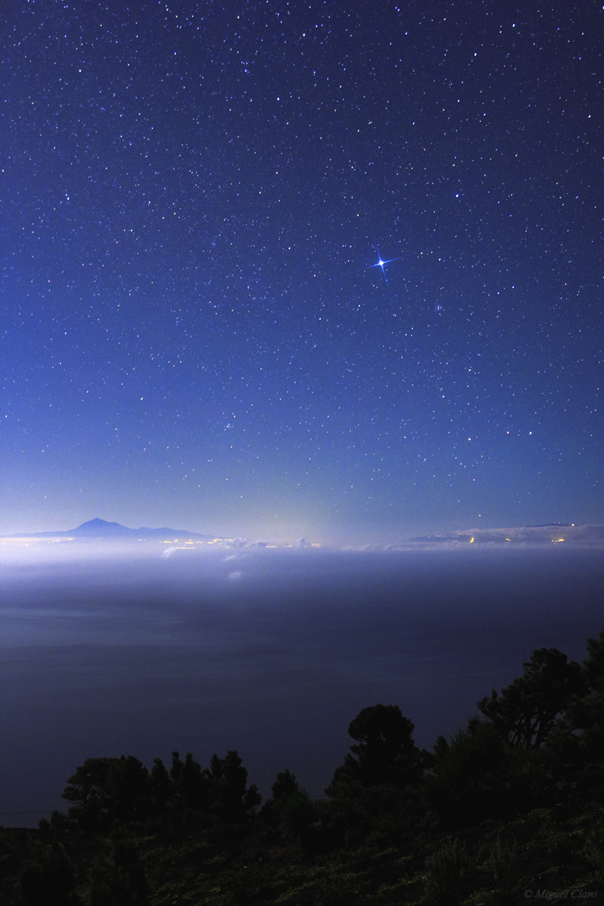
A lovely moonlite scene captured in La Palma moutains, in Los Canarios, Fuencaliente, facing to the Atlantic Ocean. While Sirius, the brightest star in the northen hemisphere is shining blue and strong in the morning sky, the Teide volcano seems to emerge from the clouds in the horizon, with 3718 km is the highest point above sea level in the islands of the Atlantic Ocean and the world’s third largest volcano. In the image, is also visible the entire constellation of Canis Major, and below right the Sirius, is clearly visible the star cluster M41.
Canon 60Da – ISO1250; 24mm at f/2.8; Exp. 15 secs. in 28/09/2013 at: 4h22 AM
Milky Way above Caldera de Taburiente

In this mosaic image, captured in a height of 2,200 meters from the sea level, and above the clouds, we can see the central region of the Milky Way with Sagittarius constellation surrounded by a region rich in emission nebulae. Above the clouds and near the horizon of Caldera de Taburiente – a very large volcanic crater with about 10 km across – lies the “orange” star Antares, from Scorpius constellation as seen on the right side of the image. In the oposite direction (at left), we can see some green and orange airglow bands. The picture was taken in Pico de La Cruz, La Palma, Canary Island.
| Canon 60Da – ISO2000; 24mm at f/2; Exp. 20 secs. in 26/09/2013 at: 22h56 Mosaic of 20 images.
La Palma Dark and Light

In this single image, captured in a height of 2,200 meters from the sea level, and above the clouds, we can see the central region of the Milky Way rich in gas and emission nebulae. Above the clouds and near the horizon is visible part of Caldera de Taburiente, a very large volcanic crater with about 10 km across. At the right side of the image, lies the “orange” star Antares, from Scorpius constellation. The picture was taken in Pico de La Cruz, La Palma, Canary Island. This picture shows the contrast between the excellent quality of the sky for astronomy in the Canaries – which is determined and protected by a Sky Law – and the effect of light pollution, coming from the city lights of Santa Cruz de La Palma, visible through a hole in the clouds in Caldera.
| Canon 60Da – ISO2000; 24mm at f/2; Exp. 20 secs. in 26/09/2013 at: 22h52 AM
A Bright Meteor

A bright meteor above the clouds in Caldera de Taburiente, La Palma, Canary islands. Near the top left we could see part of central region of Milky Way. | Canon 50D – ISO2500; 35mm at f/2; Exp. 20 secs. in 26/09/2013 at: 22h02 AM
A Quiet Moon Scene in La Palma

This picture shows a quiet moon scene viewed from Mirador de Las Ventas, in La Palma, the Canary islands, while some photographers are enjoying and capturing his own views of the moon between the clouds, and reflected in the Atlantic Ocean.
Canon 50D – ISO1000; 24mm at f/4; Exp. 8 secs. in 26/09/2013 at: 1h28 AM
A painting of Nature

In this starry cloudy moonlit, we could watch what actually seems to be a rainy night, but, indeed, it was not rain, but a short startrail in a cloudy and windy night, above the alqueva´s lake, in a region called Albufeira de Pedrogão. Thanks to light of the moon, wind and clouds, I´ve got this peculiar result, I´ve called: “the painting of nature”.
Canon 60Da – ISO640, f/2.8; Exp. 6s ; 24mm. 27/04/2013 23h35
Cloudy Moonlit

Image of a Starry cloudy moonlit above the Pedrogão´s Albufeira, in Moura, a region of the Dark Sky Alqueva Reserve. Canon 60Da – ISO640, f/2.8; Exp. 6s ; 24mm. 27/04/2013 23h21 AM
Below is a Short time lapse sequence, of a cloud formation under the moonlit and above the Pedrogão´s Albufeira, in Moura, a region of the Dark Sky Alqueva Reserve.
The Big Dipper in a moonlit sky
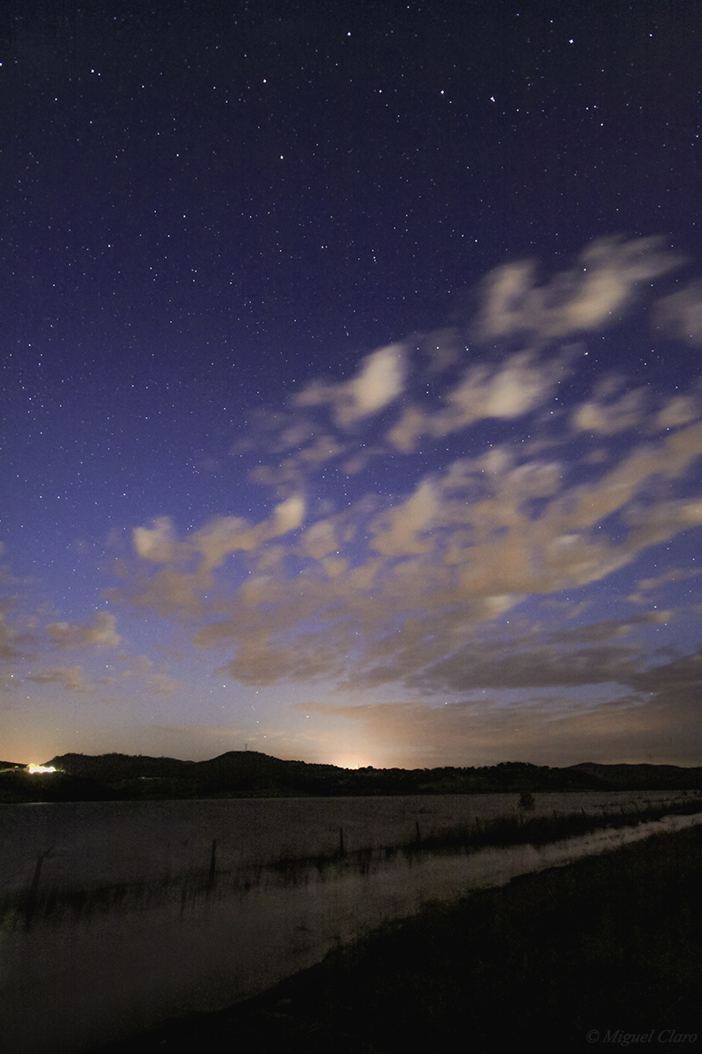
The Big Dipper in a moonlit sky. Image captured above Pedrogão´s Albufeira, in Moura, a region of great Alqueva´s Lake, covered by the Dark Sky Reserve.
Canon 50D – ISO2000 ; f/4 ; Exp. 30s. ; 10mm. 27/04/2013 at 22h53
Starry cloudy twilight

Panorama of a Starry cloudy twilight above the Pedrogão´s Albufeira, in Moura, a region of great Alqueva´s Lake, covered by the Dark Sky Reserve. Jupiter, visible near the center image and low in the horizon, is the brightest star. Above it, is visible the entire constellation of Auriga.
Canon 60Da – ISO1250, f/2; Exp. 13s ; 24mm. 27/04/2013 22h52 AM
Sunset Jupiter

After the sunset, in the begining of twilight, only the brightest stars can emerge from the blue lighted sky, normally only the planets have light enough to do this, like we can see in the upper left corner, with the planet Jupiter shining against this dramatic sky and landscape, captured in the Contenda homestead.
Canon 50D – ISO200, f/10; Exp. 20s ; 10mm. 26/04/2013 20h43
Barroca Startrail
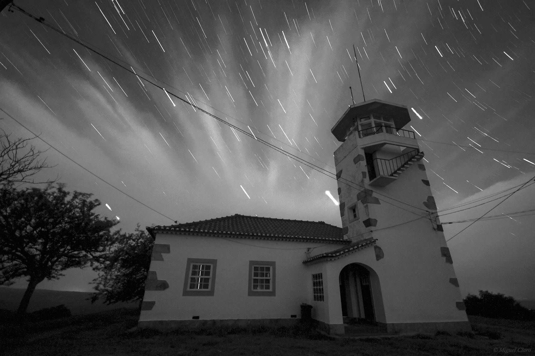
A black and white startrail captured in the house of Barroca´s mount, in the Contenda homestead. Canon 50D – ISO2000 ; f/4 ; Exp. 30s. ; 10mm. 26/04/2013 at 21h37
Crepuscular Rays in Tomina
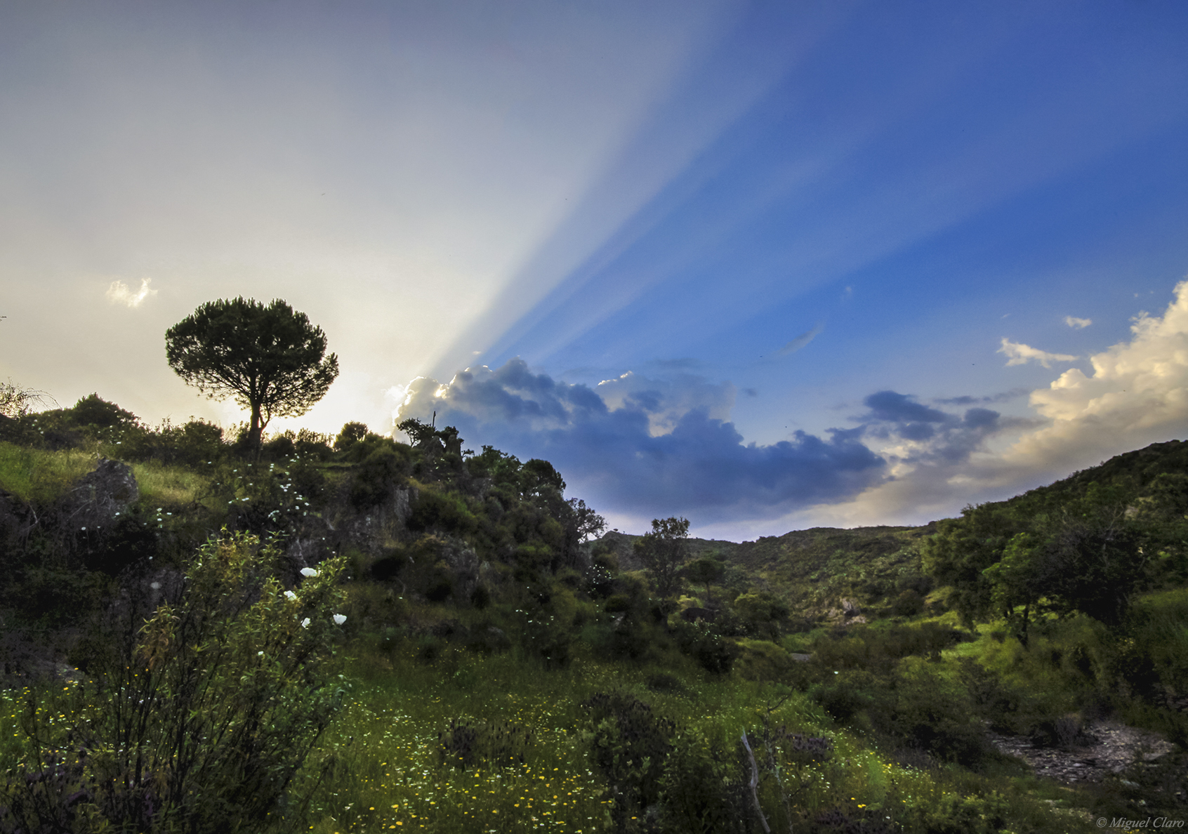
Image captured near Convento da Tomina region, a area inside the great Contenda homestead, near Moura and Barrancos, Portugal. In the sky we could see the dramatic effect of the phenomenon known as “Crepuscular rays, in atmospheric optics, are rays of sunlight that appear to radiate from the point in the sky where the sun is located. These rays, which stream through gaps in clouds (particularly stratocumulus) or between other objects, are columns of sunlit air separated by darker cloud-shadowed regions. Despite seeming to converge at a point, the rays are in fact near-parallel shafts of sunlight, and their apparent convergence is a perspective effect (similar, for example, to the way that parallel railway lines seem to converge at a point in the distance).”
“The name comes from their frequent occurrences during crepuscular hours (those around dawn and dusk), when the contrasts between light and dark are the most obvious. Crepuscular comes from the Latin word “crepusculum”, meaning twilight.”
Canon 50D – ISO500, f/13; Exp. 1/320s ; 10mm. 26/04/2013 19h16
Below you will find a resume with all publications – printed and online – related to this particular photograph.
Please refer the i-frame above, generated automatically from the overview page Press.
Tomina´s Sunset

The landscape in the sunset captured near Convento da Tomina region, a area inside the great Contenda homestead, near Moura and Barrancos, Portugal.
Canon 50D – ISO800, f/5; Exp. 1/250s ; 10mm. 26/04/2013 at 20h09.
Nautical Sky

Image taken near the nautical center of Monsaraz, during the Nautical Twilight, a special moment when the first stars appear in the sky. Few moments after I took the image, I saw a strong Zodiacal Light coming from the direction of the mountain. See the short time lapse movie. Canon 50D – ISO1000; f/4; exp. 15 secs; Lens 10mm.
The rise of a New World

Sunrise from Monsaraz Village, Portugal. Canon 60Da – ISO100 35mm f/22 Exp.1/80s in 22/12/2012 at 07h54 AM
Dreaming scene at the morning

A dreamy panoramic view of the early morning with fog, on the big lake Alqueva, in Monsaraz. Canon EOS60Da – F/4 Exp.1s ISO125 35mm lens. Panoramic of 5 images taken in 22/12/2012 at 7:06 AM.
Big Full Moon

Imagem da maior lua cheia de 2012. Fotografada em 5 de Maio. Canon 50D -ISO1250 a 1250mm F/13.8 Exp.1/40s
The Spring Moon

The Full Moon between a great formation of clouds, seen from Portugal. This first full Moon of northern spring, is called the “Egg Moon” for being associated with Easter.
Sum of 3 images, taken at the same time but with differents exposures to get detail in the moon as well as in the clouds around it. 06-04-2012 at 20:40
For clouds:
Canon 50D ISO800 f/8 500mm Exp. 0.6″
For Moon:
Canon 50D ISO500 f/8 500mm Exp. 1/100s
Solar Wall

This image was taken in the Serra de Sintra, near the solar wall, a rock with about 30 meters in height, where climbers usually make climbing and rappelling.
Canon 50D -ISO800 10mm F/4 Exp.25″. Image taken in 12/01/2012 at 00h44
Ilhéu de São Roque – Ponta Delgada

Panoramic image of the islet of São Roque in Ponta Delagada, Azores, obtained at 5:34 at the morning, and where we can see the effect of light pollution reflected in the clouds, in a contrast between nature and civilization.
Canon 50D – ISO800 F/4 30″sec. 10mm in 4/12/2011 at 05h34 | Panoramic picture, composed by 3 images taken at eep night around 05h34.
Lagoa das Sete Cidades at Night – Azores

Lagoa das Sete Cidade (English: Lake of the Seven Cities) is a twin-lake situated in the crater of a massive crater on the Portuguese archipelago of the Azores. It consists of two ecologically-different small-lakes connected by a narrow passage (and crossed by a bridge), located inside a dormant volcano on the western third of the island of São Miguel. The Lagoa das Sete Cidades part of a natural landscape of communitarian interest: it is the largest body of water in the region and one of the most important freshwater resources in the archipelago. More info click here.
This place have a peculiar weather and we could see in this image taken at a deep night with a long exposure, a strange cloud formation that is around the volcano crater as well as all the light pollution reflected in the clouds, from the small village that exists in the center of the crater. The air planes normally avoid to fly above it.
Canon 50D – ISO800 F/4 180sec. 10mm in 4/12/2011 at 02h40 | Panoramic picture, composed by 3 images taken at deep night around 02h40, in a long exposure of 3 minutes for each photo.
The Sun´s Burning the Clouds

Image of the Sunset behind a strong group of clouds near the horizon. It seems the Sun is burning some of them, to show up. The photo was taken from Capuchos, Almada
Canon 50D – ISO250 F/20 1/8000sec. at 300mm in 5/11/2011 at 17h18.
Total Lunar Eclipse 2011

Eclipse Total da Lua, visto a partir do Portinho da Arrábida. Em Portugal, a lua já nasceu eclipsada e na fase da totalidade, sendo possível ver a mudança de tom no rasto à medida que a Lua sai do cone de sombra da Terra, até ao termino do Eclipse. 15-06-2011 entre as 21h43 e as 22h49. Soma de 357 imagens cada uma de 10 segundos, totalizando uma integração de 59.5 minutos.
Canon 50D -ISO200 16mm F/5 Exp.10s por imagem.
Jupiter and Crescent Moon

Jupiter e a Lua em fase Crescente junto ao Oceano Atlântico. Imagem obtida na zona da Nato, na Fonte-de-Telha.
Canon 50D -ISO1600 20mm F/5.6 Exp.13s
Moonlit Trees and a Starry Cloudy Sky

Imagens da Lua na fase quase cheia, iluminando as paisagens com uma luz tão intensa que quase parece de dia. Na imagem vertical obtida num pinhal na Fonte-de-Telha podemos ver algumas estrelas brilhantes por entre os ramos de um pinheiro, destacando a Estrela Sírius e a constelação de Orion, totalmente visivel ao centro da imagem e por entre os ramos do pinheiro. Na imagem Horizontal em baixo, é possível observar uma bonita formação de nuvens e à esquerda são visíveis as Pleiades.
Canon 50D – ISO640 10mm F/4 Exp. 15″ 15-02-11 22:16/23:39

The Starting of Nautical Twilight

Imagem do céu estrelado obtida no Alentejo no começo do Crepúsculo Nautico, às 5h00 AM de 22-07-2010. Pode ainda ver-se uma formação de nebulosidade como se de uma aurora se trata-se. É interessante verificar o início do dia a nascer onde o azul da atmosfera reflectida pelos primeiros raios de Sol se começa a misturar com o escuro da noite, ainda visível no topo da imagem.
Canon 50D- 30″ a F/4 ISO3200 10mm 22-07-10 5h00am

Alinhamento entre Saturno, Marte, Vénus e Regulus

Alinhamento entre os planetas Saturno, Marte, Vénus e a esrtela Regulus. Imagem obtida nos Capuchos, em Almada. É possível ver ainda a Costa da Caparica e parte de Lisboa, assim como do Oceano Atlântico.
Canon 50D- Exp.15″ F/5 ISO200 a 10mm 13-07-10 22h02

The Espichel Skygazer

Imagens do Luar numa noite estrelada e simultaneamente enevoada, obtidas na zona rochosa do Cabo Espichel a 168m de altitude.
Above: Canon 50D -ISO800 F/5.6 Exp-30″ 20mm : 02-06-10 às 02h22.

Above: Canon 50D -ISO800 F/5 Exp-30″ 10mm : 02-06-10 às 02h18.
Arrábida Night Lights

Imagem do movimento das estrelas registado ao longo da noite com a Lua quase cheia, no dia 26 de Março de 2010 entre as 22h43 e as 23h01 Para o resultado final foi feita uma soma manual de 33 imagens no CS3 cada uma de 30 segundos, totalizando uma integração de 18 minutos, com uma Canon 50D a uma abertura F-5 a ISO 800, com uma Lente Sigma HSM EX a 10mm. Imagem obtida na Serra da Arrábida. Setúbal.

Halo-Win Moon – Halo Lunar difuso

Halo-Win Moon – Imagem de um halo lunar provocado devido à presença de cristais de gelo na atmosfera, que refractam a luz da Lua. Imagem obtida na noite de Halloween. Canon 400D – ISO400 70mm F/4.5 Exp. 1/4 em 31-10-09 às 20:10 + ISO400 70mm F/22 Exp. 1/10 em 31-10-09 às 20:13.
“Harvest Moon” sobre a Ponte 25 de Abril

Lua Cheia fotografada sobre a Ponte 25 de Abril no dia em que é apelidada de “Harvest Moon”, por ser encontrar mais próximo do Equinócio de Outono. Imagem obtida em Almada junto ao Rio Tejo.
Canon 400D ISO 400 22mm F/4.5 Exp. 8 ” em 3-10-09 às 6:07


